TopoQuest Logo
Do you find TopoQuest useful?
Help keep TopoQuest running and adding new maps/features by donating!
Bitcoin:  19c7KJd3qBynnjoSw5npx9KScwjBe4ifkT
Litecoin:  LXs6TkuXGGXo1vDsWCkWVdjQX94eUKd6ui
Home View Maps Find Maps Find Places Resources & Links


Robinson Summit, Nevada Topographic Map

USGS Map Title: Robinson Summit, NV
USGS Map MRC: 39115D1
DRG (GeoTIFF) Download: o39115d1.tif


Neighboring USGS Topographic Map Quads:


  Thirtymile Ranch, NV  
39115E2
 

  Combs Creek, NV  
39115E1
 

  Steptoe Ranch, NV  
39114E8
 

  Marking Corral Summit, NV  
39115D2
 

  Robinson Summit, NV  
39115D1
 

  Lusetti Canyon, NV  
39114D8
 

  Waldy Pond, NV  
39115C2
 

  Riepetown, NV  
39115C1
 

  Ruth, NV  
39114C8


Map MRC Location:

N40°
W116°
N40°
W115°
H8 H7 H6 H5 H4 H3 H2 H1
G8 G7 G6 G5 G4 G3 G2 G1
F8 F7 F6 F5 F4 F3 F2 F1
E8 E7 E6 E5 E4 E3 E2 E1
D8 D7 D6 D5 D4 D3 D2 D1
C8 C7 C6 C5 C4 C3 C2 C1
B8 B7 B6 B5 B4 B3 B2 B1
A8 A7 A6 A5 A4 A3 A2 A1
N39°
W116°
N39°
W115°

Robinson Summit, NV USGS 1:24K Topographic Map Preview:
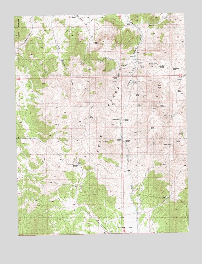
Robinson Summit, NV USGS Topographic Map
Click on map above to begin viewing in our Map Viewer.

This topographic map contains these locations and features:
Feature Name Type Latitude Longitude GNIS ID View Map
Akron SpringSpringN39.4730°W115.0659°838398View Map
Anaud SpringSpringN39.4347°W115.0278°847222View Map
Band SpringSpringN39.4557°W115.0074°838593View Map
Bradley CanyonValleyN39.4935°W115.0359°839044View Map
Bradley SpringSpringN39.4677°W115.0544°839045View Map
Buffalo SpringSpringN39.4535°W115.0392°847223View Map
Camptender SpringSpringN39.4722°W115.0370°839300View Map
Cedar SpringSpringN39.4674°W115.1070°839398View Map
Clock SpringSpringN39.4469°W115.0205°839576View Map
Cottonwood CanyonValleyN39.4755°W115.0389°839724View Map
Cottonwood SpringsSpringN39.4606°W115.0398°839777View Map
Egan RangeRangeN39.4391°W115.0292°859655View Map
Gleason Spring OneSpringN39.4399°W115.0470°840657View Map
Gleason Spring TwoSpringN39.4281°W115.0487°840658View Map
Grassy SpringSpringN39.4492°W115.0562°840787View Map
Jamestown SpringSpringN39.4727°W115.0750°841357View Map
Locket SpringSpringN39.4408°W115.0510°841751View Map
Miller RanchLocaleN39.4838°W115.0692°842138View Map
New York SpringSpringN39.4483°W115.0372°842461View Map
Niagara SpringSpringN39.4414°W115.0128°842468View Map
Petes SpringSpringN39.4258°W115.0268°842787View Map
Piscevich SummitGapN39.4702°W115.0186°842875View Map
Roadside SpringSpringN39.4270°W115.0466°845237View Map
Robinson SummitGapN39.4147°W115.0831°843258View Map
Robison RanchLocaleN39.4935°W115.0417°854597View Map
Rocco SpringSpringN39.4492°W115.0215°843260View Map
Rock SpringSpringN39.4578°W115.0726°843289View Map
Rock Spring CanyonValleyN39.4980°W115.1003°843305View Map
Ruth DivisionCivilN39.3757°W115.0761°1937469View Map
Sage Hen CanyonValleyN39.4749°W115.0392°843425View Map
Sage Hen SpringSpringN39.4641°W115.0511°843432View Map
Schoolhouse SpringSpringN39.4685°W115.0109°843539View Map
Shade SpringsSpringN39.4560°W115.0208°845247View Map
South SpringSpringN39.4309°W115.0044°843888View Map
Summit SpringsSpringN39.4708°W115.0239°845271View Map
Tank SpringSpringN39.4420°W115.0726°844170View Map
Uhalde SpringSpringN39.4524°W115.0328°847224View Map
Westside SpringSpringN39.4699°W115.0317°845284View Map
Wildcat SpringSpringN39.4249°W115.0124°846003View Map

Note: Coordinates in the location and feature list above are referenced to NAD83 datum.


Copyright (C) 2008-2025 Ryan Niemi / Sunset Dynamics ... All Rights Reserved