TopoQuest Logo
Do you find TopoQuest useful?
Help keep TopoQuest running and adding new maps/features by donating!
Bitcoin:  19c7KJd3qBynnjoSw5npx9KScwjBe4ifkT
Litecoin:  LXs6TkuXGGXo1vDsWCkWVdjQX94eUKd6ui
Home View Maps Find Maps Find Places Resources & Links


Lusetti Canyon, Nevada Topographic Map

USGS Map Title: Lusetti Canyon, NV
USGS Map MRC: 39114D8
DRG (GeoTIFF) Download: o39114d8.tif


Neighboring USGS Topographic Map Quads:


  Combs Creek, NV  
39115E1
 

  Steptoe Ranch, NV  
39114E8
 

  Steptoe, NV  
39114E7
 

  Robinson Summit, NV  
39115D1
 

  Lusetti Canyon, NV  
39114D8
 

  McGill, NV  
39114D7
 

  Riepetown, NV  
39115C1
 

  Ruth, NV  
39114C8
 

  East Ely, NV  
39114C7


Map MRC Location:

N40°
W115°
N40°
W114°
H8 H7 H6 H5 H4 H3 H2 H1
G8 G7 G6 G5 G4 G3 G2 G1
F8 F7 F6 F5 F4 F3 F2 F1
E8 E7 E6 E5 E4 E3 E2 E1
D8 D7 D6 D5 D4 D3 D2 D1
C8 C7 C6 C5 C4 C3 C2 C1
B8 B7 B6 B5 B4 B3 B2 B1
A8 A7 A6 A5 A4 A3 A2 A1
N39°
W115°
N39°
W114°

Lusetti Canyon, NV USGS 1:24K Topographic Map Preview:
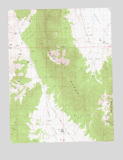
Lusetti Canyon, NV USGS Topographic Map
Click on map above to begin viewing in our Map Viewer.

This topographic map contains these locations and features:
Feature Name Type Latitude Longitude GNIS ID View Map
Archie SpringSpringN39.4508°W114.9756°838494View Map
Bennett SpringSpringN39.4684°W114.8846°838694View Map
Bristlecone WildernessReserveN39.4385°W114.9187°2575170View Map
Clark SpringSpringN39.4696°W114.8908°839552View Map
Ely State PrisonBuildingN39.3855°W114.9385°2080244View Map
Fera FortyWellN39.4708°W114.9092°850953View Map
Fera ThirtysevenWellN39.4388°W114.9097°850954View Map
Hercules Gap WellWellN39.3955°W114.9528°840957View Map
Heusser MountainSummitN39.4069°W114.8792°856269View Map
Jones CanyonValleyN39.4327°W114.9636°841412View Map
Jones SpringsSpringN39.4332°W114.9914°848566View Map
Kogan PlaceLocaleN39.4674°W114.9959°856063View Map
Lusetti CanyonValleyN39.4669°W114.9234°841886View Map
Lusetti RanchLocaleN39.4747°W114.9047°841887View Map
Lusetti SpringSpringN39.4100°W114.8840°854937View Map
McManus SpringSpringN39.4580°W114.9850°842030View Map
Mountain High SchoolSchoolN39.3856°W114.9386°2080245View Map
Rattlesnake SpringSpringN39.3937°W114.8818°843098View Map
Smith SpringSpringN39.4776°W114.9902°843781View Map
The CoveBendN39.4522°W114.9000°844246View Map
Toner SpringSpringN39.4887°W114.9752°844356View Map
White Pine CountyCivilN39.4422°W114.9017°858615View Map

Note: Coordinates in the location and feature list above are referenced to NAD83 datum.


Copyright (C) 2008-2024 Ryan Niemi / Sunset Dynamics ... All Rights Reserved