TopoQuest Logo
Do you find TopoQuest useful?
Help keep TopoQuest running and adding new maps/features by donating!
Bitcoin:  19c7KJd3qBynnjoSw5npx9KScwjBe4ifkT
Litecoin:  LXs6TkuXGGXo1vDsWCkWVdjQX94eUKd6ui
Home View Maps Find Maps Find Places Resources & Links


Roby, Texas Topographic Map

USGS Map Title: Roby, TX
USGS Map MRC: 32100F4
DRG (GeoTIFF) Download: o32100f4.tif


Neighboring USGS Topographic Map Quads:


  Hobbs, TX  
32100G5
 

  Rotan, TX  
32100G4
 

  Royston, TX  
32100G3
 

  Bull Creek, TX  
32100F5
 

  Roby, TX  
32100F4
 

  Longworth, TX  
32100F3
 

  Bernecker, TX  
32100E5
 

  Busby, TX  
32100E4
 

  Eskota, TX  
32100E3


Map MRC Location:

N33°
W101°
N33°
W100°
H8 H7 H6 H5 H4 H3 H2 H1
G8 G7 G6 G5 G4 G3 G2 G1
F8 F7 F6 F5 F4 F3 F2 F1
E8 E7 E6 E5 E4 E3 E2 E1
D8 D7 D6 D5 D4 D3 D2 D1
C8 C7 C6 C5 C4 C3 C2 C1
B8 B7 B6 B5 B4 B3 B2 B1
A8 A7 A6 A5 A4 A3 A2 A1
N32°
W101°
N32°
W100°

Roby, TX USGS 1:24K Topographic Map Preview:
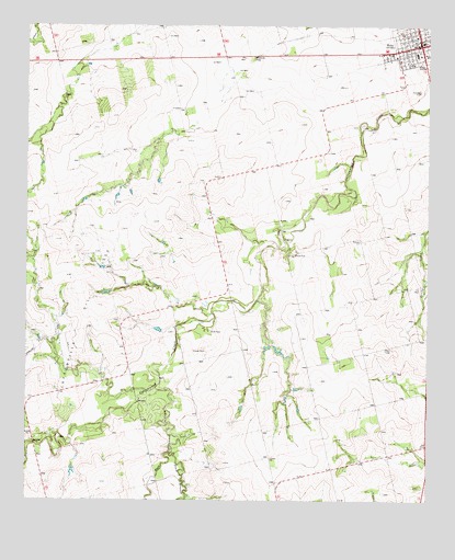
Roby, TX USGS Topographic Map
Click on map above to begin viewing in our Map Viewer.

This topographic map contains these locations and features:
Feature Name Type Latitude Longitude GNIS ID View Map
CenterPopulated PlaceN32.7282°W100.4529°1332520View Map
City of RobyCivilN32.7460°W100.3794°2410974View Map
Claytonville Oil FieldOilfieldN32.6571°W100.4857°1332923View Map
East Cottonwood CreekStreamN32.6543°W100.4598°1334899View Map
El Paso ChurchChurchN32.6932°W100.3965°1335239View Map
Fisher CountyCivilN32.7428°W100.4022°1383861View Map
Fisher County JailBuildingN32.7459°W100.3774°2738845View Map
Fisher County Sheriff's OfficeBuildingN32.7460°W100.3770°2552122View Map
Liberty ChurchChurchN32.6359°W100.4243°1339882View Map
Plum BranchStreamN32.6373°W100.4554°1344262View Map
RobyPopulated PlaceN32.7448°W100.3776°1375773View Map
Roby City HallBuildingN32.7449°W100.3796°2753164View Map
Roby DivisionCivilN32.6479°W100.4020°1939136View Map
Roby Post OfficePost OfficeN32.7465°W100.3772°2731820View Map
Roby Volunteer Fire DepartmentBuildingN32.7447°W100.3807°2552049View Map

Note: Coordinates in the location and feature list above are referenced to NAD83 datum.


Copyright (C) 2008-2025 Ryan Niemi / Sunset Dynamics ... All Rights Reserved