TopoQuest Logo
Do you find TopoQuest useful?
Help keep TopoQuest running and adding new maps/features by donating!
Bitcoin:  19c7KJd3qBynnjoSw5npx9KScwjBe4ifkT
Litecoin:  LXs6TkuXGGXo1vDsWCkWVdjQX94eUKd6ui
Home View Maps Find Maps Find Places Resources & Links


Rotan, Texas Topographic Map

USGS Map Title: Rotan, TX
USGS Map MRC: 32100G4
DRG (GeoTIFF) Download: o32100g4.tif


Neighboring USGS Topographic Map Quads:


  Tige Canyon, TX  
32100H5
 

  White Canyon, TX  
32100H4
 

  Poke Mountain, TX  
32100H3
 

  Hobbs, TX  
32100G5
 

  Rotan, TX  
32100G4
 

  Royston, TX  
32100G3
 

  Bull Creek, TX  
32100F5
 

  Roby, TX  
32100F4
 

  Longworth, TX  
32100F3


Map MRC Location:

N33°
W101°
N33°
W100°
H8 H7 H6 H5 H4 H3 H2 H1
G8 G7 G6 G5 G4 G3 G2 G1
F8 F7 F6 F5 F4 F3 F2 F1
E8 E7 E6 E5 E4 E3 E2 E1
D8 D7 D6 D5 D4 D3 D2 D1
C8 C7 C6 C5 C4 C3 C2 C1
B8 B7 B6 B5 B4 B3 B2 B1
A8 A7 A6 A5 A4 A3 A2 A1
N32°
W101°
N32°
W100°

Rotan, TX USGS 1:24K Topographic Map Preview:
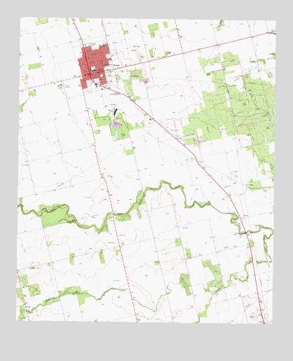
Rotan, TX USGS Topographic Map
Click on map above to begin viewing in our Map Viewer.

This topographic map contains these locations and features:
Feature Name Type Latitude Longitude GNIS ID View Map
Aaron ParkParkN32.8470°W100.4801°1329163View Map
Alkali CreekStreamN32.7882°W100.3754°1329366View Map
Church of ChristChurchN32.8540°W100.4668°2018917View Map
City of RotanCivilN32.8540°W100.4655°2411004View Map
First Baptist Church of RotanChurchN32.8534°W100.4651°2018915View Map
FisherPopulated PlaceN32.7937°W100.3898°1378294View Map
Fisher CemeteryCemeteryN32.8057°W100.3807°1335831View Map
Fisher County AirportAirportN32.8228°W100.4146°1387430View Map
Fisher County HospitalHospitalN32.8336°W100.4361°2718164View Map
Hackberry CreekStreamN32.8570°W100.4976°1337189View Map
Hemphill County LibraryBuildingN32.8301°W100.3823°2014979View Map
North RobyPopulated PlaceN32.8068°W100.3871°1377187View Map
North Roby ChurchChurchN32.8062°W100.3993°1342795View Map
RotanPopulated PlaceN32.8520°W100.4657°1345626View Map
Rotan CemeteryCemeteryN32.8593°W100.4412°1345627View Map
Rotan City HallBuildingN32.8517°W100.4688°2753964View Map
Rotan Elementary SchoolSchoolN32.8523°W100.4651°2005824View Map
Rotan High SchoolSchoolN32.8523°W100.4651°2005825View Map
Rotan Junior High SchoolSchoolN32.8523°W100.4651°2005826View Map
Rotan Post OfficePost OfficeN32.8530°W100.4677°2732239View Map
Rotan Volunteer Fire DepartmentBuildingN32.8501°W100.4670°2551157View Map
Saint Joseph Baptist ChurchChurchN32.8587°W100.4654°2018916View Map
SardisPopulated PlaceN32.7557°W100.4959°1379035View Map

Note: Coordinates in the location and feature list above are referenced to NAD83 datum.


Copyright (C) 2008-2025 Ryan Niemi / Sunset Dynamics ... All Rights Reserved