TopoQuest Logo
Do you find TopoQuest useful?
Help keep TopoQuest running and adding new maps/features by donating!
Bitcoin:  19c7KJd3qBynnjoSw5npx9KScwjBe4ifkT
Litecoin:  LXs6TkuXGGXo1vDsWCkWVdjQX94eUKd6ui
Home View Maps Find Maps Find Places Resources & Links


Big Sinks, New Mexico Topographic Map

USGS Map Title: Big Sinks, NM
USGS Map MRC: 32103B7
DRG (GeoTIFF) Download: o32103b7.tif


Neighboring USGS Topographic Map Quads:


  Remuda Basin, NM  
32103C8
 

  Los Medanos, NM  
32103C7
 

  Bootleg Ridge, NM  
32103C6
 

  Pierce Canyon, NM  
32103B8
 

  Big Sinks, NM  
32103B7
 

  Paduca Breaks NW, NM  
32103B6
 

  Ross Ranch, NM  
32103A8
 

  Phantom Banks, NM  
32103A7
 

  Paduca Breaks West, NM  
32103A6


Map MRC Location:

N33°
W104°
N33°
W103°
H8 H7 H6 H5 H4 H3 H2 H1
G8 G7 G6 G5 G4 G3 G2 G1
F8 F7 F6 F5 F4 F3 F2 F1
E8 E7 E6 E5 E4 E3 E2 E1
D8 D7 D6 D5 D4 D3 D2 D1
C8 C7 C6 C5 C4 C3 C2 C1
B8 B7 B6 B5 B4 B3 B2 B1
A8 A7 A6 A5 A4 A3 A2 A1
N32°
W104°
N32°
W103°

Big Sinks, NM USGS 1:24K Topographic Map Preview:
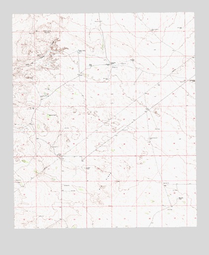
Big Sinks, NM USGS Topographic Map
Click on map above to begin viewing in our Map Viewer.

This topographic map contains these locations and features:
Feature Name Type Latitude Longitude GNIS ID View Map
06641 Water WellWellN32.1490°W103.8416°931097View Map
07046 Water WellWellN32.2262°W103.8308°932165View Map
07048 Water WellWellN32.2010°W103.8555°931091View Map
07049 Water WellWellN32.1657°W103.8421°932157View Map
07050 Water WellWellN32.2393°W103.7808°931085View Map
07051 Water WellWellN32.1762°W103.7824°932159View Map
20020 Water WellWellN32.2196°W103.8063°932164View Map
Big SinksAreaN32.1515°W103.8138°886329View Map
Centinela MoundSummitN32.2398°W103.8516°899568View Map
Eagles WindmillLocaleN32.2401°W103.7805°888626View Map
Greenwood TankReservoirN32.2092°W103.7525°889613View Map
Hurston TankReservoirN32.1418°W103.7635°890274View Map
Jo Bar TankReservoirN32.1601°W103.8266°890468View Map
Keyhole WindmillLocaleN32.1771°W103.7827°890683View Map
New WindmillLocaleN32.2021°W103.8569°892511View Map
Poker LakeLakeN32.2195°W103.8239°893381View Map
Poker TankReservoirN32.2280°W103.8300°893382View Map
Twin Wells RanchLocaleN32.2201°W103.8077°895969View Map
Windy TankReservoirN32.1911°W103.8511°896711View Map
Windy WindmillLocaleN32.1673°W103.8427°896712View Map

Note: Coordinates in the location and feature list above are referenced to NAD83 datum.


Copyright (C) 2008-2025 Ryan Niemi / Sunset Dynamics ... All Rights Reserved