TopoQuest Logo
Do you find TopoQuest useful?
Help keep TopoQuest running and adding new maps/features by donating!
Bitcoin:  19c7KJd3qBynnjoSw5npx9KScwjBe4ifkT
Litecoin:  LXs6TkuXGGXo1vDsWCkWVdjQX94eUKd6ui
Home View Maps Find Maps Find Places Resources & Links


Remuda Basin, New Mexico Topographic Map

USGS Map Title: Remuda Basin, NM
USGS Map MRC: 32103C8
DRG (GeoTIFF) Download: o32103c8.tif


Neighboring USGS Topographic Map Quads:


  Indian Flats, NM  
32104D1
 

  Tower Hill South, NM  
32103D8
 

  Livingston Ridge, NM  
32103D7
 

  Loving, NM  
32104C1
 

  Remuda Basin, NM  
32103C8
 

  Los Medanos, NM  
32103C7
 

  Malaga, NM  
32104B1
 

  Pierce Canyon, NM  
32103B8
 

  Big Sinks, NM  
32103B7


Map MRC Location:

N33°
W104°
N33°
W103°
H8 H7 H6 H5 H4 H3 H2 H1
G8 G7 G6 G5 G4 G3 G2 G1
F8 F7 F6 F5 F4 F3 F2 F1
E8 E7 E6 E5 E4 E3 E2 E1
D8 D7 D6 D5 D4 D3 D2 D1
C8 C7 C6 C5 C4 C3 C2 C1
B8 B7 B6 B5 B4 B3 B2 B1
A8 A7 A6 A5 A4 A3 A2 A1
N32°
W104°
N32°
W103°

Remuda Basin, NM USGS 1:24K Topographic Map Preview:
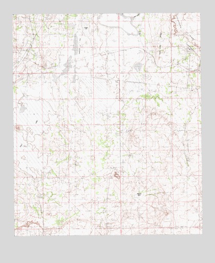
Remuda Basin, NM USGS Topographic Map
Click on map above to begin viewing in our Map Viewer.

This topographic map contains these locations and features:
Feature Name Type Latitude Longitude GNIS ID View Map
05116 Water WellWellN32.2951°W103.9244°932169View Map
05123 Water WellWellN32.3498°W103.9833°931078View Map
06669 Water WellWellN32.3498°W103.9833°931077View Map
06680 Water WellWellN32.3623°W103.9147°931071View Map
06681 Water WellWellN32.3532°W103.9077°932175View Map
06682 Water WellWellN32.3540°W103.8805°932176View Map
07036 Water WellWellN32.2623°W103.8774°931087View Map
08607 Water WellWellN32.2882°W103.9366°932168View Map
20002 Water WellWellN32.3296°W103.9108°932172View Map
20003 Water WellWellN32.2973°W103.8869°931079View Map
Duval MineMineN32.3551°W103.8855°929247View Map
Forty-Niner RidgeRidgeN32.3584°W103.9024°889160View Map
Hodges Potash PropertyMineN32.3085°W103.9488°917595View Map
Indian WellWellN32.2979°W103.8869°890328View Map
J Bar F WellWellN32.3640°W103.9172°890370View Map
Lindsey LakeLakeN32.3678°W103.9519°891084View Map
Nash DrawMineN32.3501°W103.8852°915670View Map
Nash Draw MineMineN32.3543°W103.8824°915675View Map
Nash WellWellN32.3307°W103.9141°892375View Map
Remuda BasinBasinN32.2732°W103.9188°893861View Map
Salt LakeLakeN32.3203°W103.9877°897468View Map
Salt Lake MineMineN32.3237°W103.9930°915668View Map
Tamarisk FlatLakeN32.3547°W103.9606°895496View Map
West WellWellN32.3704°W103.9638°896427View Map

Note: Coordinates in the location and feature list above are referenced to NAD83 datum.


Copyright (C) 2008-2025 Ryan Niemi / Sunset Dynamics ... All Rights Reserved