TopoQuest Logo
Do you find TopoQuest useful?
Help keep TopoQuest running and adding new maps/features by donating!
Bitcoin:  19c7KJd3qBynnjoSw5npx9KScwjBe4ifkT
Litecoin:  LXs6TkuXGGXo1vDsWCkWVdjQX94eUKd6ui
Home View Maps Find Maps Find Places Resources & Links


Rockvale, Colorado Topographic Map

USGS Map Title: Rockvale, CO
USGS Map MRC: 38105C2
DRG (GeoTIFF) Download: o38105c2.tif


Neighboring USGS Topographic Map Quads:


  Royal Gorge, CO  
38105D3
 

  Canon City, CO  
38105D2
 

  Florence, CO  
38105D1
 

  Curley Peak, CO  
38105C3
 

  Rockvale, CO  
38105C2
 

  Florence SE, CO  
38105C1
 

  Mount Tyndall, CO  
38105B3
 

  Hardscrabble Mountain, CO  
38105B2
 

  Wetmore, CO  
38105B1


Map MRC Location:

N39°
W106°
N39°
W105°
H8 H7 H6 H5 H4 H3 H2 H1
G8 G7 G6 G5 G4 G3 G2 G1
F8 F7 F6 F5 F4 F3 F2 F1
E8 E7 E6 E5 E4 E3 E2 E1
D8 D7 D6 D5 D4 D3 D2 D1
C8 C7 C6 C5 C4 C3 C2 C1
B8 B7 B6 B5 B4 B3 B2 B1
A8 A7 A6 A5 A4 A3 A2 A1
N38°
W106°
N38°
W105°

Rockvale, CO USGS 1:24K Topographic Map Preview:
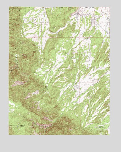
Rockvale, CO USGS Topographic Map
Click on map above to begin viewing in our Map Viewer.

This topographic map contains these locations and features:
Feature Name Type Latitude Longitude GNIS ID View Map
Bassick MineMineN38.3450°W105.2042°1725024View Map
Beacon MineMineN38.3628°W105.2014°1725025View Map
Bentley Pegmatite MineMineN38.3367°W105.2294°1725026View Map
Black Diamond MineMineN38.2981°W105.1653°1725027View Map
Black Diamond MineMineN38.2931°W105.1672°192066View Map
Black Hawk QuarryMineN38.2872°W105.1519°1725028View Map
Black Knight ClaypitMineN38.3536°W105.1939°192049View Map
Black Knight MineMineN38.3531°W105.1939°1725029View Map
Caldirola Number 1 MineMineN38.3458°W105.1750°192051View Map
Caldirola Number 2 MineMineN38.3292°W105.1780°192061View Map
Caldirola PitMineN38.2956°W105.1778°1725021View Map
Canon Chief MineMineN38.2972°W105.1686°192065View Map
Canon Imperial MineMineN38.3731°W105.1264°1725003View Map
Canon Liberty MineMineN38.2878°W105.1528°192074View Map
Canon Monarch MineMineN38.2683°W105.1511°1725030View Map
Canon National MineMineN38.2867°W105.1661°192072View Map
Canon Peacock MineMineN38.2828°W105.1492°1725031View Map
Canon Shamrock MineMineN38.2739°W105.1492°1725032View Map
Canon Zenith MineMineN38.2889°W105.1517°196826View Map
Carson MineMineN38.3567°W105.2155°1725033View Map
Cedar Canon MineMineN38.3472°W105.1850°192050View Map
Chandler (historical)Populated PlaceN38.3731°W105.2005°204919View Map
Coal CreekPopulated PlaceN38.3611°W105.1483°192054View Map
Coal Creek CanyonValleyN38.3243°W105.1714°192058View Map
Coal Creek Canyon MineMineN38.3258°W105.1736°192062View Map
Coal Creek Number 2 MineMineN38.3522°W105.1497°192057View Map
Coal Creek Post OfficePost OfficeN38.3622°W105.1474°2750917View Map
Coal Creek Volunteer Fire DepartmentBuildingN38.3586°W105.1480°2667261View Map
Corley Number 6 MineMineN38.2981°W105.1694°192064View Map
Dilley Ranch MineMineN38.2736°W105.2280°1725023View Map
Dorchester Number One MineMineN38.2800°W105.1525°1725046View Map
Double Dick MinesMineN38.2900°W105.1655°192071View Map
First Alkali CreekStreamN38.3708°W105.1294°192055View Map
Florence DivisionCivilN38.3298°W105.1524°1935462View Map
Golden Quality Number Five MineMineN38.3347°W105.1936°1725022View Map
Grape Creek MineMineN38.3008°W105.2064°1735766View Map
Grey Creek MineMineN38.2739°W105.1605°1725034View Map
Kenwood MineMineN38.3217°W105.1539°1725035View Map
Last Hope ClaimsMineN38.3367°W105.2408°1725036View Map
Locke ParkFlatN38.2772°W105.2464°203554View Map
Manley MineMineN38.2739°W105.1492°1725037View Map
Middle Fork Coal Creek CanyonValleyN38.2931°W105.2129°192059View Map
Mill CreekStreamN38.3747°W105.2230°191917View Map
Miller MineMineN38.3458°W105.2180°1725038View Map
Monarch Number 4 MineMineN38.2683°W105.1511°192077View Map
North Cow CreekStreamN38.3742°W105.2050°192048View Map
Oak Creek Grade ProspectMineN38.3297°W105.2361°1725047View Map
Pine Gulch MinesMineN38.2831°W105.1489°192076View Map
Radiant CampLocaleN38.3244°W105.1533°192067View Map
Radiant MineMineN38.3239°W105.1650°1725039View Map
Rawley MinesMineN38.3239°W105.1258°189900View Map
Red Carbon MineMineN38.2819°W105.1642°1725040View Map
Rex Carbon MineMineN38.2817°W105.1644°192073View Map
Rockafellow MineMineN38.2864°W105.1528°1725041View Map
RockvalePopulated PlaceN38.3697°W105.1639°203568View Map
Rockvale MineMineN38.3633°W105.1705°1725042View Map
Rockvale Post OfficePost OfficeN38.3687°W105.1640°2759213View Map
Rockvale Volunteer Fire DepartmentBuildingN38.3682°W105.1648°2667372View Map
Round MountainSummitN38.3042°W105.2483°203348View Map
Second Alkali CreekStreamN38.3631°W105.1261°192056View Map
Second Newlin CreekStreamN38.2661°W105.2308°192068View Map
Serpent ProspectMineN38.3008°W105.2064°1735767View Map
Shaw Opening MineMineN38.3164°W105.1564°1725043View Map
Sheeley TrailTrailN38.2856°W105.2172°192044View Map
Smith MineMineN38.2811°W105.1497°1725044View Map
South Chandler CreekStreamN38.3575°W105.2333°191915View Map
South Field AreaMineN38.2833°W105.1533°192046View Map
South Newlin CreekStreamN38.2578°W105.2011°192070View Map
South Oak CreekStreamN38.3683°W105.1608°192053View Map
Southfield Cherokee MineMineN38.2969°W105.1514°1725045View Map
Stony PointCliffN38.2964°W105.2033°192063View Map
Stultz GulchValleyN38.3275°W105.2407°191920View Map
Third Newlin CreekStreamN38.2600°W105.2172°192069View Map
Town of Coal CreekCivilN38.3620°W105.1418°2413219View Map
Town of RockvaleCivilN38.3647°W105.1648°2412564View Map
Twin Pines MineMineN38.3403°W105.1792°192052View Map
Venta MineMineN38.2831°W105.1564°192075View Map
West Fork Coal Creek CanyonValleyN38.2956°W105.2022°192060View Map

Note: Coordinates in the location and feature list above are referenced to NAD83 datum.


Copyright (C) 2008-2024 Ryan Niemi / Sunset Dynamics ... All Rights Reserved