TopoQuest Logo
Do you find TopoQuest useful?
Help keep TopoQuest running and adding new maps/features by donating!
Bitcoin:  19c7KJd3qBynnjoSw5npx9KScwjBe4ifkT
Litecoin:  LXs6TkuXGGXo1vDsWCkWVdjQX94eUKd6ui
Home View Maps Find Maps Find Places Resources & Links


Rockville, Indiana Topographic Map

USGS Map Title: Rockville, IN
USGS Map MRC: 39087G2
DRG (GeoTIFF) Download: o39087g2.tif


Neighboring USGS Topographic Map Quads:


  Kingman, IN  
39087H3
 

  Wallace, IN  
39087H2
 

  Alamo, IN  
39087H1
 

  Montezuma, IN  
39087G3
 

  Rockville, IN  
39087G2
 

  Bellmore, IN  
39087G1
 

  Mecca, IN  
39087F3
 

  Catlin, IN  
39087F2
 

  Mansfield, IN  
39087F1


Map MRC Location:

N40°
W88°
N40°
W87°
H8 H7 H6 H5 H4 H3 H2 H1
G8 G7 G6 G5 G4 G3 G2 G1
F8 F7 F6 F5 F4 F3 F2 F1
E8 E7 E6 E5 E4 E3 E2 E1
D8 D7 D6 D5 D4 D3 D2 D1
C8 C7 C6 C5 C4 C3 C2 C1
B8 B7 B6 B5 B4 B3 B2 B1
A8 A7 A6 A5 A4 A3 A2 A1
N39°
W88°
N39°
W87°

Rockville, IN USGS 1:24K Topographic Map Preview:
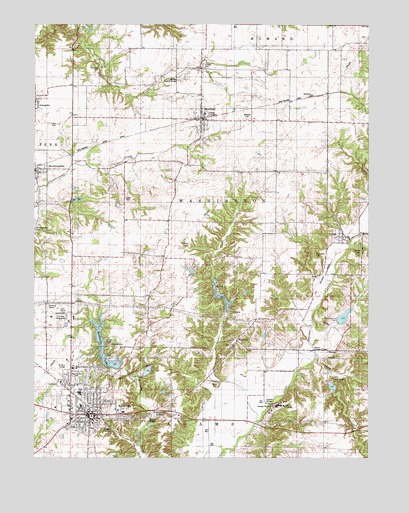
Rockville, IN USGS Topographic Map
Click on map above to begin viewing in our Map Viewer.

This topographic map contains these locations and features:
Feature Name Type Latitude Longitude GNIS ID View Map
Adams Covered Bridge (historical)BridgeN39.7812°W87.1456°446659View Map
Barnes CemeteryCemeteryN39.8097°W87.1277°430501View Map
Beeson Covered BridgeBridgeN39.7625°W87.2028°446660View Map
BethanyPopulated PlaceN39.8542°W87.1472°430860View Map
Bethany CemeteryCemeteryN39.8477°W87.1704°430862View Map
Bill Diddle CreekStreamN39.7903°W87.2295°1789058View Map
Billie Creek BridgeBridgeN39.7612°W87.2064°1789059View Map
Billie Creek VillagePopulated PlaceN39.7614°W87.2020°449083View Map
BloomingdalePopulated PlaceN39.8334°W87.2497°431202View Map
Buchanan CemeteryCemeteryN39.8086°W87.1450°431707View Map
Catlin BridgeBridgeN39.7917°W87.2386°1789056View Map
CincinnatiPopulated PlaceN39.8570°W87.2261°452157View Map
Coffin CemeteryCemeteryN39.8463°W87.2413°432738View Map
Cumberland CreekStreamN39.7789°W87.1447°448352View Map
Elder CemeteryCemeteryN39.8248°W87.2161°434061View Map
JudsonPopulated PlaceN39.8131°W87.1345°437137View Map
Lakeview Estates LakeReservoirN39.7691°W87.2012°448821View Map
Lakeview Estates Lake DamDamN39.7700°W87.2033°448822View Map
Leatherwood Station BridgeBridgeN39.7625°W87.2028°1789052View Map
Little Raccoon Structure Number 15DamN39.7734°W87.1400°447608View Map
Little Raccoon Structure Number 2-CDamN39.7767°W87.2183°448525View Map
Little Raccoon Structure Number 3DamN39.7934°W87.1767°447615View Map
MarshallPopulated PlaceN39.8481°W87.1878°438656View Map
Marshall Volunteer Fire DepartmentBuildingN39.8475°W87.1894°2625855View Map
Memory Garden CemeteryCemeteryN39.7735°W87.2347°439006View Map
NyesvillePopulated PlaceN39.7845°W87.1745°440380View Map
Overman CemeteryCemeteryN39.8116°W87.1921°440781View Map
Parke CountyCivilN39.7736°W87.2064°450380View Map
Parke County Emergency Medical Services and Transport ServiceBuildingN39.7651°W87.2391°2719365View Map
Parke County Golf CourseLocaleN39.7931°W87.2389°1789057View Map
Parke County Sheriff's OfficeBuildingN39.7755°W87.2448°2758291View Map
Pin HookPopulated PlaceN39.8150°W87.1272°452159View Map
Poplar CemeteryCemeteryN39.8634°W87.1869°441442View Map
Rawlings CemeteryCemeteryN39.8623°W87.2264°441794View Map
Rays BranchStreamN39.7823°W87.1458°448354View Map
RockvillePopulated PlaceN39.7625°W87.2292°442226View Map
Rockville Elementary SchoolSchoolN39.7653°W87.2311°447183View Map
Rockville Fire Department / Parke County Rescue SquadBuildingN39.7594°W87.2269°2625670View Map
Rockville Junior-Senior High SchoolSchoolN39.7687°W87.2333°447184View Map
Rockville Police DepartmentBuildingN39.7589°W87.2271°2758074View Map
Rockville Town Police DepartmentBuildingN39.7754°W87.2448°2758025View Map
Rowe CemeteryCemeteryN39.7716°W87.1822°442364View Map
Sand CreekStreamN39.7606°W87.1664°442961View Map
Sand Creek ChurchChurchN39.7823°W87.1750°442971View Map
Sand Creek StationLocaleN39.7753°W87.1664°452158View Map
Springdale RunStreamN39.8125°W87.1292°448355View Map
Town of MarshallCivilN39.8477°W87.1868°2396738View Map
Town of RockvilleCivilN39.7665°W87.2295°2396886View Map
Township of WashingtonCivilN39.8247°W87.1788°454012View Map

Note: Coordinates in the location and feature list above are referenced to NAD83 datum.


Copyright (C) 2008-2025 Ryan Niemi / Sunset Dynamics ... All Rights Reserved