TopoQuest Logo
Do you find TopoQuest useful?
Help keep TopoQuest running and adding new maps/features by donating!
Bitcoin:  19c7KJd3qBynnjoSw5npx9KScwjBe4ifkT
Litecoin:  LXs6TkuXGGXo1vDsWCkWVdjQX94eUKd6ui
Home View Maps Find Maps Find Places Resources & Links


Alamo, Indiana Topographic Map

USGS Map Title: Alamo, IN
USGS Map MRC: 39087H1
DRG (GeoTIFF) Download: o39087h1.tif


Neighboring USGS Topographic Map Quads:


  Hillsboro, IN  
40087A2
 

  Waynetown, IN  
40087A1
 

  Crawfordsville, IN  
40086A8
 

  Wallace, IN  
39087H2
 

  Alamo, IN  
39087H1
 

  New Market, IN  
39086H8
 

  Rockville, IN  
39087G2
 

  Bellmore, IN  
39087G1
 

  Russellville, IN  
39086G8


Map MRC Location:

N40°
W88°
N40°
W87°
H8 H7 H6 H5 H4 H3 H2 H1
G8 G7 G6 G5 G4 G3 G2 G1
F8 F7 F6 F5 F4 F3 F2 F1
E8 E7 E6 E5 E4 E3 E2 E1
D8 D7 D6 D5 D4 D3 D2 D1
C8 C7 C6 C5 C4 C3 C2 C1
B8 B7 B6 B5 B4 B3 B2 B1
A8 A7 A6 A5 A4 A3 A2 A1
N39°
W88°
N39°
W87°

Alamo, IN USGS 1:24K Topographic Map Preview:
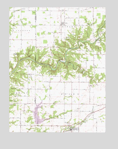
Alamo, IN USGS Topographic Map
Click on map above to begin viewing in our Map Viewer.

This topographic map contains these locations and features:
Feature Name Type Latitude Longitude GNIS ID View Map
AlamoPopulated PlaceN39.9820°W87.0572°430039View Map
Alamo Conservation ClubLocaleN39.9695°W87.0511°452279View Map
Banner MillsPopulated PlaceN39.9328°W87.1011°452151View Map
Big BranchStreamN39.9362°W87.1189°431018View Map
ByronPopulated PlaceN39.9037°W87.1056°431926View Map
Cold Spring CampParkN39.9617°W87.0331°432749View Map
Compton BranchStreamN39.9814°W87.0200°432840View Map
Corner CreekStreamN39.9700°W87.0081°449484View Map
Davis BranchStreamN39.9637°W87.0175°433342View Map
Davis BridgeBridgeN39.9670°W87.0120°433343View Map
Deer MillPopulated PlaceN39.9475°W87.0556°433435View Map
Devils BackboneRidgeN39.9448°W87.0481°433506View Map
Freedom ChurchChurchN39.9209°W87.0197°434808View Map
Indian CreekStreamN39.9448°W87.0533°436746View Map
Karnes CreekStreamN39.9700°W87.0075°437169View Map
Lake WavelandReservoirN39.8924°W87.0879°446924View Map
Lake Waveland ParkParkN39.8945°W87.0792°446925View Map
Liberty SchoolSchoolN39.9414°W87.0145°437845View Map
Little Raccoon Structure Number 8DamN39.8839°W87.0860°447605View Map
Maple Ridge CemeteryCemeteryN39.8846°W87.0484°438575View Map
Old Shoe BranchStreamN39.8856°W87.0872°440596View Map
Old Union CemeteryCemeteryN39.8979°W87.0372°440615View Map
Pedestal RockPillarN39.9512°W87.1003°440970View Map
Rass Clore BranchStreamN39.9353°W87.1192°441780View Map
Ripley Township Volunteer Fire DepartmentBuildingN39.9832°W87.0570°2626267View Map
Shades PondReservoirN39.9346°W87.0733°448766View Map
Shades Pond DamDamN39.9348°W87.0733°448765View Map
Shades State ParkParkN39.9417°W87.0917°447656View Map
Shades State Park Airport (historical)AirportN39.9312°W87.0650°449379View Map
Sloan DitchCanalN39.9812°W87.0070°443619View Map
Smith BranchStreamN39.9650°W87.0292°443659View Map
Sparks CemeteryCemeteryN39.9681°W87.0488°443910View Map
Spencer BranchStreamN39.9003°W87.0878°443935View Map
Stonebraker BranchStreamN39.9659°W87.0253°444212View Map
Stonebraker CemeteryCemeteryN39.9821°W87.0212°444213View Map
Sycamore FordPopulated PlaceN39.9584°W87.0467°444512View Map
Town of AlamoCivilN39.9835°W87.0554°2397421View Map
Town of WavelandCivilN39.8773°W87.0455°2397726View Map
Township of BrownCivilN39.9106°W87.0050°453139View Map
Township of RipleyCivilN39.9995°W87.0416°453803View Map
Truax HillSummitN39.9967°W87.0539°444929View Map
WavelandPopulated PlaceN39.8770°W87.0445°445564View Map
Waveland Elementary SchoolSchoolN39.8798°W87.0403°447344View Map
Waveland Volunteer Fire DepartmentBuildingN39.8776°W87.0455°2626129View Map

Note: Coordinates in the location and feature list above are referenced to NAD83 datum.


Copyright (C) 2008-2025 Ryan Niemi / Sunset Dynamics ... All Rights Reserved