TopoQuest Logo
Do you find TopoQuest useful?
Help keep TopoQuest running and adding new maps/features by donating!
Bitcoin:  19c7KJd3qBynnjoSw5npx9KScwjBe4ifkT
Litecoin:  LXs6TkuXGGXo1vDsWCkWVdjQX94eUKd6ui
Home View Maps Find Maps Find Places Resources & Links


Romero, Texas Topographic Map

USGS Map Title: Romero, TX
USGS Map MRC: 35102F8
DRG (GeoTIFF) Download: o35102f8.tif


Neighboring USGS Topographic Map Quads:


  Amistad SE, NM  
35103G1
 

  Whiteaker Ranch, TX  
35102G8
 

  Middle Water, TX  
35102G7
 

  Doyle Hill, NM  
35103F1
 

  Romero, TX  
35102F8
 

  Spring Creek Ranch, TX  
35102F7
 

  Nara Visa, NM  
35103E1
 

  Knoblaw, TX  
35102E8
 

  Romero SE, TX  
35102E7


Map MRC Location:

N36°
W103°
N36°
W102°
H8 H7 H6 H5 H4 H3 H2 H1
G8 G7 G6 G5 G4 G3 G2 G1
F8 F7 F6 F5 F4 F3 F2 F1
E8 E7 E6 E5 E4 E3 E2 E1
D8 D7 D6 D5 D4 D3 D2 D1
C8 C7 C6 C5 C4 C3 C2 C1
B8 B7 B6 B5 B4 B3 B2 B1
A8 A7 A6 A5 A4 A3 A2 A1
N35°
W103°
N35°
W102°

Romero, TX USGS 1:24K Topographic Map Preview:
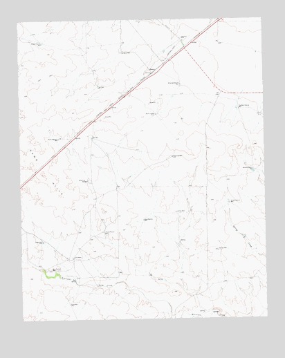
Romero, TX USGS Topographic Map
Click on map above to begin viewing in our Map Viewer.

This topographic map contains these locations and features:
Feature Name Type Latitude Longitude GNIS ID View Map
Bottom Pasture WellWellN35.6864°W102.8808°1352717View Map
Bull Pasture WellWellN35.6453°W102.9847°1353250View Map
Bull SpringSpringN35.6416°W102.9727°1353258View Map
Castleberry RanchLocaleN35.7417°W102.9166°1353945View Map
Castleberry Ranch Airport (historical)AirportN35.7375°W102.9174°1386475View Map
Coots RanchLocaleN35.6509°W102.9733°1354953View Map
Coots WellWellN35.6314°W102.9752°1354954View Map
House Pasture WellWellN35.6612°W102.9572°1359711View Map
Leader WellWellN35.6575°W102.9891°1361020View Map
Middle Pasture WellWellN35.6731°W102.8933°1362737View Map
Middle Pasture WellWellN35.7400°W102.9883°1362738View Map
North Jog WellWellN35.7103°W102.9297°1364082View Map
North Sampson WellWellN35.7003°W102.9799°1375192View Map
Petition WellWellN35.6534°W102.8991°1365113View Map
RomeroPopulated PlaceN35.7275°W102.9313°1380456View Map
Sand HillsSummitN35.6859°W102.9888°1367610View Map
Sand Hills WellWellN35.6828°W102.9663°1367613View Map
Shipping Pasture WellWellN35.7228°W102.9172°1368199View Map
Soil Bank WellWellN35.7359°W102.9466°1368587View Map
South Jog WellWellN35.6923°W102.9216°1368700View Map
Top West Pasture WellWellN35.7123°W102.8877°1370018View Map
Town WellWellN35.7223°W102.9594°1370056View Map
Trap WellWellN35.6695°W102.9191°1370078View Map
Twin WellWellN35.7006°W102.9627°1370373View Map
West Pasture WellWellN35.6662°W102.9369°1371186View Map

Note: Coordinates in the location and feature list above are referenced to NAD83 datum.


Copyright (C) 2008-2025 Ryan Niemi / Sunset Dynamics ... All Rights Reserved