TopoQuest Logo
Do you find TopoQuest useful?
Help keep TopoQuest running and adding new maps/features by donating!
Bitcoin:  19c7KJd3qBynnjoSw5npx9KScwjBe4ifkT
Litecoin:  LXs6TkuXGGXo1vDsWCkWVdjQX94eUKd6ui
Home View Maps Find Maps Find Places Resources & Links


Romero SE, Texas Topographic Map

USGS Map Title: Romero SE, TX
USGS Map MRC: 35102E7
DRG (GeoTIFF) Download: o35102e7.tif


Neighboring USGS Topographic Map Quads:


  Romero, TX  
35102F8
 

  Spring Creek Ranch, TX  
35102F7
 

  Pedarosa Camp, TX  
35102F6
 

  Knoblaw, TX  
35102E8
 

  Romero SE, TX  
35102E7
 

  Humdinger Spring, TX  
35102E6
 

  Trujillo Camp, TX  
35102D8
 

  Vat Camp, TX  
35102D7
 

  Big George Tank, TX  
35102D6


Map MRC Location:

N36°
W103°
N36°
W102°
H8 H7 H6 H5 H4 H3 H2 H1
G8 G7 G6 G5 G4 G3 G2 G1
F8 F7 F6 F5 F4 F3 F2 F1
E8 E7 E6 E5 E4 E3 E2 E1
D8 D7 D6 D5 D4 D3 D2 D1
C8 C7 C6 C5 C4 C3 C2 C1
B8 B7 B6 B5 B4 B3 B2 B1
A8 A7 A6 A5 A4 A3 A2 A1
N35°
W103°
N35°
W102°

Romero SE, TX USGS 1:24K Topographic Map Preview:
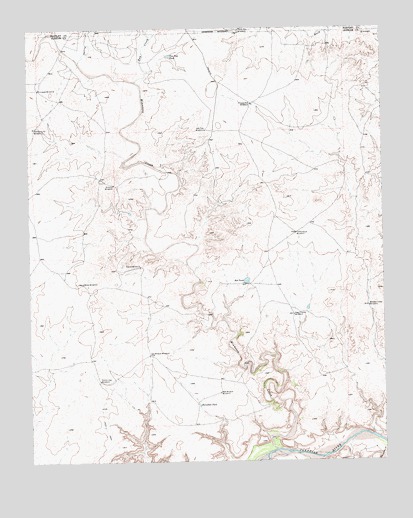
Romero SE, TX USGS Topographic Map
Click on map above to begin viewing in our Map Viewer.

This topographic map contains these locations and features:
Feature Name Type Latitude Longitude GNIS ID View Map
Corner WindmillPopulated PlaceN35.5562°W102.8358°1379594View Map
Cottonwood WindmillLocaleN35.5659°W102.7810°1355147View Map
Division WindmillLocaleN35.5800°W102.8449°1356077View Map
East Chavez WindmillLocaleN35.5423°W102.7819°1356593View Map
Freeze Out WindmillLocaleN35.6031°W102.7958°1357724View Map
Hay CreekStreamN35.6098°W102.8366°1358922View Map
Horseshoe TankReservoirN35.5161°W102.8159°1359675View Map
Minneosa CreekStreamN35.5034°W102.7891°1362953View Map
Minneosa WindmillLocaleN35.6078°W102.8716°1362954View Map
New Wildcat WindmillLocaleN35.5195°W102.8085°1363816View Map
Old Santa Fe WindmillLocaleN35.5964°W102.8735°1364486View Map
Old Wildcat WindmillLocaleN35.5306°W102.8333°1364504View Map
Poison Oak WindmillLocaleN35.5234°W102.8510°1365509View Map
Red TankReservoirN35.5521°W102.7989°1366239View Map
Smitty WindmillLocaleN35.5514°W102.8566°1368515View Map
Spring CreekStreamN35.6153°W102.8569°1368991View Map
Three-Way WindmillLocaleN35.6245°W102.8002°1369895View Map
Van Tyle TankReservoirN35.6171°W102.8253°1370577View Map
Van Tyle WindmillLocaleN35.5956°W102.8119°1370578View Map
Wooden Tower WindmillLocaleN35.5445°W102.7558°1371906View Map

Note: Coordinates in the location and feature list above are referenced to NAD83 datum.


Copyright (C) 2008-2025 Ryan Niemi / Sunset Dynamics ... All Rights Reserved