TopoQuest Logo
Do you find TopoQuest useful?
Help keep TopoQuest running and adding new maps/features by donating!
Bitcoin:  19c7KJd3qBynnjoSw5npx9KScwjBe4ifkT
Litecoin:  LXs6TkuXGGXo1vDsWCkWVdjQX94eUKd6ui
Home View Maps Find Maps Find Places Resources & Links


Rose Hill, Iowa Topographic Map

USGS Map Title: Rose Hill, IA
USGS Map MRC: 41092C4
DRG (GeoTIFF) Download: o41092c4.tif


Neighboring USGS Topographic Map Quads:


  Union Mills, IA  
41092D5
 

  Gibson, IA  
41092D4
 

  What Cheer, IA  
41092D3
 

  University Park, IA  
41092C5
 

  Rose Hill, IA  
41092C4
 

  Delta, IA  
41092C3
 

  Kirkville, IA  
41092B5
 

  Fremont, IA  
41092B4
 

  Hedrick, IA  
41092B3


Map MRC Location:

N42°
W93°
N42°
W92°
H8 H7 H6 H5 H4 H3 H2 H1
G8 G7 G6 G5 G4 G3 G2 G1
F8 F7 F6 F5 F4 F3 F2 F1
E8 E7 E6 E5 E4 E3 E2 E1
D8 D7 D6 D5 D4 D3 D2 D1
C8 C7 C6 C5 C4 C3 C2 C1
B8 B7 B6 B5 B4 B3 B2 B1
A8 A7 A6 A5 A4 A3 A2 A1
N41°
W93°
N41°
W92°

Rose Hill, IA USGS 1:24K Topographic Map Preview:
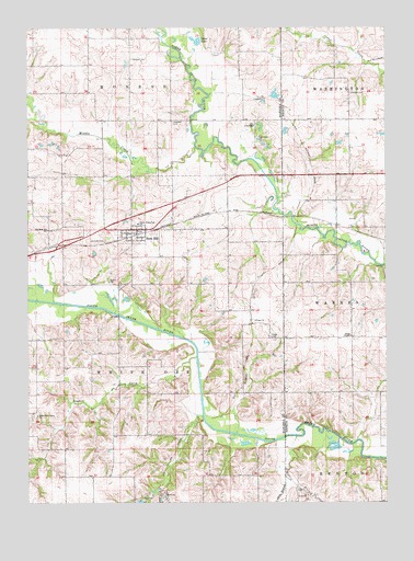
Rose Hill, IA USGS Topographic Map
Click on map above to begin viewing in our Map Viewer.

This topographic map contains these locations and features:
Feature Name Type Latitude Longitude GNIS ID View Map
AtwoodPopulated PlaceN41.3250°W92.4060°464274View Map
Atwood (historical)LocaleN41.3250°W92.4060°1976182View Map
Atwood Post Office (historical)Post OfficeN41.3250°W92.4060°1976181View Map
Bedwell CemeteryCemeteryN41.3667°W92.4637°454473View Map
City of Rose HillCivilN41.3204°W92.4637°2396428View Map
Goose LakeLakeN41.3716°W92.4410°456971View Map
Hewitt CemeteryCemeteryN41.3278°W92.3807°1976299View Map
Hopewell CemeteryCemeteryN41.3501°W92.4496°457652View Map
Hopewell Post Office (historical)Post OfficeN41.3522°W92.4380°466599View Map
Jackson CemeteryCemeteryN41.3191°W92.4733°457887View Map
Mattix BranchStreamN41.2670°W92.4069°458857View Map
Middle CreekStreamN41.3433°W92.4410°459032View Map
North White Oak SchoolSchoolN41.3236°W92.4616°459645View Map
Old Rose Hill CemeteryCemeteryN41.3207°W92.4930°1970900View Map
Old Rose Hill SchoolSchoolN41.3220°W92.4927°459835View Map
Olive BranchStreamN41.2564°W92.4107°459854View Map
Rose HillPopulated PlaceN41.3220°W92.4621°460788View Map
Rose Hill Community ChurchChurchN41.3220°W92.4621°1970839View Map
Rose Hill MarshParkN41.3070°W92.4682°1970699View Map
Rose Hill Post OfficePost OfficeN41.3220°W92.4621°1970840View Map
Rosehill (historical)LocaleN41.3211°W92.4613°1970841View Map
Snyder CreekStreamN41.2881°W92.4416°461732View Map
TiogaPopulated PlaceN41.2970°W92.4224°464270View Map
Tioga (historical)LocaleN41.2970°W92.4224°1970721View Map
Tioga CemeteryCemeteryN41.2937°W92.4156°462254View Map
Tioga ChurchChurchN41.2978°W92.4213°462255View Map
Tioga Post Office (historical)Post OfficeN41.2970°W92.4224°1970722View Map
Township of White OakCivilN41.2928°W92.4686°468996View Map
Union ChapelChurchN41.2936°W92.3877°462441View Map
Waddell CemeteryCemeteryN41.3577°W92.3875°462598View Map
White OakLocaleN41.2792°W92.4971°466019View Map
White Oak CemeteryCemeteryN41.2739°W92.4968°1970899View Map
White Oak Conservation AreaParkN41.2750°W92.4710°1970698View Map
White Oak Grove ChurchChurchN41.2728°W92.4969°462992View Map
White Oak Post Office (historical)Post OfficeN41.2795°W92.4966°466598View Map

Note: Coordinates in the location and feature list above are referenced to NAD83 datum.


Copyright (C) 2008-2025 Ryan Niemi / Sunset Dynamics ... All Rights Reserved