TopoQuest Logo
Do you find TopoQuest useful?
Help keep TopoQuest running and adding new maps/features by donating!
Bitcoin:  19c7KJd3qBynnjoSw5npx9KScwjBe4ifkT
Litecoin:  LXs6TkuXGGXo1vDsWCkWVdjQX94eUKd6ui
Home View Maps Find Maps Find Places Resources & Links


Kirkville, Iowa Topographic Map

USGS Map Title: Kirkville, IA
USGS Map MRC: 41092B5
DRG (GeoTIFF) Download: o41092b5.tif


Neighboring USGS Topographic Map Quads:


  Oskaloosa, IA  
41092C6
 

  University Park, IA  
41092C5
 

  Rose Hill, IA  
41092C4
 

  Eddyville, IA  
41092B6
 

  Kirkville, IA  
41092B5
 

  Fremont, IA  
41092B4
 

  Avery, IA  
41092A6
 

  Chillicothe, IA  
41092A5
 

  Ottumwa North, IA  
41092A4


Map MRC Location:

N42°
W93°
N42°
W92°
H8 H7 H6 H5 H4 H3 H2 H1
G8 G7 G6 G5 G4 G3 G2 G1
F8 F7 F6 F5 F4 F3 F2 F1
E8 E7 E6 E5 E4 E3 E2 E1
D8 D7 D6 D5 D4 D3 D2 D1
C8 C7 C6 C5 C4 C3 C2 C1
B8 B7 B6 B5 B4 B3 B2 B1
A8 A7 A6 A5 A4 A3 A2 A1
N41°
W93°
N41°
W92°

Kirkville, IA USGS 1:24K Topographic Map Preview:
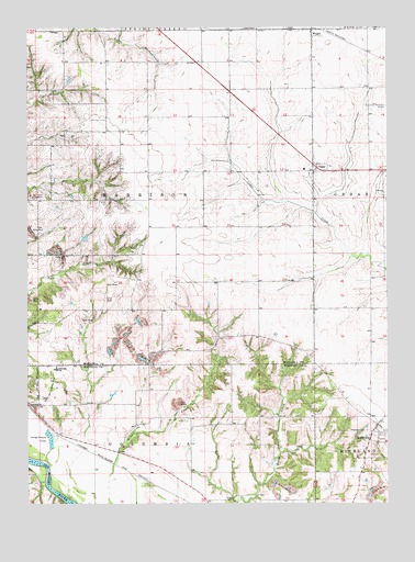
Kirkville, IA USGS Topographic Map
Click on map above to begin viewing in our Map Viewer.

This topographic map contains these locations and features:
Feature Name Type Latitude Longitude GNIS ID View Map
CedarPopulated PlaceN41.2122°W92.5257°455220View Map
Cedar (historical)LocaleN41.2122°W92.5257°1970874View Map
Cedar Post OfficePost OfficeN41.2122°W92.5257°1970872View Map
Cedar United Methodist ChurchChurchN41.2122°W92.5257°1970873View Map
Christian Reformed ChurchChurchN41.2122°W92.5257°1970871View Map
City of KirkvilleCivilN41.1422°W92.5036°2395548View Map
Eddyville - Blakesburg - Fremont Junior / Senior High SchoolSchoolN41.1606°W92.6152°456226View Map
Funk CemeteryCemeteryN41.1583°W92.5169°1975615View Map
Funk Family CemeteryCemeteryN41.2000°W92.5252°1970887View Map
KirkvillePopulated PlaceN41.1456°W92.5041°458108View Map
Kirkville Post OfficePost OfficeN41.1456°W92.5041°1975558View Map
Lostcreek Post Office (historical)Post OfficeN41.1903°W92.6057°1970732View Map
Nicholson ParkParkN41.2131°W92.5263°1970697View Map
Pekay Post Office (historical)Post OfficeN41.2028°W92.6196°1970734View Map
Stump CemeteryCemeteryN41.1556°W92.5530°1975598View Map
Township of HarrisonCivilN41.2054°W92.5832°468015View Map
Westview CemeteryCemeteryN41.1442°W92.5074°462952View Map
Wilcox CemeteryCemeteryN41.1264°W92.5919°1975616View Map
WrightPopulated PlaceN41.2492°W92.5260°463215View Map
Wright (historical)LocaleN41.2495°W92.5260°1970731View Map
Wright Community ChurchChurchN41.2486°W92.5266°1970829View Map
Wright Post Office (historical)Post OfficeN41.2492°W92.5260°1970730View Map

Note: Coordinates in the location and feature list above are referenced to NAD83 datum.


Copyright (C) 2008-2024 Ryan Niemi / Sunset Dynamics ... All Rights Reserved