TopoQuest Logo
Do you find TopoQuest useful?
Help keep TopoQuest running and adding new maps/features by donating!
Bitcoin:  19c7KJd3qBynnjoSw5npx9KScwjBe4ifkT
Litecoin:  LXs6TkuXGGXo1vDsWCkWVdjQX94eUKd6ui
Home View Maps Find Maps Find Places Resources & Links


Big Stone Gap, Virginia Topographic Map

USGS Map Title: Big Stone Gap, VA
USGS Map MRC: 36082G7
DRG (GeoTIFF) Download: o36082g7.tif


Neighboring USGS Topographic Map Quads:


  Benham, KY  
36082H8
 

  Appalachia, VA  
36082H7
 

  Norton, VA  
36082H6
 

  Keokee, VA  
36082G8
 

  Big Stone Gap, VA  
36082G7
 

  East Stone Gap, VA  
36082G6
 

  Stickleyville, VA  
36082F8
 

  Duffield, VA  
36082F7
 

  Clinchport, VA  
36082F6


Map MRC Location:

N37°
W83°
N37°
W82°
H8 H7 H6 H5 H4 H3 H2 H1
G8 G7 G6 G5 G4 G3 G2 G1
F8 F7 F6 F5 F4 F3 F2 F1
E8 E7 E6 E5 E4 E3 E2 E1
D8 D7 D6 D5 D4 D3 D2 D1
C8 C7 C6 C5 C4 C3 C2 C1
B8 B7 B6 B5 B4 B3 B2 B1
A8 A7 A6 A5 A4 A3 A2 A1
N36°
W83°
N36°
W82°

Big Stone Gap, VA USGS 1:24K Topographic Map Preview:
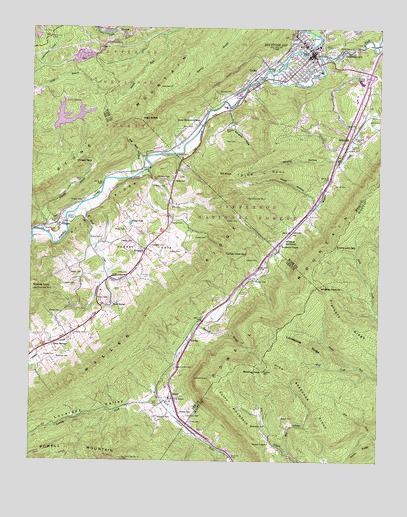
Big Stone Gap, VA USGS Topographic Map
Click on map above to begin viewing in our Map Viewer.

This topographic map contains these locations and features:
Feature Name Type Latitude Longitude GNIS ID View Map
Alvis ChapelChurchN36.7679°W82.8235°1481302View Map
Arbuckle Hill CemeteryCemeteryN36.7770°W82.8224°1481335View Map
Bailey CemeteryCemeteryN36.8134°W82.8424°1481396View Map
Barron CemeteryCemeteryN36.8187°W82.8249°1481477View Map
BeamantownPopulated PlaceN36.8682°W82.7629°1492531View Map
Beech Grove ChurchChurchN36.8690°W82.7640°1481592View Map
Big Stone Gap Police DepartmentBuildingN36.8625°W82.7712°2767021View Map
Big Stone Gap Post OfficePost OfficeN36.8667°W82.7750°2766157View Map
Big Stone Gap Rescue SquadBuildingN36.8679°W82.7763°2721170View Map
Big Stone Gap Volunteer Fire DepartmentBuildingN36.8680°W82.7760°2085828View Map
Big Stone Gap Volunteer Fire Department Station 2BuildingN36.8489°W82.7766°2721128View Map
Bishop CemeteryCemeteryN36.7640°W82.8207°1481816View Map
Bowen CemeteryCemeteryN36.7626°W82.7846°1481945View Map
Bowen ChapelChurchN36.7548°W82.7888°1481947View Map
Bowling KnobSummitN36.7759°W82.7910°1481951View Map
Buck CreekStreamN36.8340°W82.8332°1496497View Map
Bullit ParkParkN36.8668°W82.7815°1482162View Map
CadetPopulated PlaceN36.8604°W82.7946°1492691View Map
Cadet School (historical)SchoolN36.8473°W82.8143°1496594View Map
Carroll CemeteryCemeteryN36.8298°W82.7660°1482335View Map
Christ Episcopal ChurchChurchN36.8657°W82.7746°1496597View Map
Clarkston CemeteryCemeteryN36.8120°W82.8318°1482552View Map
Cliff MountainSummitN36.7607°W82.7968°1492779View Map
Coldiron CemeteryCemeteryN36.7873°W82.8574°1482636View Map
Collier CemeteryCemeteryN36.8106°W82.8213°1482648View Map
Collier CemeteryCemeteryN36.8145°W82.8118°1482649View Map
Collier CemeteryCemeteryN36.8193°W82.8004°1482650View Map
County Line School (historical)SchoolN36.8120°W82.7860°1496605View Map
CrestLocaleN36.8654°W82.8549°1482831View Map
Dalton-Cantrell HallBuildingN36.8560°W82.7584°2084299View Map
Deep Spring School (historical)SchoolN36.7848°W82.8674°1496504View Map
Deep SpringsPopulated PlaceN36.7834°W82.8668°1492854View Map
Eden CemeteryCemeteryN36.7608°W82.8169°1483236View Map
Elisha Lick GapGapN36.8120°W82.7657°1483261View Map
Elk KnobSummitN36.8329°W82.8027°1492911View Map
Exeter CemeteryCemeteryN36.8704°W82.8424°1483323View Map
Flannery RidgeRidgeN36.7882°W82.7646°1483433View Map
Gibson ChapelChurchN36.8201°W82.8591°1483616View Map
Gilly CemeteryCemeteryN36.8232°W82.8249°1483638View Map
Glencoe CemeteryCemeteryN36.8681°W82.7677°1483668View Map
Godwin HallBuildingN36.8543°W82.7584°2084297View Map
Goodloe (historical)Populated PlaceN36.8612°W82.8602°1496520View Map
Goodloe CenterBuildingN36.8535°W82.7592°2084302View Map
Gravely BranchStreamN36.8162°W82.8716°1483769View Map
Greene CemeteryCemeteryN36.8168°W82.8704°1483818View Map
HarveyPopulated PlaceN36.7843°W82.8177°1493059View Map
High ButteSummitN36.8482°W82.8354°1493081View Map
Holton HallBuildingN36.8549°W82.7585°2084298View Map
Hood HollowValleyN36.8244°W82.7730°1484194View Map
Hugh Williams Memorial BridgeBridgeN36.8690°W82.7757°1496621View Map
IrondalePopulated PlaceN36.8434°W82.7607°1493128View Map
Irondale ChurchChurchN36.8398°W82.7618°1484363View Map
JasperPopulated PlaceN36.7682°W82.8229°1493135View Map
Jasper School (historical)SchoolN36.7682°W82.8249°1496529View Map
Jasper Volunteer Fire DepartmentBuildingN36.7682°W82.8224°2721066View Map
Jones CemeteryCemeteryN36.8043°W82.8399°1484495View Map
Lake KeokeeReservoirN36.8483°W82.8596°1484560View Map
Lake Keokee DamDamN36.8454°W82.8668°1490248View Map
Lake Keokee Recreation SiteLocaleN36.8576°W82.8596°1494297View Map
Lane CemeteryCemeteryN36.8423°W82.8015°1484651View Map
Lawson CemeteryCemeteryN36.8079°W82.7929°1484735View Map
Lonesome RidgeRidgeN36.7829°W82.7760°1485042View Map
Lovelady CreekStreamN36.7670°W82.8260°1485097View Map
Lovelady ValleyValleyN36.7652°W82.8272°1485099View Map
McKinley CemeteryCemeteryN36.7795°W82.8654°1485310View Map
Meredith CemeteryCemeteryN36.7626°W82.8285°1485357View Map
Mill HollowValleyN36.7524°W82.7814°1485442View Map
Mountain Empire Community CollegeSchoolN36.8551°W82.7585°2084296View Map
Mountain SchoolSchoolN36.7604°W82.7899°1485686View Map
Napier CemeteryCemeteryN36.7920°W82.8640°1485790View Map
Old Still HollowValleyN36.8369°W82.8373°1485966View Map
OlingerPopulated PlaceN36.8173°W82.8646°1493373View Map
Olinger CemeteryCemeteryN36.8245°W82.8565°1485970View Map
Olinger GapGapN36.8362°W82.8591°1485972View Map
OretonPopulated PlaceN36.8157°W82.7815°1485990View Map
Peterson CemeteryCemeteryN36.8056°W82.7924°1486168View Map
Philips ChapelChurchN36.8612°W82.7588°1486176View Map
Phillips-Taylor HallBuildingN36.8541°W82.7590°2084301View Map
Pick Breeches RidgeRidgeN36.7659°W82.7724°1486184View Map
Pine SpurRidgeN36.8332°W82.7913°1486231View Map
Reasor CemeteryCemeteryN36.7801°W82.8702°1486528View Map
Reasor CemeteryCemeteryN36.7962°W82.8474°1486529View Map
Reasor CemeteryCemeteryN36.8006°W82.8582°1496131View Map
Reasor CemeteryCemeteryN36.8037°W82.8607°1496132View Map
Rhoton CemeteryCemeteryN36.8023°W82.7943°1486576View Map
Roaring BranchStreamN36.7868°W82.8171°1486653View Map
Robb HallBuildingN36.8551°W82.7590°2084300View Map
Robinette CemeteryCemeteryN36.8429°W82.7568°1486679View Map
Robinette ChapelChurchN36.8126°W82.7846°1486682View Map
SeminaryPopulated PlaceN36.8107°W82.8335°1493535View Map
Seminary School (historical)SchoolN36.8112°W82.8341°1496569View Map
Seminary United Methodist ChurchChurchN36.8107°W82.8335°1496570View Map
Shipley HollowValleyN36.8371°W82.7649°1487205View Map
Shupe CemeteryCemeteryN36.7668°W82.8243°1496571View Map
Slemp CemeteryCemeteryN36.8145°W82.8499°1487310View Map
Slemp CemeteryCemeteryN36.8168°W82.8410°1487311View Map
Slemp PondLakeN36.8186°W82.8393°1487313View Map
South Fork Powell RiverStreamN36.8618°W82.7882°1487408View Map
Stocker KnobSummitN36.7990°W82.8738°1493657View Map
Stone MountainRangeN36.8576°W82.8282°1487600View Map
Stone Mountain ChapelChurchN36.8476°W82.8149°1487601View Map
Sturgil CemeteryCemeteryN36.7706°W82.8249°1496576View Map
Tannery CemeteryCemeteryN36.8570°W82.8027°1487773View Map
Three ForksAreaN36.8629°W82.7891°1493704View Map
TitoPopulated PlaceN36.7582°W82.8143°1493711View Map
Tomlinson CemeteryCemeteryN36.7629°W82.8185°1487946View Map
Town of Big Stone GapCivilN36.8616°W82.7774°2390730View Map
Trinity United Methodist ChurchChurchN36.8632°W82.7763°1496651View Map
TurkeyBasinN36.8106°W82.8410°1488015View Map
Turkey Cove GapGapN36.8107°W82.8052°1488018View Map
Wade CemeteryCemeteryN36.8306°W82.8232°1488144View Map
Wake SpringSpringN36.7949°W82.8453°1488151View Map
Wallen's Ridge State PrisonBuildingN36.8421°W82.7867°2741370View Map
Wampler CemeteryCemeteryN36.8318°W82.8246°1488181View Map
Wells CemeteryCemeteryN36.8465°W82.8171°1488226View Map
Wildcat School (historical)SchoolN36.8234°W82.7749°1496654View Map
Wildcat SummitGapN36.8143°W82.7843°1488377View Map
Williams CemeteryCemeteryN36.8462°W82.8040°1488389View Map
Williams CoveValleyN36.8511°W82.8043°1488393View Map
Wilson CemeteryCemeteryN36.8293°W82.8310°1488410View Map
Wolf CreekStreamN36.7770°W82.7565°1488438View Map
Wrights PastureFlatN36.7984°W82.7682°1487096View Map
Zion ChurchChurchN36.8465°W82.7588°1487134View Map

Note: Coordinates in the location and feature list above are referenced to NAD83 datum.


Copyright (C) 2008-2024 Ryan Niemi / Sunset Dynamics ... All Rights Reserved