TopoQuest Logo
Do you find TopoQuest useful?
Help keep TopoQuest running and adding new maps/features by donating!
Bitcoin:  19c7KJd3qBynnjoSw5npx9KScwjBe4ifkT
Litecoin:  LXs6TkuXGGXo1vDsWCkWVdjQX94eUKd6ui
Home View Maps Find Maps Find Places Resources & Links


Rosepine, Louisiana Topographic Map

USGS Map Title: Rosepine, LA
USGS Map MRC: 30093H3
DRG (GeoTIFF) Download: o30093h3.tif


Neighboring USGS Topographic Map Quads:


  Burr Ferry, LA  
31093A4
 

  New Llano, LA  
31093A3
 

  Fort Polk, LA  
31093A2
 

  Knight, LA  
30093H4
 

  Rosepine, LA  
30093H3
 

  Hurricane Branch, LA  
30093H2
 

  Neale, LA  
30093G4
 

  DeRidder, LA  
30093G3
 

  Boneset Creek, LA  
30093G2


Map MRC Location:

N31°
W94°
N31°
W93°
H8 H7 H6 H5 H4 H3 H2 H1
G8 G7 G6 G5 G4 G3 G2 G1
F8 F7 F6 F5 F4 F3 F2 F1
E8 E7 E6 E5 E4 E3 E2 E1
D8 D7 D6 D5 D4 D3 D2 D1
C8 C7 C6 C5 C4 C3 C2 C1
B8 B7 B6 B5 B4 B3 B2 B1
A8 A7 A6 A5 A4 A3 A2 A1
N30°
W94°
N30°
W93°

Rosepine, LA USGS 1:24K Topographic Map Preview:
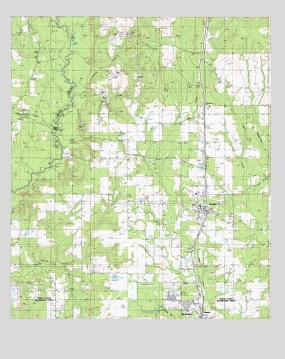
Rosepine, LA USGS Topographic Map
Click on map above to begin viewing in our Map Viewer.

This topographic map contains these locations and features:
Feature Name Type Latitude Longitude GNIS ID View Map
Big BranchStreamN30.9677°W93.3441°533039View Map
Cypress Creek Baptist ChurchChurchN30.8974°W93.3738°554170View Map
Cypress Creek Baptist ChurchChurchN30.8974°W93.3728°2601560View Map
Cypress Creek CemeteryCemeteryN30.9088°W93.3410°534367View Map
DeRidder Fire Department Northside StationBuildingN30.8788°W93.2855°2691703View Map
First Baptist Church of RosepineChurchN30.9196°W93.2846°550003View Map
KDLA-AM (De Ridder)TowerN30.8788°W93.2904°1633169View Map
KEAZ-FM (De Ridder)TowerN30.8788°W93.2904°1633050View Map
KROK-FM (De Ridder)TowerN30.8949°W93.2674°1633051View Map
Lillie ChurchChurchN30.9899°W93.3629°536451View Map
Little Clear CreekStreamN30.9285°W93.2607°547596View Map
Louisiana Noname 66 DamDamN30.8802°W93.3002°556922View Map
Louisiana Noname 67 DamDamN30.8769°W93.2918°556923View Map
Miller CemeteryCemeteryN30.9860°W93.3607°537136View Map
NeamePopulated PlaceN30.9746°W93.2818°543511View Map
Nichols CreekStreamN30.9682°W93.3479°537675View Map
Ollieville ChurchChurchN30.9582°W93.3713°537877View Map
Parish Governing Authority District 1CivilN30.9982°W93.2834°1929766View Map
PinewoodPopulated PlaceN30.9635°W93.2821°542173View Map
Pleasantview ChurchChurchN30.9485°W93.3304°538269View Map
Pocosin CreekStreamN30.9538°W93.3538°538280View Map
Rivers of Living Water ChurchChurchN30.8760°W93.2845°2602342View Map
RosepinePopulated PlaceN30.9199°W93.2824°538726View Map
Rosepine CemeteryCemeteryN30.9244°W93.2774°550064View Map
Rosepine Elementary SchoolSchoolN30.9217°W93.2837°550065View Map
Rosepine Junior Senior High SchoolSchoolN30.9270°W93.2860°550066View Map
Rosepine Post OfficePost OfficeN30.9251°W93.2819°1631391View Map
Rosepine Town MarshalBuildingN30.9204°W93.2820°2755239View Map
Rosepine United Pentecostal ChurchChurchN30.9244°W93.2818°550067View Map
Rosepine Volunteer Fire DepartmentBuildingN30.9149°W93.2816°2672931View Map
Shiloh Primitive Baptist ChurchChurchN30.9189°W93.2796°2602807View Map
Town of RosepineCivilN30.9208°W93.2857°2407247View Map
Tri Parish Rehabilitation HospitalBuildingN30.9408°W93.2842°2601226View Map
Walnut Grove ChurchChurchN30.9177°W93.3632°540220View Map
Ward SevenCivilN30.9182°W93.2727°545253View Map
West Louisiana Experimental StationLocaleN30.9482°W93.2771°550089View Map

Note: Coordinates in the location and feature list above are referenced to NAD83 datum.


Copyright (C) 2008-2024 Ryan Niemi / Sunset Dynamics ... All Rights Reserved