TopoQuest Logo
Do you find TopoQuest useful?
Help keep TopoQuest running and adding new maps/features by donating!
Bitcoin:  19c7KJd3qBynnjoSw5npx9KScwjBe4ifkT
Litecoin:  LXs6TkuXGGXo1vDsWCkWVdjQX94eUKd6ui
Home View Maps Find Maps Find Places Resources & Links


Ross Mountain, Alabama Topographic Map

USGS Map Title: Ross Mountain, AL
USGS Map MRC: 33085E5
DRG (GeoTIFF) Download: o33085e5.tif


Neighboring USGS Topographic Map Quads:


  Choccolocco, AL  
33085F6
 

  Heflin, AL  
33085F5
 

  Fruithurst, AL  
33085F4
 

  Hollis Crossroads, AL  
33085E6
 

  Ross Mountain, AL  
33085E5
 

  Hightower, AL  
33085E4
 

  Delta, AL  
33085D6
 

  Micaville, AL  
33085D5
 

  Newell, AL  
33085D4


Map MRC Location:

N34°
W86°
N34°
W85°
H8 H7 H6 H5 H4 H3 H2 H1
G8 G7 G6 G5 G4 G3 G2 G1
F8 F7 F6 F5 F4 F3 F2 F1
E8 E7 E6 E5 E4 E3 E2 E1
D8 D7 D6 D5 D4 D3 D2 D1
C8 C7 C6 C5 C4 C3 C2 C1
B8 B7 B6 B5 B4 B3 B2 B1
A8 A7 A6 A5 A4 A3 A2 A1
N33°
W86°
N33°
W85°

Ross Mountain, AL USGS 1:24K Topographic Map Preview:
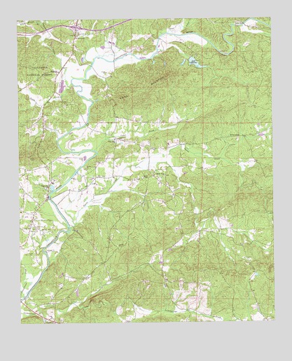
Ross Mountain, AL USGS Topographic Map
Click on map above to begin viewing in our Map Viewer.

This topographic map contains these locations and features:
Feature Name Type Latitude Longitude GNIS ID View Map
Arbacoochee (historical)Populated PlaceN33.5762°W85.5172°159079View Map
Arbacoochee Lode and Placer MineMineN33.5782°W85.5200°1802548View Map
Bald MountainRidgeN33.5171°W85.5616°162705View Map
Beason Grove Baptist ChurchChurchN33.5604°W85.5538°159133View Map
Beason Grove CemeteryCemeteryN33.5604°W85.5527°1730358View Map
Beason MillLocaleN33.5632°W85.5602°162706View Map
BelltownPopulated PlaceN33.6034°W85.6066°159145View Map
Blake MountainRidgeN33.5221°W85.5047°162710View Map
Bobo BranchStreamN33.6237°W85.6127°159221View Map
Cahulga CreekStreamN33.5971°W85.5997°159295View Map
Cane CreekStreamN33.6190°W85.5527°159316View Map
Caver MineMineN33.5190°W85.5958°163080View Map
Cedar CreekStreamN33.5709°W85.5877°159344View Map
Cedar Creek ChurchChurchN33.5754°W85.5786°159347View Map
Chulafinnee CreekStreamN33.5101°W85.6241°159406View Map
Clear CreekStreamN33.5673°W85.5258°162717View Map
Denman BridgeBridgeN33.5509°W85.6100°162725View Map
Dynne CreekStreamN33.5393°W85.6002°159543View Map
Endora (historical)LocaleN33.5387°W85.5458°162727View Map
Evans BridgeBridgeN33.6168°W85.5550°162728View Map
Evans CemeteryCemeteryN33.6195°W85.5583°163646View Map
Flemming MineMineN33.5346°W85.5691°163081View Map
Gold HillPopulated PlaceN33.5865°W85.5277°1802547View Map
Greens ChapelChurchN33.5596°W85.5644°159696View Map
Harmony Grove School (historical)SchoolN33.5134°W85.5216°162734View Map
Heflin DivisionCivilN33.6059°W85.6089°161605View Map
Hepsabah CemeteryCemeteryN33.5009°W85.6077°163648View Map
Hepsabah ChurchChurchN33.5004°W85.6080°159756View Map
Howells Grove School (historical)SchoolN33.5601°W85.5036°162741View Map
Interchange 199CrossingN33.6221°W85.5958°163044View Map
Kemp MountainRidgeN33.5271°W85.5711°162742View Map
Lake CleburneReservoirN33.6067°W85.5374°159415View Map
Lake Cleburne DamDamN33.6093°W85.5395°161447View Map
Morris MineMineN33.5371°W85.5991°163082View Map
Mountain Grove ChurchChurchN33.5615°W85.6250°160194View Map
Mulkey ProspectMineN33.5298°W85.5866°163083View Map
New Harmony CemeteryCemeteryN33.6182°W85.5958°1805716View Map
New Harmony ChurchChurchN33.6182°W85.5972°160231View Map
Oak Hill ChurchChurchN33.5318°W85.5766°160276View Map
Oakfuskee (historical)LocaleN33.5023°W85.6133°162751View Map
Oakfuskee Post Office (historical)Post OfficeN33.5098°W85.6222°166187View Map
Oswalt (historical)LocaleN33.5371°W85.5219°162753View Map
Pleasant Hill ChurchChurchN33.5557°W85.6116°160411View Map
Pleasant Hill School (historical)SchoolN33.5501°W85.6175°162754View Map
Riddles BridgeBridgeN33.5079°W85.6227°162758View Map
Ross BridgeBridgeN33.6062°W85.5888°162760View Map
Ross MountainSummitN33.6004°W85.5538°160537View Map
Sheep CreekStreamN33.6223°W85.5144°162762View Map
Snake CreekStreamN33.5984°W85.5988°160637View Map
Teagues Mill (historical)LocaleN33.5446°W85.5377°162764View Map
Union Hill School (historical)SchoolN33.5251°W85.5850°162767View Map
Vise Grove ChurchChurchN33.5193°W85.5444°164210View Map
Woodstock MineMineN33.5118°W85.6180°163084View Map

Note: Coordinates in the location and feature list above are referenced to NAD83 datum.


Copyright (C) 2008-2024 Ryan Niemi / Sunset Dynamics ... All Rights Reserved