TopoQuest Logo
Do you find TopoQuest useful?
Help keep TopoQuest running and adding new maps/features by donating!
Bitcoin:  19c7KJd3qBynnjoSw5npx9KScwjBe4ifkT
Litecoin:  LXs6TkuXGGXo1vDsWCkWVdjQX94eUKd6ui
Home View Maps Find Maps Find Places Resources & Links


Rotterdam Junction, New York Topographic Map

USGS Map Title: Rotterdam Junction, NY
USGS Map MRC: 42074G1
DRG (GeoTIFF) Download: o42074g1.tif


Neighboring USGS Topographic Map Quads:


  Amsterdam, NY  
42074H2
 

  Pattersonville, NY  
42074H1
 

  Burnt Hills, NY  
42073H8
 

  Duanesburg, NY  
42074G2
 

  Rotterdam Junction, NY  
42074G1
 

  Schenectady, NY  
42073G8
 

  Gallupville, NY  
42074F2
 

  Altamont, NY  
42074F1
 

  Voorheesville, NY  
42073F8


Map MRC Location:

N43°
W75°
N43°
W74°
H8 H7 H6 H5 H4 H3 H2 H1
G8 G7 G6 G5 G4 G3 G2 G1
F8 F7 F6 F5 F4 F3 F2 F1
E8 E7 E6 E5 E4 E3 E2 E1
D8 D7 D6 D5 D4 D3 D2 D1
C8 C7 C6 C5 C4 C3 C2 C1
B8 B7 B6 B5 B4 B3 B2 B1
A8 A7 A6 A5 A4 A3 A2 A1
N42°
W75°
N42°
W74°

Rotterdam Junction, NY USGS 1:24K Topographic Map Preview:
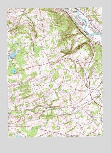
Rotterdam Junction, NY USGS Topographic Map
Click on map above to begin viewing in our Map Viewer.

This topographic map contains these locations and features:
Feature Name Type Latitude Longitude GNIS ID View Map
Bonny BrookStreamN42.7773°W74.0690°944432View Map
Briar Creek Golf CourseLocaleN42.7661°W74.0306°2615352View Map
Christ Church of the HillsChurchN42.8210°W74.0692°2615706View Map
Duane LakePopulated PlaceN42.7531°W74.1076°1852896View Map
Duane Lake Census Designated PlaceCensusN42.7526°W74.1089°2389418View Map
Duanesburg Rest AreaLocaleN42.7878°W74.0215°2615113View Map
Ellers School (historical)SchoolN42.8579°W74.0268°949510View Map
Featherstonhaugh LakeLakeN42.8140°W74.1163°949950View Map
Ferguson CemeteryCemeteryN42.7734°W74.0741°949979View Map
GiffordPopulated PlaceN42.7509°W74.0485°951074View Map
Hillcrest Mobile Home ParkPopulated PlaceN42.7625°W74.1061°2462695View Map
Holy Cross CemeteryCemeteryN42.7835°W74.0025°953044View Map
Iroquois ClubLocaleN42.7751°W74.0212°953787View Map
KelleysPopulated PlaceN42.7795°W74.0679°972680View Map
Kingdom Hall of Jehovahs WitnessesChurchN42.7572°W74.0781°2616567View Map
Lower Rotterdam JunctionPopulated PlaceN42.8606°W74.0287°956106View Map
Moccasin KillStreamN42.8531°W74.0243°957460View Map
Mohawk Valley Airport (historical)AirportN42.8693°W74.0275°978289View Map
Pine Grove Fire DepartmentBuildingN42.7646°W74.0011°2718620View Map
Plotter KillStreamN42.8470°W74.0129°960753View Map
Plotterkill Volunteer Fire CompanyBuildingN42.8209°W74.0708°2718736View Map
PrincetownPopulated PlaceN42.7790°W74.0646°961142View Map
Princetown ChurchChurchN42.8073°W74.0793°961143View Map
Princetown Reformed ChurchChurchN42.7510°W74.0484°2437908View Map
Princetown Reformed Church CemeteryCemeteryN42.7515°W74.0485°2437907View Map
Princetown Town HallBuildingN42.7805°W74.0334°2617671View Map
Rabbit HollowValleyN42.8681°W74.0254°962116View Map
RectorsPopulated PlaceN42.8623°W74.0165°962266View Map
Rectors Volunteer Fire DistrictBuildingN42.8592°W74.0146°2718317View Map
Rotterdam JunctionPopulated PlaceN42.8745°W74.0465°970542View Map
Rotterdam Junction Fire District 1BuildingN42.8695°W74.0387°2718248View Map
Rotterdam Junction Post OfficePost OfficeN42.8694°W74.0376°2618096View Map
Rotterdam Rest AreaLocaleN42.8400°W74.0072°2615127View Map
Rynex CornersPopulated PlaceN42.8215°W74.0712°963147View Map
Saint Cyril and Method CemeteryCemeteryN42.7857°W74.0043°963453View Map
Schalmont High SchoolSchoolN42.7817°W74.0167°2437898View Map
Schalmont Middle SchoolSchoolN42.7819°W74.0183°2437897View Map
Schenectady CountyCivilN42.8181°W74.0586°974144View Map
Schenectady Seventh Day Adventist ChurchChurchN42.7587°W74.0278°2617070View Map
Sonrise Bible ChurchChurchN42.7781°W74.0027°2616272View Map
Town of PrincetownCivilN42.8113°W74.0781°979399View Map
Town of RotterdamCivilN42.8133°W74.0129°979437View Map
Van Slyck CemeteryCemeteryN42.8438°W74.0116°968430View Map
Washout CreekStreamN42.8651°W74.0271°968878View Map
West HillPopulated PlaceN42.8156°W74.0123°969251View Map
WGY-AM (Schenectady)TowerN42.7937°W74.0096°977647View Map
Woestina Elementary SchoolSchoolN42.8742°W74.0437°971534View Map
WyattsPopulated PlaceN42.8512°W74.0096°971771View Map

Note: Coordinates in the location and feature list above are referenced to NAD83 datum.


Copyright (C) 2008-2024 Ryan Niemi / Sunset Dynamics ... All Rights Reserved