TopoQuest Logo
Do you find TopoQuest useful?
Help keep TopoQuest running and adding new maps/features by donating!
Bitcoin:  19c7KJd3qBynnjoSw5npx9KScwjBe4ifkT
Litecoin:  LXs6TkuXGGXo1vDsWCkWVdjQX94eUKd6ui
Home View Maps Find Maps Find Places Resources & Links


Round Bottom, Ohio Topographic Map

USGS Map Title: Round Bottom, OH
USGS Map MRC: 39080F8
DRG (GeoTIFF) Download: o39080f8.tif


Neighboring USGS Topographic Map Quads:


  Woodsfield, OH  
39081G1
 

  Cameron, OH  
39080G8
 

  Powhatan Point, OH  
39080G7
 

  Antioch, OH  
39081F1
 

  Round Bottom, OH  
39080F8
 

  New Martinsville, WV  
39080F7
 

  New Matamoras, OH  
39081E1
 

  Paden City, WV  
39080E8
 

  Porters Falls, WV  
39080E7


Map MRC Location:

N40°
W81°
N40°
W80°
H8 H7 H6 H5 H4 H3 H2 H1
G8 G7 G6 G5 G4 G3 G2 G1
F8 F7 F6 F5 F4 F3 F2 F1
E8 E7 E6 E5 E4 E3 E2 E1
D8 D7 D6 D5 D4 D3 D2 D1
C8 C7 C6 C5 C4 C3 C2 C1
B8 B7 B6 B5 B4 B3 B2 B1
A8 A7 A6 A5 A4 A3 A2 A1
N39°
W81°
N39°
W80°

Round Bottom, OH USGS 1:24K Topographic Map Preview:
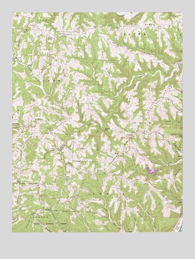
Round Bottom, OH USGS Topographic Map
Click on map above to begin viewing in our Map Viewer.

This topographic map contains these locations and features:
Feature Name Type Latitude Longitude GNIS ID View Map
Alum RunStreamN39.7206°W80.8790°1075258View Map
Baptist RidgeRidgeN39.6481°W80.8934°1075303View Map
Beautiful RidgeRidgeN39.7267°W80.9132°1075333View Map
Boston HillSummitN39.6590°W80.8773°1075426View Map
Chapel Hill Methodist CemeteryCemeteryN39.7370°W80.9601°1963755View Map
Chapel Hill Methodist ChurchChurchN39.7373°W80.9601°1075564View Map
Connecting RidgeRidgeN39.6701°W80.9162°1075617View Map
DairyPopulated PlaceN39.6526°W80.9804°1075670View Map
Dairy Post Office (historical)Post OfficeN39.6529°W80.9804°2037297View Map
Duffy HillSummitN39.6479°W80.8795°1075751View Map
Emma Grove CemeteryCemeteryN39.6715°W80.8751°1075808View Map
Fuchs CemeteryCemeteryN39.7108°W80.9546°1963759View Map
GoodwinPopulated PlaceN39.6798°W80.9115°1075935View Map
Goodwin Post Office (historical)Post OfficeN39.6792°W80.9109°2037308View Map
Hannibal RidgeRidgeN39.6773°W80.8898°1075999View Map
Harmon RidgeRidgeN39.7220°W80.9318°1076009View Map
Kraft CemeteryCemeteryN39.7225°W80.9662°1076193View Map
Lock FifteenDamN39.6284°W80.8754°1076284View Map
Long RidgeRidgeN39.6981°W80.8923°1076298View Map
McEldowney BarBarN39.6334°W80.8832°1549542View Map
McIntire CemeteryCemeteryN39.7400°W80.9506°1076365View Map
MortonPopulated PlaceN39.6734°W80.9498°1077285View Map
Morton Post Office (historical)Post OfficeN39.6737°W80.9498°2037327View Map
Morton Ridge ChurchChurchN39.6651°W80.9495°1076438View Map
Mount Moriah CemeteryCemeteryN39.6578°W80.9487°1076451View Map
Mount Olive CemeteryCemeteryN39.6556°W80.9587°1963779View Map
Mount Olive ChurchChurchN39.6554°W80.9593°1076454View Map
Mount Sinai Methodist CemeteryCemeteryN39.7409°W80.8923°1963780View Map
Mount Sinai Methodist ChurchChurchN39.7409°W80.8923°1076459View Map
Mount Union CemeteryCemeteryN39.7003°W80.8840°1963781View Map
Mount Union ChurchChurchN39.7006°W80.8840°1043529View Map
Mount Zion CemeteryCemeteryN39.6815°W80.9090°1963783View Map
Mule RidgeRidgeN39.7040°W80.9134°1076483View Map
Mutton RunStreamN39.7137°W80.9812°1076489View Map
OakPopulated PlaceN39.7412°W80.9395°1076535View Map
Oak Post Office (historical)Post OfficeN39.7417°W80.9401°2037366View Map
Oliver RunStreamN39.6717°W80.9648°1076574View Map
Parker CemeteryCemeteryN39.6520°W80.9762°1076596View Map
Pine RunStreamN39.6856°W80.9457°1076642View Map
Pleasant RidgeRidgeN39.7367°W80.9909°1076653View Map
Pleasant Ridge CemeteryCemeteryN39.7417°W80.9840°1076657View Map
Quarto Number Seven Slurry Impoundment Three DamDamN39.7201°W80.8798°1079547View Map
Round BottomPopulated PlaceN39.7351°W80.9693°1076774View Map
Saint James Lutheran CemeteryCemeteryN39.7409°W80.9240°1963795View Map
Saint James Lutheran ChurchChurchN39.7409°W80.9237°1076793View Map
Saint Johns ChurchChurchN39.6687°W80.9220°1076788View Map
Saint Johns Methodist CemeteryCemeteryN39.6684°W80.9223°1963796View Map
Salem CemeteryCemeteryN39.6648°W80.9495°1963800View Map
Salem CemeteryCemeteryN39.7423°W80.9126°1963801View Map
Salem ChurchChurchN39.7423°W80.9123°1076809View Map
Sardis CemeteryCemeteryN39.6261°W80.9149°1963802View Map
Sardis Census Designated PlaceCensusN39.6269°W80.9058°2628967View Map
Sardis RidgeRidgeN39.6398°W80.9154°1076836View Map
Short RidgeRidgeN39.6962°W80.8807°1076887View Map
Six PointPopulated PlaceN39.7237°W80.9982°1076900View Map
Slurry Impoundments 3, 3a, 3bReservoirN39.7201°W80.8798°1079548View Map
Sykes CemeteryCemeteryN39.7448°W80.8781°1077018View Map
Sykes RidgeRidgeN39.7426°W80.9157°1077019View Map
Tise RidgeRidgeN39.6315°W80.9379°1077057View Map
Tisher RidgeRidgeN39.6670°W80.9048°1077058View Map
Township of LeeCivilN39.6440°W80.9403°1086653View Map
Township of OhioCivilN39.6878°W80.8980°1086655View Map
Tubaugh LakeReservoirN39.6766°W80.9892°1077978View Map
Tubaugh Lake DamDamN39.6751°W80.9898°1077977View Map
Watkins ForkStreamN39.6834°W80.9357°1077144View Map
WATQ-FM (New Martinsville)TowerN39.6779°W80.8782°1559819View Map
Wildcat RunStreamN39.6634°W80.9615°1077190View Map
Winklers MillPopulated PlaceN39.6837°W80.9332°1077211View Map

Note: Coordinates in the location and feature list above are referenced to NAD83 datum.


Copyright (C) 2008-2025 Ryan Niemi / Sunset Dynamics ... All Rights Reserved