TopoQuest Logo
Do you find TopoQuest useful?
Help keep TopoQuest running and adding new maps/features by donating!
Bitcoin:  19c7KJd3qBynnjoSw5npx9KScwjBe4ifkT
Litecoin:  LXs6TkuXGGXo1vDsWCkWVdjQX94eUKd6ui
Home View Maps Find Maps Find Places Resources & Links


Roxton, Texas Topographic Map

USGS Map Title: Roxton, TX
USGS Map MRC: 33095E6
DRG (GeoTIFF) Download: o33095e6.tif


Neighboring USGS Topographic Map Quads:


  Tigertown, TX  
33095F7
 

  Toco, TX  
33095F6
 

  Paris, TX  
33095F5
 

  Petty, TX  
33095E7
 

  Roxton, TX  
33095E6
 

  Biardstown, TX  
33095E5
 

  Pecan Gap, TX  
33095D7
 

  Cooper North, TX  
33095D6
 

  Charleston, TX  
33095D5


Map MRC Location:

N34°
W96°
N34°
W95°
H8 H7 H6 H5 H4 H3 H2 H1
G8 G7 G6 G5 G4 G3 G2 G1
F8 F7 F6 F5 F4 F3 F2 F1
E8 E7 E6 E5 E4 E3 E2 E1
D8 D7 D6 D5 D4 D3 D2 D1
C8 C7 C6 C5 C4 C3 C2 C1
B8 B7 B6 B5 B4 B3 B2 B1
A8 A7 A6 A5 A4 A3 A2 A1
N33°
W96°
N33°
W95°

Roxton, TX USGS 1:24K Topographic Map Preview:
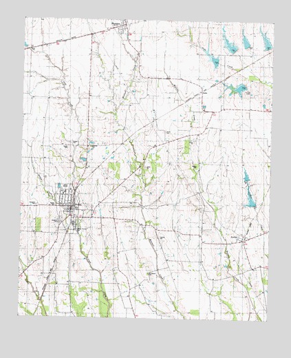
Roxton, TX USGS Topographic Map
Click on map above to begin viewing in our Map Viewer.

This topographic map contains these locations and features:
Feature Name Type Latitude Longitude GNIS ID View Map
AmbiaPopulated PlaceN33.5929°W95.6591°1379339View Map
Ambia SchoolSchoolN33.5765°W95.6675°1351071View Map
Ambia SchoolSchoolN33.5898°W95.6488°1351072View Map
Arkansas CemeteryCemeteryN33.5718°W95.7155°1889872View Map
BrookstonPopulated PlaceN33.6232°W95.6994°1352950View Map
Brookston Post OfficePost OfficeN33.6233°W95.6999°2731684View Map
Brookston Volunteer Fire Department - First RespondersBuildingN33.6228°W95.7013°2655520View Map
City of RoxtonCivilN33.5453°W95.7248°2411008View Map
Delmar SchoolSchoolN33.5159°W95.6433°1355901View Map
Denton CemeteryCemeteryN33.5457°W95.7311°1355922View Map
Denton CreekStreamN33.5359°W95.7216°1355923View Map
Dickie CemeteryCemeteryN33.5782°W95.6783°1889874View Map
Flying Tigers MuseumBuildingN33.6187°W95.6736°2014550View Map
Gough CemeteryCemeteryN33.5709°W95.7275°1889871View Map
Harrington North LakeReservoirN33.5584°W95.6369°1864627View Map
Harrington North Lake DamDamN33.5584°W95.6369°1864626View Map
Harrington South LakeReservoirN33.5484°W95.6336°1857841View Map
Harrington South Lake DamDamN33.5484°W95.6336°1857840View Map
HighPopulated PlaceN33.6123°W95.7472°1359149View Map
HowlandPopulated PlaceN33.5332°W95.6388°1359748View Map
Howland DivisionCivilN33.5669°W95.6444°1938849View Map
Mallory CemeteryCemeteryN33.5640°W95.6622°1889873View Map
McGlasson CemeteryCemeteryN33.5187°W95.6861°1362465View Map
Oklahoma SchoolSchoolN33.5093°W95.6925°1364377View Map
Pleasant Valley SchoolSchoolN33.5157°W95.7255°1365460View Map
Restland CemeteryCemeteryN33.5404°W95.7314°1366381View Map
Rice CemeteryCemeteryN33.5954°W95.6380°1890033View Map
Rockyford CemeteryCemeteryN33.5473°W95.7425°1366808View Map
RoxtonPopulated PlaceN33.5462°W95.7258°1366983View Map
Roxton City HallBuildingN33.5470°W95.7251°2753263View Map
Roxton Elementary SchoolSchoolN33.5518°W95.7280°2007917View Map
Roxton High SchoolSchoolN33.5518°W95.7280°2007918View Map
Roxton Junior High SchoolSchoolN33.5518°W95.7280°2007919View Map
Roxton Post OfficePost OfficeN33.5447°W95.7249°2731874View Map
Roxton Volunteer Fire DepartmentBuildingN33.5467°W95.7252°2655263View Map
Soil Conservation Service Site 1 DamDamN33.6084°W95.6519°1857866View Map
Soil Conservation Service Site 2 DamDamN33.6134°W95.6436°1857864View Map
Soil Conservation Service Site 2 ReservoirReservoirN33.6134°W95.6436°1857865View Map
Soil Conservation Service Site 3 DamDamN33.5968°W95.6369°1857862View Map
Soil Conservation Service Site 3 ReservoirReservoirN33.5968°W95.6369°1857863View Map
Soil Conservation Service Site 4 DamDamN33.6168°W95.6402°1857860View Map
Soil Conservation Service Site 4 ReservoirReservoirN33.6168°W95.6402°1857861View Map
Soil Conservation Service Site 5 DamDamN33.6134°W95.6286°1857858View Map
Soil Conservation Service Site 5 ReservoirReservoirN33.6134°W95.6286°1857859View Map
Soil Conservation Service Site I ReservoirReservoirN33.6084°W95.6519°1857867View Map
State Highway 5 BridgeBridgeN33.6120°W95.7475°2031632View Map
Topping CemeteryCemeteryN33.5340°W95.6802°1889875View Map

Note: Coordinates in the location and feature list above are referenced to NAD83 datum.


Copyright (C) 2008-2025 Ryan Niemi / Sunset Dynamics ... All Rights Reserved