TopoQuest Logo
Do you find TopoQuest useful?
Help keep TopoQuest running and adding new maps/features by donating!
Bitcoin:  19c7KJd3qBynnjoSw5npx9KScwjBe4ifkT
Litecoin:  LXs6TkuXGGXo1vDsWCkWVdjQX94eUKd6ui
Home View Maps Find Maps Find Places Resources & Links


Tigertown, Texas Topographic Map

USGS Map Title: Tigertown, TX
USGS Map MRC: 33095F7
DRG (GeoTIFF) Download: o33095f7.tif


Neighboring USGS Topographic Map Quads:


  Monkstown, TX  
33095G8
 

  Direct, TX  
33095G7
 

  Pat Mayse Lake West, TX  
33095G6
 

  Selfs, TX  
33095F8
 

  Tigertown, TX  
33095F7
 

  Toco, TX  
33095F6
 

  Honey Grove, TX  
33095E8
 

  Petty, TX  
33095E7
 

  Roxton, TX  
33095E6


Map MRC Location:

N34°
W96°
N34°
W95°
H8 H7 H6 H5 H4 H3 H2 H1
G8 G7 G6 G5 G4 G3 G2 G1
F8 F7 F6 F5 F4 F3 F2 F1
E8 E7 E6 E5 E4 E3 E2 E1
D8 D7 D6 D5 D4 D3 D2 D1
C8 C7 C6 C5 C4 C3 C2 C1
B8 B7 B6 B5 B4 B3 B2 B1
A8 A7 A6 A5 A4 A3 A2 A1
N33°
W96°
N33°
W95°

Tigertown, TX USGS 1:24K Topographic Map Preview:
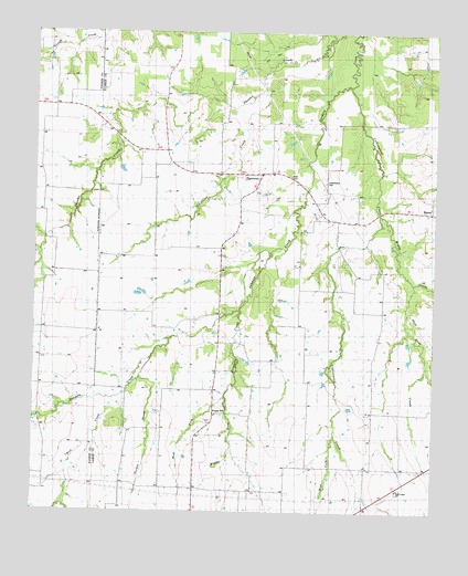
Tigertown, TX USGS Topographic Map
Click on map above to begin viewing in our Map Viewer.

This topographic map contains these locations and features:
Feature Name Type Latitude Longitude GNIS ID View Map
Bergher CreekStreamN33.6934°W95.8019°1351908View Map
Collins CreekStreamN33.7359°W95.8041°1354799View Map
Collins CreekStreamN33.7418°W95.7952°1383635View Map
Cottonwood CemeteryCemeteryN33.7112°W95.7850°1355068View Map
Cottonwood CemeteryCemeteryN33.7112°W95.7852°1383633View Map
Cottonwood CreekStreamN33.7362°W95.7772°1355104View Map
Cottonwood SchoolSchoolN33.6970°W95.7811°1355129View Map
Cottonwood SchoolSchoolN33.6979°W95.7811°1383613View Map
Doss CreekStreamN33.6851°W95.7566°1356167View Map
Felix Stephens LakeReservoirN33.6984°W95.8402°1864082View Map
Felix Stephens Lake DamDamN33.6984°W95.8402°1864081View Map
Forest HillPopulated PlaceN33.6512°W95.8180°2034664View Map
Forest HillPopulated PlaceN33.6515°W95.8169°1889616View Map
Forest Hill AirportAirportN33.6579°W95.8349°1387320View Map
Forest Hill ChurchChurchN33.6484°W95.8205°1357562View Map
Forest Hill SchoolSchoolN33.6573°W95.8191°1357564View Map
Gordon CreekStreamN33.6598°W95.8416°1358183View Map
Holt CreekStreamN33.6557°W95.8500°1374118View Map
Holt CreekStreamN33.6543°W95.8505°1383666View Map
MaxeyPopulated PlaceN33.7034°W95.7514°1362311View Map
Maxey CreekStreamN33.7029°W95.7680°1362312View Map
Michigan Prairie SchoolSchoolN33.6812°W95.8727°1362691View Map
Middle Fork Bergher CreekStreamN33.6551°W95.8150°1362721View Map
Pleasant Hill SchoolSchoolN33.6370°W95.7597°1365438View Map
Robinson Lake Number 1ReservoirN33.6618°W95.8452°1865218View Map
Robinson Lake Number 1 DamDamN33.6618°W95.8452°1865217View Map
TigertownPopulated PlaceN33.7137°W95.8044°1369938View Map
Tigertown Volunteer Fire DepartmentBuildingN33.7129°W95.8056°2655401View Map
Titus SchoolSchoolN33.7307°W95.8697°1369975View Map
Titus SchoolSchoolN33.7301°W95.8689°1383634View Map
West Fork Bergher CreekStreamN33.6551°W95.8150°1371124View Map
West Fork Cottonwood CreekStreamN33.6451°W95.7808°1371129View Map
West Lamar SchoolSchoolN33.6309°W95.7614°1889956View Map

Note: Coordinates in the location and feature list above are referenced to NAD83 datum.


Copyright (C) 2008-2024 Ryan Niemi / Sunset Dynamics ... All Rights Reserved