TopoQuest Logo
Do you find TopoQuest useful?
Help keep TopoQuest running and adding new maps/features by donating!
Bitcoin:  19c7KJd3qBynnjoSw5npx9KScwjBe4ifkT
Litecoin:  LXs6TkuXGGXo1vDsWCkWVdjQX94eUKd6ui
Home View Maps Find Maps Find Places Resources & Links


Rye, Colorado Topographic Map

USGS Map Title: Rye, CO
USGS Map MRC: 37104H8
DRG (GeoTIFF) Download: o37104h8.tif


Neighboring USGS Topographic Map Quads:


  Saint Charles Peak, CO  
38105A1
 

  Beulah, CO  
38104A8
 

  Muldoon Hill, CO  
38104A7
 

  San Isabel, CO  
37105H1
 

  Rye, CO  
37104H8
 

  Colorado City, CO  
37104H7
 

  Badito Cone, CO  
37105G1
 

  Hayden Butte, CO  
37104G8
 

  Huerfano Butte, CO  
37104G7


Map MRC Location:

N38°
W105°
N38°
W104°
H8 H7 H6 H5 H4 H3 H2 H1
G8 G7 G6 G5 G4 G3 G2 G1
F8 F7 F6 F5 F4 F3 F2 F1
E8 E7 E6 E5 E4 E3 E2 E1
D8 D7 D6 D5 D4 D3 D2 D1
C8 C7 C6 C5 C4 C3 C2 C1
B8 B7 B6 B5 B4 B3 B2 B1
A8 A7 A6 A5 A4 A3 A2 A1
N37°
W105°
N37°
W104°

Rye, CO USGS 1:24K Topographic Map Preview:
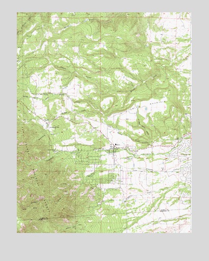
Rye, CO USGS Topographic Map
Click on map above to begin viewing in our Map Viewer.

This topographic map contains these locations and features:
Feature Name Type Latitude Longitude GNIS ID View Map
Bear Wallow CanyonValleyN37.9265°W104.9032°193920View Map
Brookside CemeteryCemeteryN37.9225°W104.9209°193918View Map
Cold SpringSpringN37.9281°W104.8839°193922View Map
Cold Spring CreekStreamN37.9286°W104.8803°193915View Map
Cuerna Verde ParkPopulated PlaceN37.9220°W104.9714°193914View Map
Gleason CanyonValleyN37.9555°W104.9330°192535View Map
Huckleberry CreekStreamN37.9389°W104.9747°192540View Map
Huckleberry HillsSummitN37.9350°W104.9733°193926View Map
Hunter DitchCanalN37.8910°W104.9336°2722934View Map
Iron SpringSpringN37.9261°W104.9061°193921View Map
KRYT-FM (Pueblo)TowerN37.9445°W104.9994°204180View Map
Middle Muddy CreekStreamN37.9533°W104.9728°192539View Map
Mount Olivet CemeteryCemeteryN37.9235°W104.9223°2750941View Map
North Muddy CreekStreamN37.9425°W104.9392°192537View Map
RyePopulated PlaceN37.9236°W104.9303°193917View Map
Rye Fire Protection District Station 1BuildingN37.9225°W104.9308°2666941View Map
Rye ParkParkN37.9206°W104.9558°193925View Map
Rye Post OfficePost OfficeN37.9236°W104.9293°2750862View Map
South Muddy CreekStreamN37.9425°W104.9392°192541View Map
Standard DitchCanalN37.9578°W104.9628°193913View Map
Table MountainSummitN37.9464°W104.9072°193919View Map
Town of RyeCivilN37.9213°W104.9321°2412588View Map

Note: Coordinates in the location and feature list above are referenced to NAD83 datum.


Copyright (C) 2008-2024 Ryan Niemi / Sunset Dynamics ... All Rights Reserved