TopoQuest Logo
Do you find TopoQuest useful?
Help keep TopoQuest running and adding new maps/features by donating!
Bitcoin:  19c7KJd3qBynnjoSw5npx9KScwjBe4ifkT
Litecoin:  LXs6TkuXGGXo1vDsWCkWVdjQX94eUKd6ui
Home View Maps Find Maps Find Places Resources & Links


Sabinata Flat, New Mexico Topographic Map

USGS Map Title: Sabinata Flat, NM
USGS Map MRC: 33105A8
DRG (GeoTIFF) Download: o33105a8.tif


Neighboring USGS Topographic Map Quads:


  Tularosa NE, NM  
33106B1
 

  Cat Mountain, NM  
33105B8
 

  Mescalero, NM  
33105B7
 

  Tularosa, NM  
33106A1
 

  Sabinata Flat, NM  
33105A8
 

  Domingo Peak, NM  
33105A7
 

  Malone Draw, NM  
32106H1
 

  Alamogordo North, NM  
32105H8
 

  High Rolls, NM  
32105H7


Map MRC Location:

N34°
W106°
N34°
W105°
H8 H7 H6 H5 H4 H3 H2 H1
G8 G7 G6 G5 G4 G3 G2 G1
F8 F7 F6 F5 F4 F3 F2 F1
E8 E7 E6 E5 E4 E3 E2 E1
D8 D7 D6 D5 D4 D3 D2 D1
C8 C7 C6 C5 C4 C3 C2 C1
B8 B7 B6 B5 B4 B3 B2 B1
A8 A7 A6 A5 A4 A3 A2 A1
N33°
W106°
N33°
W105°

Sabinata Flat, NM USGS 1:24K Topographic Map Preview:
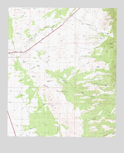
Sabinata Flat, NM USGS Topographic Map
Click on map above to begin viewing in our Map Viewer.

This topographic map contains these locations and features:
Feature Name Type Latitude Longitude GNIS ID View Map
10026 Water WellWellN33.0898°W105.9964°926384View Map
10628 Water WellWellN33.0243°W105.9936°926623View Map
AlamorosaPopulated PlaceN33.0056°W105.9922°2013470View Map
Armstrong and Armstrong RockMineN33.1040°W105.9222°916989View Map
Bitter SpringSpringN33.0436°W105.9150°901007View Map
Burro Water HoleSpringN33.0548°W105.9381°901008View Map
Chicken Ranch SpringSpringN33.0537°W105.9555°900972View Map
Cottonwood CanyonSpringN33.0050°W105.8784°900971View Map
Domingo CanyonValleyN33.0193°W105.9911°912799View Map
Dripping SpringSpringN33.0442°W105.9370°900512View Map
Gomez SpringSpringN33.0517°W105.8966°900668View Map
Gutierrez SpringSpringN33.0590°W105.9725°900669View Map
Hunter SpringSpringN33.0680°W105.8955°900486View Map
Laborcita CanyonValleyN33.0115°W105.9419°907734View Map
Martinez CanyonValleyN33.0470°W105.9455°900969View Map
Martinez SpringSpringN33.0870°W105.8793°900441View Map
Mitchell DamDamN33.0990°W105.9886°900536View Map
Rancheria CanyonValleyN33.0654°W105.9925°896874View Map
Rancheria SpringSpringN33.0906°W105.8838°896875View Map
Red TankReservoirN33.0512°W105.8883°900415View Map
Rock SpringSpringN33.0178°W105.9024°900414View Map
Sabinata FlatFlatN33.0306°W105.9880°896876View Map
Sabinata Flat ArroyoStreamN33.0187°W105.9844°885512View Map
Sabinata Flat ArroyoArroyoN33.0204°W105.9803°896877View Map
School Section WindmillLocaleN33.1001°W105.8844°900395View Map
Tularosa CanyonValleyN33.0829°W105.9911°911849View Map
Utter SpringSpringN33.0319°W105.9550°900392View Map
Wallenberg SpringSpringN33.0714°W105.9832°900394View Map
Whitmore SpringSpringN33.0690°W105.9667°900393View Map
Ysletano CanyonValleyN33.1115°W105.9386°909986View Map

Note: Coordinates in the location and feature list above are referenced to NAD83 datum.


Copyright (C) 2008-2025 Ryan Niemi / Sunset Dynamics ... All Rights Reserved