TopoQuest Logo
Do you find TopoQuest useful?
Help keep TopoQuest running and adding new maps/features by donating!
Bitcoin:  19c7KJd3qBynnjoSw5npx9KScwjBe4ifkT
Litecoin:  LXs6TkuXGGXo1vDsWCkWVdjQX94eUKd6ui
Home View Maps Find Maps Find Places Resources & Links


Sacaton Draw, New Mexico Topographic Map

USGS Map Title: Sacaton Draw, NM
USGS Map MRC: 35104A5
DRG (GeoTIFF) Download: o35104a5.tif


Neighboring USGS Topographic Map Quads:


  Bar Y Ranch, NM  
35104B6
 

  Mesa Cherisco, NM  
35104B5
 

  Mesita Del Gato, NM  
35104B4
 

  Catfish Falls, NM  
35104A6
 

  Sacaton Draw, NM  
35104A5
 

  Cuervo, NM  
35104A4
 

  Santa Rosa, NM  
34104H6
 

  Sunshine Mesa, NM  
34104H5
 

  Harben Lake, NM  
34104H4


Map MRC Location:

N36°
W105°
N36°
W104°
H8 H7 H6 H5 H4 H3 H2 H1
G8 G7 G6 G5 G4 G3 G2 G1
F8 F7 F6 F5 F4 F3 F2 F1
E8 E7 E6 E5 E4 E3 E2 E1
D8 D7 D6 D5 D4 D3 D2 D1
C8 C7 C6 C5 C4 C3 C2 C1
B8 B7 B6 B5 B4 B3 B2 B1
A8 A7 A6 A5 A4 A3 A2 A1
N35°
W105°
N35°
W104°

Sacaton Draw, NM USGS 1:24K Topographic Map Preview:
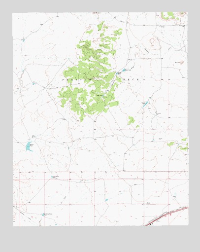
Sacaton Draw, NM USGS Topographic Map
Click on map above to begin viewing in our Map Viewer.

This topographic map contains these locations and features:
Feature Name Type Latitude Longitude GNIS ID View Map
Boot HillSummitN35.0953°W104.5044°886614View Map
Canyon TankLocaleN35.0726°W104.5292°887159View Map
Double MillsPopulated PlaceN35.0656°W104.5230°898544View Map
East Hill WellWellN35.1170°W104.5022°888665View Map
Gonzales CampLocaleN35.1031°W104.5053°889481View Map
Little Salitre TankReservoirN35.0289°W104.5973°891176View Map
Los Tanos CemeteryCemeteryN35.0028°W104.5500°891378View Map
Lower TankReservoirN35.0911°W104.5459°891457View Map
Middle TankReservoirN35.0891°W104.5507°891986View Map
Nip WellWellN35.0509°W104.5211°892546View Map
North Los Tanos TankReservoirN35.0068°W104.6037°892622View Map
Preston Beck Grant QuarryMineN35.0348°W104.6033°914982View Map
Ratcliff RanchLocaleN35.0128°W104.5300°893669View Map
RatliffLocaleN35.0014°W104.5019°929456View Map
Sacaton DrawValleyN35.1006°W104.5283°894240View Map
Salitre TankReservoirN35.0466°W104.6140°894331View Map
Shamrock Pumping StationLocaleN35.1167°W104.5200°929049View Map
Spires RanchLocaleN35.0523°W104.6114°895236View Map
Upper TankReservoirN35.0762°W104.5608°896042View Map

Note: Coordinates in the location and feature list above are referenced to NAD83 datum.


Copyright (C) 2008-2025 Ryan Niemi / Sunset Dynamics ... All Rights Reserved