TopoQuest Logo
Do you find TopoQuest useful?
Help keep TopoQuest running and adding new maps/features by donating!
Bitcoin:  19c7KJd3qBynnjoSw5npx9KScwjBe4ifkT
Litecoin:  LXs6TkuXGGXo1vDsWCkWVdjQX94eUKd6ui
Home View Maps Find Maps Find Places Resources & Links


Bar Y Ranch, New Mexico Topographic Map

USGS Map Title: Bar Y Ranch, NM
USGS Map MRC: 35104B6
DRG (GeoTIFF) Download: o35104b6.tif


Neighboring USGS Topographic Map Quads:


  Cactus Tank, NM  
35104C7
 

  Cabra Hill, NM  
35104C6
 

  Mesa Pino, NM  
35104C5
 

  Horse Pasture Tank, NM  
35104B7
 

  Bar Y Ranch, NM  
35104B6
 

  Mesa Cherisco, NM  
35104B5
 

  Colonias, NM  
35104A7
 

  Catfish Falls, NM  
35104A6
 

  Sacaton Draw, NM  
35104A5


Map MRC Location:

N36°
W105°
N36°
W104°
H8 H7 H6 H5 H4 H3 H2 H1
G8 G7 G6 G5 G4 G3 G2 G1
F8 F7 F6 F5 F4 F3 F2 F1
E8 E7 E6 E5 E4 E3 E2 E1
D8 D7 D6 D5 D4 D3 D2 D1
C8 C7 C6 C5 C4 C3 C2 C1
B8 B7 B6 B5 B4 B3 B2 B1
A8 A7 A6 A5 A4 A3 A2 A1
N35°
W105°
N35°
W104°

Bar Y Ranch, NM USGS 1:24K Topographic Map Preview:
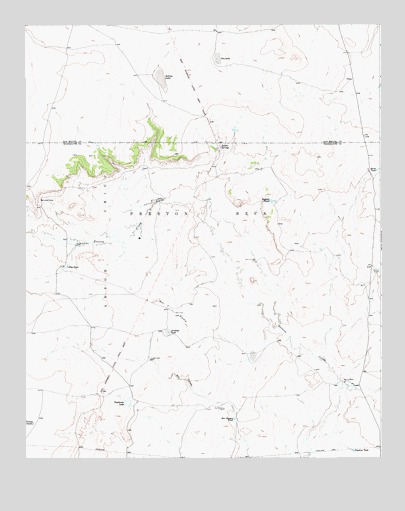
Bar Y Ranch, NM USGS Topographic Map
Click on map above to begin viewing in our Map Viewer.

This topographic map contains these locations and features:
Feature Name Type Latitude Longitude GNIS ID View Map
Antelope TankReservoirN35.1606°W104.6997°885794View Map
Bar Y DomeSummitN35.1706°W104.7047°898629View Map
Bar Y RanchLocaleN35.1470°W104.6380°886052View Map
Bookout TankReservoirN35.1992°W104.6639°886604View Map
Box Canyon TankReservoirN35.1362°W104.6772°886680View Map
Box Canyon WellWellN35.1392°W104.6805°886681View Map
Cowden RanchLocaleN35.1995°W104.7444°887992View Map
Dry LakeLakeN35.2404°W104.6826°888534View Map
Harrison WellWellN35.1817°W104.6692°889801View Map
Little Poso WellWellN35.1992°W104.7033°891169View Map
Middle Poso WellWellN35.1864°W104.7325°891969View Map
North TankReservoirN35.2078°W104.6267°892680View Map
Pipeline TankReservoirN35.1271°W104.6352°893333View Map
Poso TankReservoirN35.1801°W104.7356°893424View Map
Preston Beck GrantCivilN35.2159°W104.6867°918295View Map
Puertocito LakeReservoirN35.1412°W104.7145°898409View Map
Sabine SpringSpringN35.2151°W104.6814°914394View Map
Sabino LakeLakeN35.2361°W104.7028°897463View Map
Sabino SpringsSpringN35.2149°W104.6814°894238View Map
Trailer TankReservoirN35.1352°W104.7479°895797View Map
Vaughn WellWellN35.1534°W104.7067°896108View Map
West WellWellN35.1787°W104.6261°896438View Map

Note: Coordinates in the location and feature list above are referenced to NAD83 datum.


Copyright (C) 2008-2025 Ryan Niemi / Sunset Dynamics ... All Rights Reserved