TopoQuest Logo
Do you find TopoQuest useful?
Help keep TopoQuest running and adding new maps/features by donating!
Bitcoin:  19c7KJd3qBynnjoSw5npx9KScwjBe4ifkT
Litecoin:  LXs6TkuXGGXo1vDsWCkWVdjQX94eUKd6ui
Home View Maps Find Maps Find Places Resources & Links


Saint Catharine, Kentucky Topographic Map

USGS Map Title: Saint Catharine, KY
USGS Map MRC: 37085F3
DRG (GeoTIFF) Download: o37085f3.tif


Neighboring USGS Topographic Map Quads:


  Bardstown, KY  
37085G4
 

  Maud, KY  
37085G3
 

  Brush Grove, KY  
37085G2
 

  Loretto, KY  
37085F4
 

  Saint Catharine, KY  
37085F3
 

  Springfield, KY  
37085F2
 

  Raywick, KY  
37085E4
 

  Lebanon West, KY  
37085E3
 

  Lebanon East, KY  
37085E2


Map MRC Location:

N38°
W86°
N38°
W85°
H8 H7 H6 H5 H4 H3 H2 H1
G8 G7 G6 G5 G4 G3 G2 G1
F8 F7 F6 F5 F4 F3 F2 F1
E8 E7 E6 E5 E4 E3 E2 E1
D8 D7 D6 D5 D4 D3 D2 D1
C8 C7 C6 C5 C4 C3 C2 C1
B8 B7 B6 B5 B4 B3 B2 B1
A8 A7 A6 A5 A4 A3 A2 A1
N37°
W86°
N37°
W85°

Saint Catharine, KY USGS 1:24K Topographic Map Preview:
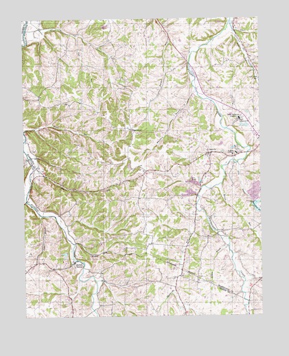
Saint Catharine, KY USGS Topographic Map
Click on map above to begin viewing in our Map Viewer.

This topographic map contains these locations and features:
Feature Name Type Latitude Longitude GNIS ID View Map
Allen BranchStreamN37.6893°W85.2619°485847View Map
Beantown (historical)Populated PlaceN37.6434°W85.3354°2566854View Map
BearwallowPopulated PlaceN37.7037°W85.3175°507469View Map
Burkes SpringPopulated PlaceN37.6476°W85.3483°507622View Map
Cane RunStreamN37.7431°W85.3469°488792View Map
CisselvillePopulated PlaceN37.6934°W85.2769°507704View Map
Coleman RunStreamN37.6734°W85.3738°489826View Map
Hardins Creek Baptist Church (historical)ChurchN37.6831°W85.3696°2567729View Map
Hickory Camp RunStreamN37.6556°W85.3494°494118View Map
Jackson BranchStreamN37.6551°W85.2669°495102View Map
Logan BranchStreamN37.6673°W85.3661°496974View Map
McIntyre Post Office (historical)Post OfficeN37.7017°W85.3001°2567748View Map
Old Grist Mill Distillery Historical MarkerParkN37.6475°W85.3496°2744536View Map
Phillips Station (historical)LocaleN37.7039°W85.3742°2567755View Map
Road RunStreamN37.6878°W85.3688°502030View Map
Road RunStreamN37.7492°W85.2647°502031View Map
Saint CatharinePopulated PlaceN37.7087°W85.2577°1890844View Map
Saint Catharine CollegeSchoolN37.7081°W85.2605°502595View Map
Saint Catharine Post OfficePost OfficeN37.7067°W85.2616°517536View Map
Saint Catherine Historical MarkerParkN37.7092°W85.2585°2744859View Map
Saint Rose Pike (historical)Populated PlaceN37.6395°W85.3037°2566901View Map
Saint Rose Priory (historical)ChurchN37.6926°W85.2641°502737View Map
Saint Rose Priory Historical MarkerParkN37.6925°W85.2631°2744855View Map
Saint Thomas Aquinas College (historical)SchoolN37.6948°W85.2628°2567768View Map
Seibert CreekStreamN37.7451°W85.2630°503156View Map
Servant RunStreamN37.6806°W85.2708°485699View Map
Shepherds RunStreamN37.6692°W85.2838°503350View Map
Short CreekStreamN37.7451°W85.3733°503442View Map
Smith School (historical)SchoolN37.6441°W85.2693°2567691View Map
Springfield ReservoirReservoirN37.6690°W85.2509°504160View Map
Station RunStreamN37.7031°W85.3747°504287View Map
Valley Hill SchoolSchoolN37.7245°W85.2502°505946View Map
Washington County Historical MarkerParkN37.6320°W85.2567°2744852View Map
Wheatley BranchStreamN37.7201°W85.2836°506519View Map
WMQQ-FM (Springfield)TowerN37.6953°W85.3183°518025View Map

Note: Coordinates in the location and feature list above are referenced to NAD83 datum.


Copyright (C) 2008-2024 Ryan Niemi / Sunset Dynamics ... All Rights Reserved