TopoQuest Logo
Do you find TopoQuest useful?
Help keep TopoQuest running and adding new maps/features by donating!
Bitcoin:  19c7KJd3qBynnjoSw5npx9KScwjBe4ifkT
Litecoin:  LXs6TkuXGGXo1vDsWCkWVdjQX94eUKd6ui
Home View Maps Find Maps Find Places Resources & Links


Loretto, Kentucky Topographic Map

USGS Map Title: Loretto, KY
USGS Map MRC: 37085F4
DRG (GeoTIFF) Download: o37085f4.tif


Neighboring USGS Topographic Map Quads:


  Cravens, KY  
37085G5
 

  Bardstown, KY  
37085G4
 

  Maud, KY  
37085G3
 

  New Haven, KY  
37085F5
 

  Loretto, KY  
37085F4
 

  Saint Catharine, KY  
37085F3
 

  Howardstown, KY  
37085E5
 

  Raywick, KY  
37085E4
 

  Lebanon West, KY  
37085E3


Map MRC Location:

N38°
W86°
N38°
W85°
H8 H7 H6 H5 H4 H3 H2 H1
G8 G7 G6 G5 G4 G3 G2 G1
F8 F7 F6 F5 F4 F3 F2 F1
E8 E7 E6 E5 E4 E3 E2 E1
D8 D7 D6 D5 D4 D3 D2 D1
C8 C7 C6 C5 C4 C3 C2 C1
B8 B7 B6 B5 B4 B3 B2 B1
A8 A7 A6 A5 A4 A3 A2 A1
N37°
W86°
N37°
W85°

Loretto, KY USGS 1:24K Topographic Map Preview:
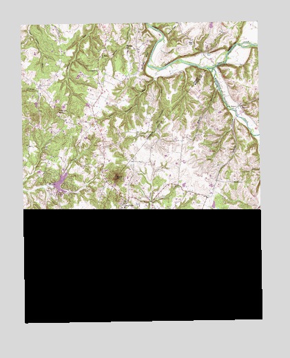
Loretto, KY USGS Topographic Map
Click on map above to begin viewing in our Map Viewer.

This topographic map contains these locations and features:
Feature Name Type Latitude Longitude GNIS ID View Map
Backbone RidgeRidgeN37.7351°W85.4338°486190View Map
Big Terrapin RunStreamN37.7301°W85.4269°487283View Map
Cambron (historical)Populated PlaceN37.7185°W85.4071°2566859View Map
Catholic Pioneers Historical MarkerParkN37.6736°W85.4468°2744522View Map
Cedar KnobSummitN37.6253°W85.4402°489229View Map
City of LorettoCivilN37.6351°W85.3985°2404956View Map
Clarktown (historical)Populated PlaceN37.6615°W85.4816°2742382View Map
Coon HollowValleyN37.6343°W85.4915°490042View Map
Coon Hollow Railroad Stop (historical)LocaleN37.6327°W85.4702°2566864View Map
DantPopulated PlaceN37.6359°W85.4558°507813View Map
Dant Distillery (historical)BuildingN37.6346°W85.4567°2566866View Map
Dant Post Office (historical)Post OfficeN37.6350°W85.4562°2566867View Map
Dant Railroad Station (historical)LocaleN37.6352°W85.4570°2566868View Map
GandertownPopulated PlaceN37.6831°W85.3900°508062View Map
GreenbrierPopulated PlaceN37.7295°W85.4591°508128View Map
Happy HollowValleyN37.7103°W85.3884°493701View Map
Hardins CreekStreamN37.7303°W85.4011°493729View Map
Holy CrossPopulated PlaceN37.6740°W85.4469°494449View Map
Holy Cross Elementary School (historical)SchoolN37.6729°W85.4468°2566872View Map
Holy Cross Post Office (historical)Post OfficeN37.6745°W85.4453°2566873View Map
Holy Rosary ChurchChurchN37.7134°W85.3875°494458View Map
Little Terrapin RunStreamN37.7262°W85.4302°496879View Map
LorettoPopulated PlaceN37.6353°W85.4008°497170View Map
Loretto DivisionCivilN37.6423°W85.4171°1937110View Map
Loretto Fire DepartmentBuildingN37.6372°W85.4031°2636527View Map
MantonPopulated PlaceN37.7148°W85.3852°508535View Map
Manton Post Office (historical)Post OfficeN37.7137°W85.3866°2567741View Map
Manton School (historical)SchoolN37.7139°W85.3860°2567742View Map
Melody LakeLakeN37.6835°W85.4800°2742395View Map
Monick BranchStreamN37.7231°W85.3963°498482View Map
Nall HillSummitN37.7409°W85.4088°499158View Map
NerinxPopulated PlaceN37.6642°W85.3994°508688View Map
New Hope Fire Department Station 2 Melody Lake ParkBuildingN37.6778°W85.4824°2637410View Map
Pine Lick KnobSummitN37.7137°W85.4811°500711View Map
Rohan KnobSummitN37.6859°W85.4505°502285View Map
Saint FrancisPopulated PlaceN37.6265°W85.4277°517029View Map
Saint Francis High SchoolSchoolN37.6362°W85.4036°502621View Map
Saint Francis of Assisi Catholic ChurchChurchN37.6257°W85.4306°2566895View Map
Saint Francis Railroad Station (historical)LocaleN37.6255°W85.4252°2566896View Map
Saint Mark ChurchChurchN37.7356°W85.4577°502679View Map
Sisters of Loretto ConventChurchN37.6637°W85.3980°503581View Map
Sisters of Loretto Motherhouse Historical MarkerParkN37.6593°W85.3959°2744515View Map
Smocks Chapel CemeteryCemeteryN37.6538°W85.4009°2566903View Map
Smocks ChurchChurchN37.6537°W85.4011°503817View Map
South Fork Pottinger CreekStreamN37.6406°W85.4983°503940View Map
Thomas Burying GroundCemeteryN37.6720°W85.4476°2566905View Map
Turkey RidgeRidgeN37.7467°W85.4194°505623View Map
Wimsatt SchoolSchoolN37.7395°W85.4444°506921View Map

Note: Coordinates in the location and feature list above are referenced to NAD83 datum.


Copyright (C) 2008-2025 Ryan Niemi / Sunset Dynamics ... All Rights Reserved