TopoQuest Logo
Do you find TopoQuest useful?
Help keep TopoQuest running and adding new maps/features by donating!
Bitcoin:  19c7KJd3qBynnjoSw5npx9KScwjBe4ifkT
Litecoin:  LXs6TkuXGGXo1vDsWCkWVdjQX94eUKd6ui
Home View Maps Find Maps Find Places Resources & Links


Saint Clair, Missouri Topographic Map

USGS Map Title: Saint Clair, MO
USGS Map MRC: 38090C8
DRG (GeoTIFF) Download: o38090c8.tif


Neighboring USGS Topographic Map Quads:


  Union, MO  
38091D1
 

  Moselle, MO  
38090D8
 

  Gray Summit, MO  
38090D7
 

  Stanton, MO  
38091C1
 

  Saint Clair, MO  
38090C8
 

  Lonedell, MO  
38090C7
 

  Meramec State Park, MO  
38091B1
 

  Cyclone Hollow, MO  
38090B8
 

  Richwoods, MO  
38090B7


Map MRC Location:

N39°
W91°
N39°
W90°
H8 H7 H6 H5 H4 H3 H2 H1
G8 G7 G6 G5 G4 G3 G2 G1
F8 F7 F6 F5 F4 F3 F2 F1
E8 E7 E6 E5 E4 E3 E2 E1
D8 D7 D6 D5 D4 D3 D2 D1
C8 C7 C6 C5 C4 C3 C2 C1
B8 B7 B6 B5 B4 B3 B2 B1
A8 A7 A6 A5 A4 A3 A2 A1
N38°
W91°
N38°
W90°

Saint Clair, MO USGS 1:24K Topographic Map Preview:
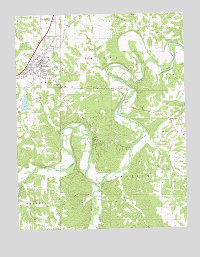
Saint Clair, MO USGS Topographic Map
Click on map above to begin viewing in our Map Viewer.

This topographic map contains these locations and features:
Feature Name Type Latitude Longitude GNIS ID View Map
Bethel Baptist Church CemeteryCemeteryN38.3198°W90.8776°2702115View Map
Bethel ChurchChurchN38.3195°W90.8768°714054View Map
Brush CreekStreamN38.3449°W90.9414°714828View Map
Brush Creek SchoolSchoolN38.3534°W90.9429°741656View Map
Carved LakeReservoirN38.2645°W90.9522°764575View Map
Carved Lake DamDamN38.2651°W90.9518°764574View Map
City of Saint ClairCivilN38.3479°W90.9934°2396481View Map
Cove CemeteryCemeteryN38.3574°W90.8884°716391View Map
Cove Church (historical)ChurchN38.3570°W90.8887°741655View Map
Cove CreekStreamN38.3492°W90.8999°716392View Map
Cove School (historical)SchoolN38.3562°W90.8896°730643View Map
Cove SpringSpringN38.3633°W90.9206°716398View Map
Crescent Lake DamDamN38.3317°W90.9918°764611View Map
Duenler SchoolSchoolN38.2617°W90.9376°741649View Map
Fairview School (historical)SchoolN38.3164°W90.9879°741653View Map
Fisher CemeteryCemeteryN38.3636°W90.8913°717953View Map
Gibson CreekStreamN38.2834°W90.9197°731573View Map
Girard BranchStreamN38.2748°W90.9393°718468View Map
Heil Lake DamDamN38.3101°W90.8785°764612View Map
Hoosier CreekStreamN38.2864°W90.9821°719779View Map
Indian CreekStreamN38.2748°W90.9394°750454View Map
Lake Saint Clair Number One DamDamN38.3201°W90.9951°764400View Map
Lake Saint Clair Number Two DamDamN38.3284°W90.9985°764610View Map
Lake Thunderbird DamDamN38.3284°W90.9401°764399View Map
Lost HillSummitN38.3517°W90.9099°721595View Map
Mount Hope SchoolSchoolN38.3228°W90.8760°741654View Map
Oklahoma SchoolSchoolN38.2564°W90.9835°741648View Map
ParkwayPopulated PlaceN38.3381°W90.9699°724046View Map
Peters Lake DamDamN38.3334°W90.9985°764608View Map
Pine Bluff SchoolSchoolN38.3101°W90.9451°741652View Map
Piney ParkPopulated PlaceN38.3012°W90.9429°731633View Map
Plum FordPopulated PlaceN38.2776°W90.9974°741161View Map
Pond Ford (historical)LocaleN38.3251°W90.9196°755593View Map
Rohls Ford (historical)LocaleN38.2887°W90.9610°755646View Map
Rye CreekStreamN38.3028°W90.9060°725697View Map
Rye Creek SchoolSchoolN38.2620°W90.8854°741650View Map
Saint ClairPopulated PlaceN38.3453°W90.9810°731643View Map
Saint Clair Fire Protection District Station 1BuildingN38.3475°W90.9822°2620786View Map
Saint Clair Fire Protection District Station 3BuildingN38.3026°W90.9412°2620784View Map
Saint Clair Police DepartmentBuildingN38.3529°W90.9813°2752322View Map
Saint Clair Post OfficePost OfficeN38.3563°W90.9783°2779472View Map
Smith Lake DamDamN38.2634°W90.9935°764401View Map
St Clair Regional AirportAirportN38.3733°W90.9747°758902View Map
Township of CentralCivilN38.3514°W90.9850°766647View Map
Village of ParkwayCivilN38.3369°W90.9717°2399625View Map
Virginia Lead Mines Ford (historical)LocaleN38.2914°W90.9176°755647View Map
Virginia Mines (historical)MineN38.3020°W90.9190°741651View Map
Virginia Mines ChurchChurchN38.2859°W90.8946°728217View Map
West Fork Brush CreekStreamN38.3434°W90.9332°728558View Map

Note: Coordinates in the location and feature list above are referenced to NAD83 datum.


Copyright (C) 2008-2025 Ryan Niemi / Sunset Dynamics ... All Rights Reserved