TopoQuest Logo
Do you find TopoQuest useful?
Help keep TopoQuest running and adding new maps/features by donating!
Bitcoin:  19c7KJd3qBynnjoSw5npx9KScwjBe4ifkT
Litecoin:  LXs6TkuXGGXo1vDsWCkWVdjQX94eUKd6ui
Home View Maps Find Maps Find Places Resources & Links


Meramec State Park, Missouri Topographic Map

USGS Map Title: Meramec State Park, MO
USGS Map MRC: 38091B1
DRG (GeoTIFF) Download: o38091b1.tif


Neighboring USGS Topographic Map Quads:


  Spring Bluff, MO  
38091C2
 

  Stanton, MO  
38091C1
 

  Saint Clair, MO  
38090C8
 

  Sullivan, MO  
38091B2
 

  Meramec State Park, MO  
38091B1
 

  Cyclone Hollow, MO  
38090B8
 

  Onondaga Cave, MO  
38091A2
 

  Anthonies Mill, MO  
38091A1
 

  Ebo, MO  
38090A8


Map MRC Location:

N39°
W92°
N39°
W91°
H8 H7 H6 H5 H4 H3 H2 H1
G8 G7 G6 G5 G4 G3 G2 G1
F8 F7 F6 F5 F4 F3 F2 F1
E8 E7 E6 E5 E4 E3 E2 E1
D8 D7 D6 D5 D4 D3 D2 D1
C8 C7 C6 C5 C4 C3 C2 C1
B8 B7 B6 B5 B4 B3 B2 B1
A8 A7 A6 A5 A4 A3 A2 A1
N38°
W92°
N38°
W91°

Meramec State Park, MO USGS 1:24K Topographic Map Preview:
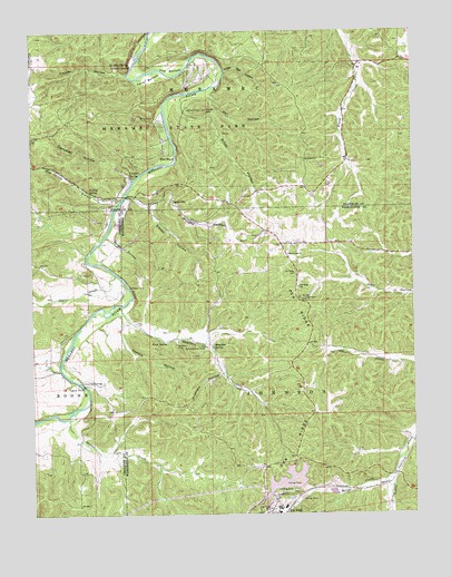
Meramec State Park, MO USGS Topographic Map
Click on map above to begin viewing in our Map Viewer.

This topographic map contains these locations and features:
Feature Name Type Latitude Longitude GNIS ID View Map
Barker School (historical)SchoolN38.1353°W91.0062°742350View Map
Beaver CreekStreamN38.1959°W91.1026°738286View Map
Blanton Copper MineMineN38.1598°W91.0529°736674View Map
Blanton Limonite BankMineN38.1670°W91.0651°736675View Map
Blanton Specular Iron BankMineN38.1709°W91.0507°736673View Map
Campbell HollowValleyN38.2123°W91.0935°715312View Map
Camper SpringSpringN38.2120°W91.0926°715316View Map
Cane BottomBendN38.2387°W91.0871°715337View Map
CaseyvillePopulated PlaceN38.2053°W91.0799°715470View Map
Copper Hill MineMineN38.1873°W91.1082°736460View Map
Copper HollowValleyN38.2387°W91.0938°716301View Map
Elm Spring BranchStreamN38.2073°W91.0951°717538View Map
Falling SpringSpringN38.2089°W91.1068°717834View Map
Fife BottomBendN38.2392°W91.0796°717907View Map
Fisher Ford (historical)LocaleN38.2278°W91.0815°755649View Map
Gamble HollowValleyN38.1764°W91.0960°718324View Map
Garrett FordLocaleN38.1912°W91.1071°736459View Map
Greens CreekStreamN38.1523°W91.1099°750150View Map
Greens HollowValleyN38.1381°W91.0840°753340View Map
Hamilton CreekStreamN38.1789°W91.0968°719036View Map
Hamilton SchoolSchoolN38.1764°W91.0671°742351View Map
Hamilton SpringSpringN38.1681°W91.0665°719045View Map
Hiblers Lead DiggingsMineN38.1637°W91.1182°736458View Map
HulseyPopulated PlaceN38.1803°W91.0368°736676View Map
Kelleter Lookout TowerTowerN38.1803°W91.0374°755245View Map
La Jolla SpringSpringN38.2412°W91.0929°720715View Map
Little Wet HollowValleyN38.2395°W91.0632°721358View Map
Lone HillSummitN38.2298°W91.0704°721451View Map
Marys CreekStreamN38.1339°W91.0079°750955View Map
Meramec Conservation AreaParkN38.2253°W91.0703°722235View Map
Meramec Park LakeReservoirN38.2167°W91.0779°735977View Map
Miller HollowValleyN38.1964°W91.0990°722379View Map
Miramiguoa ParkPopulated PlaceN38.2389°W91.0688°1759738View Map
MondayPopulated PlaceN38.2167°W91.0213°740467View Map
Monday Post Office (historical)Post OfficeN38.2167°W91.0213°759794View Map
Moosehorn LakeReservoirN38.1967°W91.0651°764560View Map
Moosehorn Lake DamDamN38.1967°W91.0651°764559View Map
Murphy HollowValleyN38.2073°W91.0921°723075View Map
New BeachLocaleN38.2181°W91.0793°723179View Map
Number 588 DamDamN38.1317°W91.0301°764593View Map
Old Copper Hill Iron BankMineN38.1948°W91.1090°736457View Map
Old Hamilton WorksLocaleN38.1684°W91.0688°755351View Map
Pea RidgePopulated PlaceN38.1259°W91.0421°751518View Map
Pea RidgeRidgeN38.1398°W91.0396°751520View Map
Pea Ridge CemeteryCemeteryN38.1872°W91.0385°724125View Map
Pea Ridge HallBuildingN38.1953°W91.0388°742349View Map
Pea Ridge MineMineN38.1262°W91.0476°751523View Map
Pea Ridge Mine DamDamN38.1317°W91.0368°764284View Map
Pea Ridge SchoolSchoolN38.1837°W91.0385°724133View Map
Pea Ridge Tailings PondReservoirN38.1317°W91.0368°764285View Map
Pentecostal ChurchChurchN38.1923°W91.0418°724214View Map
Persimmon GapGapN38.2298°W91.1049°730661View Map
Pratt SpringSpringN38.1695°W91.0815°724910View Map
Primrose Hill Iron BankMineN38.1609°W91.0654°736672View Map
Primrose HollowValleyN38.1612°W91.0635°724935View Map
Red Hill Lead DiggingsMineN38.1889°W91.1215°736456View Map
Reedville ChurchChurchN38.2164°W91.0365°725197View Map
Reedville SchoolLocaleN38.2359°W91.0438°742347View Map
Sappington BridgeBridgeN38.1584°W91.1088°755390View Map
Silver HollowValleyN38.2317°W91.0768°726449View Map
Sleepy HollowValleyN38.2045°W91.0868°726542View Map
Stater CreekStreamN38.1870°W91.0985°727042View Map
Sullivan and Bridell Iron MineMineN38.1859°W91.1021°736455View Map
Sullivan Lead MineMineN38.1692°W91.1140°736454View Map
Thurman Ford (historical)LocaleN38.2323°W91.0638°755650View Map
Village of Miramiguoa ParkCivilN38.2390°W91.0687°2399378View Map
Wet HollowValleyN38.2331°W91.0682°728665View Map
Zion School (historical)LocaleN38.1442°W91.1099°742348View Map

Note: Coordinates in the location and feature list above are referenced to NAD83 datum.


Copyright (C) 2008-2025 Ryan Niemi / Sunset Dynamics ... All Rights Reserved