TopoQuest Logo
Do you find TopoQuest useful?
Help keep TopoQuest running and adding new maps/features by donating!
Bitcoin:  19c7KJd3qBynnjoSw5npx9KScwjBe4ifkT
Litecoin:  LXs6TkuXGGXo1vDsWCkWVdjQX94eUKd6ui
Home View Maps Find Maps Find Places Resources & Links


Saint George, Georgia Topographic Map

USGS Map Title: Saint George, GA
USGS Map MRC: 30082E1
DRG (GeoTIFF) Download: o30082e1.tif


Neighboring USGS Topographic Map Quads:


  Chesser Island, GA  
30082F2
 

  Toledo, GA  
30082F1
 

  Hilliard, FL  
30081F8
 

  Moniac, GA  
30082E2
 

  Saint George, GA  
30082E1
 

  Hilliard SW, FL  
30081E8
 

  Macclenny NW, GA  
30082D2
 

  Macclenny NE, GA  
30082D1
 

  Bryceville, FL  
30081D8


Map MRC Location:

N31°
W83°
N31°
W82°
H8 H7 H6 H5 H4 H3 H2 H1
G8 G7 G6 G5 G4 G3 G2 G1
F8 F7 F6 F5 F4 F3 F2 F1
E8 E7 E6 E5 E4 E3 E2 E1
D8 D7 D6 D5 D4 D3 D2 D1
C8 C7 C6 C5 C4 C3 C2 C1
B8 B7 B6 B5 B4 B3 B2 B1
A8 A7 A6 A5 A4 A3 A2 A1
N30°
W83°
N30°
W82°

Saint George, GA USGS 1:24K Topographic Map Preview:
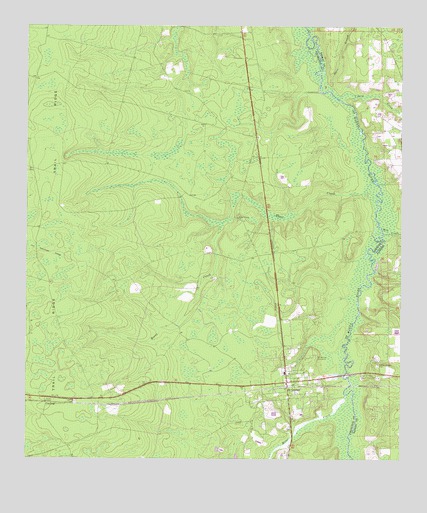
Saint George, GA USGS Topographic Map
Click on map above to begin viewing in our Map Viewer.

This topographic map contains these locations and features:
Feature Name Type Latitude Longitude GNIS ID View Map
Bell BridgeBridgeN30.5252°W82.0171°303600View Map
Boone CreekStreamN30.5811°W82.0090°311654View Map
Boone Creek ChurchChurchN30.5697°W82.0546°354811View Map
Boones Creek CemeteryCemeteryN30.5702°W82.0543°357742View Map
Boones Creek School (historical)SchoolN30.5694°W82.0543°357743View Map
Charlton County Fire Department Station 2BuildingN30.5231°W82.0381°2603791View Map
ClarkingPopulated PlaceN30.5163°W82.1182°331407View Map
Conner-Green CemeteryCemeteryN30.5275°W82.0073°280717View Map
Deep CreekStreamN30.6041°W82.0201°281420View Map
Earnest A Bell BridgeBridgeN30.5247°W82.0184°357756View Map
Mill CreekStreamN30.5663°W82.0059°286877View Map
Mims CreekStreamN30.5177°W82.0179°318306View Map
New Life ChurchChurchN30.5152°W82.0298°357774View Map
Pine Grove ChurchChurchN30.5188°W82.0348°357783View Map
Saint GeorgePopulated PlaceN30.5211°W82.0376°322063View Map
Saint George CemeteryCemeteryN30.5297°W82.0279°322064View Map
Saint George DivisionCivilN30.5730°W82.1120°1936520View Map
Saint George Elementary SchoolSchoolN30.5250°W82.0384°357789View Map
Stave BranchStreamN30.6063°W82.0232°291655View Map
Trail RidgeRidgeN30.5056°W82.1111°324268View Map
Williams School (historical)SchoolN30.5833°W82.0523°334141View Map

Note: Coordinates in the location and feature list above are referenced to NAD83 datum.


Copyright (C) 2008-2025 Ryan Niemi / Sunset Dynamics ... All Rights Reserved