TopoQuest Logo
Do you find TopoQuest useful?
Help keep TopoQuest running and adding new maps/features by donating!
Bitcoin:  19c7KJd3qBynnjoSw5npx9KScwjBe4ifkT
Litecoin:  LXs6TkuXGGXo1vDsWCkWVdjQX94eUKd6ui
Home View Maps Find Maps Find Places Resources & Links


Saint Ignatius, Montana Topographic Map

USGS Map Title: Saint Ignatius, MT
USGS Map MRC: 47114C1
DRG (GeoTIFF) Download: o47114c1.tif


Neighboring USGS Topographic Map Quads:


  Charlo, MT  
47114D2
 

  Fort Connah, MT  
47114D1
 

  Mount Calowahcan, MT  
47113D8
 

  Ravalli, MT  
47114C2
 

  Saint Ignatius, MT  
47114C1
 

  Saint Marys Lake, MT  
47113C8
 

  Saddle Mountain, MT  
47114B2
 

  Arlee, MT  
47114B1
 

  Gold Creek, MT  
47113B8


Map MRC Location:

N48°
W115°
N48°
W114°
H8 H7 H6 H5 H4 H3 H2 H1
G8 G7 G6 G5 G4 G3 G2 G1
F8 F7 F6 F5 F4 F3 F2 F1
E8 E7 E6 E5 E4 E3 E2 E1
D8 D7 D6 D5 D4 D3 D2 D1
C8 C7 C6 C5 C4 C3 C2 C1
B8 B7 B6 B5 B4 B3 B2 B1
A8 A7 A6 A5 A4 A3 A2 A1
N47°
W115°
N47°
W114°

Saint Ignatius, MT USGS 1:24K Topographic Map Preview:
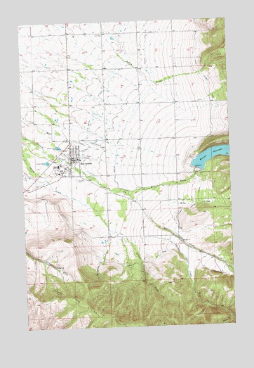
Saint Ignatius, MT USGS Topographic Map
Click on map above to begin viewing in our Map Viewer.

This topographic map contains these locations and features:
Feature Name Type Latitude Longitude GNIS ID View Map
18N19W04DDBB01 WellWellN47.3447°W114.0115°822353View Map
18N19W05BBC_01 WellWellN47.3533°W114.0529°822401View Map
18N19W05CCC_01 WellWellN47.3422°W114.0532°822323View Map
18N19W06CBC_01 WellWellN47.3452°W114.0701°822355View Map
18N19W08CBC_01 WellWellN47.3310°W114.0537°822262View Map
18N19W10BCCC01 WellWellN47.3344°W114.0112°822281View Map
18N19W17ADD_01 WellWellN47.3205°W114.0334°822190View Map
18N19W17BBBB01 WellWellN47.3260°W114.0537°822230View Map
18N19W19ADC_01 WellWellN47.3058°W114.0571°822099View Map
18N19W19CBAC01 WellWellN47.3033°W114.0729°822085View Map
18N19W19CBCB01 WellWellN47.3130°W114.0751°822137View Map
18N19W19CCB_01 WellWellN47.3005°W114.0743°822061View Map
18N19W20ACA_01 WellWellN47.3077°W114.0398°822101View Map
18N19W21BBD_01 WellWellN47.3094°W114.0290°822107View Map
18N19W22CADD01 WellWellN47.3016°W114.0018°822068View Map
18N19W28CCDB01 WellWellN47.2844°W114.0301°821944View Map
18N19W29DACC01 WellWellN47.2872°W114.0382°821968View Map
18N19W30ADA_01 WellWellN47.2933°W114.0557°822002View Map
18N19W30CCCA01 WellWellN47.2841°W114.0743°821937View Map
18N19W30DCBB01 WellWellN47.2869°W114.0646°821962View Map
18N20W01CCAC01 WellWellN47.3460°W114.0959°822360View Map
18N20W02AAAD01 WellWellN47.3544°W114.0973°822407View Map
18N20W02CDD_01 WellWellN47.3424°W114.1087°822326View Map
18N20W10ADD_01 WellWellN47.3349°W114.1184°822285View Map
18N20W11DDA_01 WellWellN47.3297°W114.0982°822252View Map
18N20W12CCC_01 WellWellN47.3288°W114.0929°822248View Map
18N20W12DDD_01 WellWellN47.3280°W114.0768°822242View Map
18N20W13DCCD01 WellWellN47.3130°W114.0829°822138View Map
18N20W14DBD_01 WellWellN47.3166°W114.1037°822160View Map
18N20W14DBD_02 WellWellN47.3169°W114.1034°822164View Map
18N20W14DBDC01 WellWellN47.3166°W114.1037°822161View Map
18N20W14DCA_01 WellWellN47.3152°W114.1034°822153View Map
18N20W15DCAD01 WellWellN47.3144°W114.1246°822151View Map
18N20W23DADA01 WellWellN47.3022°W114.0973°822070View Map
18N20W25ADA_01 WellWellN47.2930°W114.0759°822001View Map
18N20W25DBDD01 WellWellN47.2847°W114.0837°821948View Map
19N19W28CDD_01 WellWellN47.3702°W114.0223°822497View Map
19N19W29CDC_01 WellWellN47.3705°W114.0479°822502View Map
19N20W25DDD_01 WellWellN47.3705°W114.0757°822503View Map
19N20W27DDD_01 WellWellN47.3705°W114.1184°822504View Map
19N20W35AAA_01 WellWellN47.3697°W114.0976°822490View Map
19N20W36ABB_01 WellWellN47.3688°W114.0823°822486View Map
Assembly of God ChurchChurchN47.3199°W114.0940°1796899View Map
Christian and Missionary Alliance ChurchChurchN47.3199°W114.0940°1796898View Map
Cold CreekStreamN47.2758°W114.0065°781490View Map
Doug Allards Flathead Indian MuseumBuildingN47.3216°W114.1037°1797049View Map
Dry CreekStreamN47.3055°W114.0646°782582View Map
Dry CreekStreamN47.3502°W114.0482°782583View Map
F Mission CanalCanalN47.2774°W114.0468°771280View Map
Four Winds Historical VillageLocaleN47.3199°W114.0940°1796794View Map
Industrial Arts School (historical)SchoolN47.3149°W114.1032°1796819View Map
Kingdom Hall of Jehovahs WitnessesChurchN47.3199°W114.0940°1796901View Map
McCollum CreekStreamN47.2897°W114.0740°773978View Map
Medicine TreeHospitalN47.3199°W114.0940°1796999View Map
Mikes CreekStreamN47.3066°W114.0493°787338View Map
Mission B CanalCanalN47.3652°W114.0484°774278View Map
Mission C CanalCanalN47.3513°W114.0715°774281View Map
Mission DamDamN47.3166°W114.0209°795644View Map
Mission DistrictCivilN47.3483°W114.0379°2419019View Map
Mission Hospital (historical)HospitalN47.3163°W114.1037°787499View Map
Mission ReservoirReservoirN47.3192°W114.0083°787502View Map
Mission Valley Health CenterHospitalN47.3199°W114.0940°1796998View Map
Pinehaven Christian Children's Ranch and SchoolSchoolN47.2730°W114.1213°1796857View Map
Pleasant View CemeteryCemeteryN47.3083°W114.1187°775288View Map
Saint IgnatiusPopulated PlaceN47.3199°W114.0940°776104View Map
Saint Ignatius AmbulanceBuildingN47.3180°W114.0969°2637905View Map
Saint Ignatius CampingLocaleN47.3272°W114.0962°1797022View Map
Saint Ignatius Catholic CemeteryCemeteryN47.3108°W114.0934°776105View Map
Saint Ignatius Christian ChurchChurchN47.3199°W114.0940°1796902View Map
Saint Ignatius Elementary SchoolSchoolN47.3190°W114.0923°1796872View Map
Saint Ignatius Fire DepartmentBuildingN47.3182°W114.0946°2546614View Map
Saint Ignatius Mission (historical)LocaleN47.3149°W114.1032°1796820View Map
Saint Ignatius Mission ChurchChurchN47.3147°W114.1032°1796824View Map
Saint Ignatius Old Catholic CemeteryCemeteryN47.3143°W114.1046°1797003View Map
Saint Ignatius Police DepartmentBuildingN47.3182°W114.0946°1796811View Map
Saint Ignatius Post OfficePost OfficeN47.3195°W114.0946°1796825View Map
Saint Ignatius Public LibraryBuildingN47.3199°W114.0940°1797007View Map
Saint Joseph School (historical)SchoolN47.3135°W114.1037°776114View Map
St Ignatius AirportAirportN47.3260°W114.0818°806517View Map
Statue of the Sacred HeartParkN47.3149°W114.1032°1796821View Map
Taelman ParkParkN47.3149°W114.1032°1796823View Map
The Church of Jesus Christ of Latter day SaintsChurchN47.3199°W114.0940°1796897View Map
Thorne CreekStreamN47.2844°W114.0618°777593View Map
Town of Saint IgnatiusCivilN47.3187°W114.0956°2412594View Map
United Methodist ChurchChurchN47.3199°W114.0940°1796896View Map
Villa Ursula (historical)SchoolN47.3149°W114.1032°1796822View Map
Zion Lutheran ChurchChurchN47.3199°W114.0940°1796900View Map

Note: Coordinates in the location and feature list above are referenced to NAD83 datum.


Copyright (C) 2008-2024 Ryan Niemi / Sunset Dynamics ... All Rights Reserved