TopoQuest Logo
Do you find TopoQuest useful?
Help keep TopoQuest running and adding new maps/features by donating!
Bitcoin:  19c7KJd3qBynnjoSw5npx9KScwjBe4ifkT
Litecoin:  LXs6TkuXGGXo1vDsWCkWVdjQX94eUKd6ui
Home View Maps Find Maps Find Places Resources & Links


Billmore, Missouri Topographic Map

USGS Map Title: Billmore, MO
USGS Map MRC: 36091E2
DRG (GeoTIFF) Download: o36091e2.tif


Neighboring USGS Topographic Map Quads:


  Many Springs, MO  
36091F3
 

  Riverton, MO  
36091F2
 

  Bardley, MO  
36091F1
 

  Myrtle, MO  
36091E3
 

  Billmore, MO  
36091E2
 

  Gatewood, MO  
36091E1
 

  Hardy NE, AR  
36091D3
 

  Dalton, AR  
36091D2
 

  Warm Springs, AR  
36091D1


Map MRC Location:

N37°
W92°
N37°
W91°
H8 H7 H6 H5 H4 H3 H2 H1
G8 G7 G6 G5 G4 G3 G2 G1
F8 F7 F6 F5 F4 F3 F2 F1
E8 E7 E6 E5 E4 E3 E2 E1
D8 D7 D6 D5 D4 D3 D2 D1
C8 C7 C6 C5 C4 C3 C2 C1
B8 B7 B6 B5 B4 B3 B2 B1
A8 A7 A6 A5 A4 A3 A2 A1
N36°
W92°
N36°
W91°

Billmore, MO USGS 1:24K Topographic Map Preview:
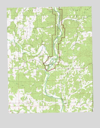
Billmore, MO USGS Topographic Map
Click on map above to begin viewing in our Map Viewer.

This topographic map contains these locations and features:
Feature Name Type Latitude Longitude GNIS ID View Map
Baker SchoolSchoolN36.5120°W91.1451°746906View Map
Big BranchStreamN36.5476°W91.1951°748821View Map
BillmorePopulated PlaceN36.5628°W91.2151°748859View Map
Billmore HollowValleyN36.5784°W91.2024°748860View Map
Billmore School (historical)SchoolN36.5634°W91.2090°735223View Map
Blue SpringSpringN36.5562°W91.1896°748933View Map
Brown Spring HollowValleyN36.6109°W91.1385°749045View Map
Caldwell SpringSpringN36.5642°W91.2415°749156View Map
CalmPopulated PlaceN36.5517°W91.1618°749163View Map
Colvin CreekStreamN36.5129°W91.1685°749434View Map
Cotton CreekStreamN36.5845°W91.2440°749488View Map
Dog HollowValleyN36.6206°W91.1332°749673View Map
Dry CreekStreamN36.5847°W91.2394°749716View Map
Dry Creek SchoolSchoolN36.6070°W91.2265°746900View Map
Fagan CreekStreamN36.5106°W91.1687°749880View Map
Fairview School (historical)SchoolN36.5120°W91.2290°746903View Map
Frederick CreekStreamN36.5637°W91.1779°749985View Map
Gatewood Volunteer Fire Department Station 4BuildingN36.5514°W91.1526°2621628View Map
GriswoldPopulated PlaceN36.5115°W91.1449°740297View Map
Griswold Post OfficePost OfficeN36.5115°W91.1449°760054View Map
Happy HollowValleyN36.5723°W91.2062°750219View Map
Hurricane CreekStreamN36.6001°W91.1727°750427View Map
Johnson Ferry (historical)CrossingN36.5503°W91.1935°735222View Map
Jones SpringSpringN36.5567°W91.1887°750544View Map
Kimes HollowValleyN36.5906°W91.2393°750607View Map
Liberty ChurchChurchN36.5587°W91.1557°750695View Map
Liberty School (historical)SchoolN36.5514°W91.1618°735219View Map
Little BranchStreamN36.5515°W91.2037°750736View Map
Lum Barn HollowValleyN36.5501°W91.2201°750892View Map
Morgan SpringSpringN36.5628°W91.1846°751158View Map
Mount Carmel CemeteryCemeteryN36.5106°W91.1646°751170View Map
Mount Carmel Church (historical)ChurchN36.5109°W91.1657°735221View Map
Mount Carmel SchoolSchoolN36.5303°W91.1721°746905View Map
Mud SpringSpringN36.5584°W91.1976°751219View Map
Myrtle Church (historical)ChurchN36.5126°W91.2496°746904View Map
Peace Valley SchoolSchoolN36.5137°W91.1990°746902View Map
Piney CreekStreamN36.6196°W91.1746°751634View Map
Pleasant Hill CemeteryCemeteryN36.5951°W91.1426°751655View Map
Pleasant Hill School (historical)SchoolN36.6006°W91.1454°735218View Map
Rush CreekStreamN36.5656°W91.1768°751983View Map
Rush Creek CampLocaleN36.5645°W91.1765°751984View Map
Sand SpringSpringN36.5703°W91.2287°752024View Map
Sibkey SpringSpringN36.6192°W91.1876°752150View Map
Spring Valley CreekStreamN36.5245°W91.1957°752326View Map
Stubblefield BranchStreamN36.5017°W91.2201°735220View Map
Stubblefield Ferry (historical)CrossingN36.5120°W91.1699°746907View Map
Sullivan SpringSpringN36.5570°W91.1868°752427View Map
Swamp CreekStreamN36.5717°W91.2265°752450View Map
The NarrowsBendN36.5601°W91.1851°752519View Map
The Narrows AccessLocaleN36.5512°W91.1904°754956View Map
Thomasons MillLocaleN36.5623°W91.1835°746901View Map
Township of BillmoreCivilN36.5670°W91.2090°767100View Map
Township of Cedar BluffCivilN36.5552°W91.1539°767102View Map
Vault SpringSpringN36.5642°W91.1885°752698View Map
WaterLocaleN36.5942°W91.1471°740298View Map
Water Post OfficePost OfficeN36.5942°W91.1471°760060View Map

Note: Coordinates in the location and feature list above are referenced to NAD83 datum.


Copyright (C) 2008-2024 Ryan Niemi / Sunset Dynamics ... All Rights Reserved