TopoQuest Logo
Do you find TopoQuest useful?
Help keep TopoQuest running and adding new maps/features by donating!
Bitcoin:  19c7KJd3qBynnjoSw5npx9KScwjBe4ifkT
Litecoin:  LXs6TkuXGGXo1vDsWCkWVdjQX94eUKd6ui
Home View Maps Find Maps Find Places Resources & Links


Warm Springs, Arkansas Topographic Map

USGS Map Title: Warm Springs, AR
USGS Map MRC: 36091D1
DRG (GeoTIFF) Download: o36091d1.tif


Neighboring USGS Topographic Map Quads:


  Billmore, MO  
36091E2
 

  Gatewood, MO  
36091E1
 

  Poynor, MO  
36090E8
 

  Dalton, AR  
36091D2
 

  Warm Springs, AR  
36091D1
 

  Maynard, AR  
36090D8
 

  Ravenden Springs, AR  
36091C2
 

  Ravenden Springs SE, AR  
36091C1
 

  Pocahontas, AR  
36090C8


Map MRC Location:

N37°
W92°
N37°
W91°
H8 H7 H6 H5 H4 H3 H2 H1
G8 G7 G6 G5 G4 G3 G2 G1
F8 F7 F6 F5 F4 F3 F2 F1
E8 E7 E6 E5 E4 E3 E2 E1
D8 D7 D6 D5 D4 D3 D2 D1
C8 C7 C6 C5 C4 C3 C2 C1
B8 B7 B6 B5 B4 B3 B2 B1
A8 A7 A6 A5 A4 A3 A2 A1
N36°
W92°
N36°
W91°

Warm Springs, AR USGS 1:24K Topographic Map Preview:
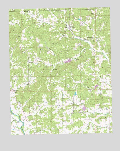
Warm Springs, AR USGS Topographic Map
Click on map above to begin viewing in our Map Viewer.

This topographic map contains these locations and features:
Feature Name Type Latitude Longitude GNIS ID View Map
AntiochPopulated PlaceN36.3959°W91.0476°70153View Map
Antioch Baptist ChurchChurchN36.3953°W91.0498°76181View Map
Antioch CemeteryCemeteryN36.3948°W91.0504°60414View Map
Bald KnobSummitN36.4453°W91.0223°57315View Map
Barum BranchStreamN36.4448°W91.0646°46128View Map
Bellah HillsSummitN36.4717°W91.1140°46363View Map
Blackwell Den ChurchChurchN36.4467°W91.0968°46699View Map
Burr CemeteryCemeteryN36.4667°W91.0154°47214View Map
Catto SpringSpringN36.4395°W91.0720°47533View Map
Cowden SpringSpringN36.4824°W91.0864°48122View Map
Dry CreekStreamN36.3884°W91.1132°48652View Map
Eden ChurchChurchN36.4170°W91.1190°48815View Map
Fourche Creek Site 16 DamDamN36.4467°W91.0385°79916View Map
Fourche Creek Site 16 ReservoirReservoirN36.4467°W91.0385°79917View Map
Fourche Creek Site 17 DamDamN36.4284°W91.0118°81216View Map
Fourche Creek Site 17 ReservoirReservoirN36.4271°W91.0122°81217View Map
Fourche Creek Site 18 DamDamN36.4001°W91.0335°81214View Map
Fourche Creek Site 18 ReservoirReservoirN36.4002°W91.0344°81215View Map
Gentry HillSummitN36.4792°W91.1210°57806View Map
Green Fork CreekStreamN36.4687°W91.0385°750138View Map
HamilPopulated PlaceN36.4031°W91.0654°57043View Map
Hamil ChurchChurchN36.4051°W91.0648°70173View Map
Hamil School (historical)SchoolN36.4034°W91.0651°70174View Map
Higgens CreekStreamN36.3884°W91.1168°50095View Map
Hurricane CreekStreamN36.3865°W91.1096°50441View Map
IngramPopulated PlaceN36.3990°W91.0076°77273View Map
Jones CreekStreamN36.3948°W91.1157°50732View Map
Looney CemeteryCemeteryN36.3948°W91.1232°60413View Map
Macedonia CemeteryCemeteryN36.4709°W91.0743°60417View Map
Macedonia ChurchChurchN36.4706°W91.0740°51581View Map
Meadows LakeReservoirN36.4886°W91.0382°79919View Map
Meadows Lake DamDamN36.4884°W91.0368°79918View Map
Midway CreekStreamN36.3937°W91.1154°51951View Map
Nelson CemeteryCemeteryN36.3814°W91.0229°52607View Map
PalestinePopulated PlaceN36.4326°W91.0065°70193View Map
Palestine CemeteryCemeteryN36.4323°W91.0057°60415View Map
Palestine Church of ChristChurchN36.4326°W91.0051°77945View Map
Phillips KnobSummitN36.4937°W91.0240°58360View Map
Pratt CemeteryCemeteryN36.4545°W91.0012°78095View Map
Roach CemeteryCemeteryN36.4039°W91.0443°54057View Map
Spikes CemeteryCemeteryN36.3995°W91.0112°55069View Map
Stone HillSummitN36.4190°W91.1021°58693View Map
Township of JacksonCivilN36.4072°W91.0655°69026View Map
Township of Warm SpringsCivilN36.4675°W91.0423°69038View Map
Turner CreekStreamN36.4534°W91.0085°55742View Map
Tyer RidgeRidgeN36.3881°W91.0171°55769View Map
Upshaw CemeteryCemeteryN36.4187°W91.1210°55858View Map
Wallace LakeReservoirN36.4147°W91.0448°79921View Map
Wallace Lake DamDamN36.4134°W91.0435°79920View Map
Warm SpringsPopulated PlaceN36.4803°W91.0515°78698View Map
Warm Springs CemeteryCemeteryN36.4814°W91.0460°60416View Map
Warm Springs CreekStreamN36.4598°W91.0232°56061View Map
Warm Springs Post Office (historical)Post OfficeN36.4795°W91.0507°83924View Map
Warm Springs Volunteer Fire StationBuildingN36.4821°W91.0501°2117272View Map
Wells CemeteryCemeteryN36.3848°W91.1021°56148View Map
Whittenberg CemeteryCemeteryN36.4684°W91.0285°56336View Map
Whittenberg SpringSpringN36.4702°W91.0213°56337View Map
Wooldridge SpringSpringN36.4485°W91.0439°56538View Map

Note: Coordinates in the location and feature list above are referenced to NAD83 datum.


Copyright (C) 2008-2025 Ryan Niemi / Sunset Dynamics ... All Rights Reserved