TopoQuest Logo
Do you find TopoQuest useful?
Help keep TopoQuest running and adding new maps/features by donating!
Bitcoin:  19c7KJd3qBynnjoSw5npx9KScwjBe4ifkT
Litecoin:  LXs6TkuXGGXo1vDsWCkWVdjQX94eUKd6ui
Home View Maps Find Maps Find Places Resources & Links


Saint Joseph, Minnesota Topographic Map

USGS Map Title: Saint Joseph, MN
USGS Map MRC: 45094E3
DRG (GeoTIFF) Download: o45094e3.tif


Neighboring USGS Topographic Map Quads:


  Holdingford, MN  
45094F4
 

  Saint Stephen, MN  
45094F3
 

  Little Rock Lake, MN  
45094F2
 

  Avon, MN  
45094E4
 

  Saint Joseph, MN  
45094E3
 

  Saint Cloud, MN  
45094E2
 

  Cold Spring, MN  
45094D4
 

  Rockville, MN  
45094D3
 

  Saint Augusta, MN  
45094D2


Map MRC Location:

N46°
W95°
N46°
W94°
H8 H7 H6 H5 H4 H3 H2 H1
G8 G7 G6 G5 G4 G3 G2 G1
F8 F7 F6 F5 F4 F3 F2 F1
E8 E7 E6 E5 E4 E3 E2 E1
D8 D7 D6 D5 D4 D3 D2 D1
C8 C7 C6 C5 C4 C3 C2 C1
B8 B7 B6 B5 B4 B3 B2 B1
A8 A7 A6 A5 A4 A3 A2 A1
N45°
W95°
N45°
W94°

Saint Joseph, MN USGS 1:24K Topographic Map Preview:
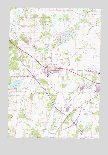
Saint Joseph, MN USGS Topographic Map
Click on map above to begin viewing in our Map Viewer.

This topographic map contains these locations and features:
Feature Name Type Latitude Longitude GNIS ID View Map
Academic Services BuildingBuildingN45.5603°W94.3194°2068156View Map
Ardolf Science CenterBuildingN45.5611°W94.3208°2068153View Map
Aurora HallBuildingN45.5614°W94.3189°2068139View Map
Benedicta Arts CenterBuildingN45.5592°W94.3211°2068151View Map
Brian HallBuildingN45.5611°W94.3236°2068155View Map
City of Pleasant Lake (historical)CivilN45.5011°W94.2892°2628240View Map
City of Saint JosephCivilN45.5609°W94.3074°2396497View Map
Claire Lynch HallBuildingN45.5589°W94.3181°2068148View Map
Clemens LibraryBuildingN45.5606°W94.3206°2068143View Map
College of Saint BenedictSchoolN45.5611°W94.3206°2068238View Map
College of Saint Benedict GarageBuildingN45.5636°W94.3214°2068134View Map
CollegevillePopulated PlaceN45.5944°W94.3631°641398View Map
Collegeville Post OfficePost OfficeN45.5944°W94.3628°2068241View Map
Corona HallBuildingN45.5611°W94.3206°2068140View Map
County Ditch Number SeventeenCanalN45.5233°W94.2675°641730View Map
East ApartmentsBuildingN45.5603°W94.3172°2068145View Map
Evin HallBuildingN45.5617°W94.3225°2068142View Map
Five PointsPopulated PlaceN45.6077°W94.2611°654705View Map
Haehn Campus CenterBuildingN45.5589°W94.3183°2068149View Map
Henrita Academic BuildingBuildingN45.5603°W94.3181°2068144View Map
Idzerda HouseBuildingN45.5581°W94.3181°2068150View Map
Interchange 158CrossingN45.5833°W94.3583°2068391View Map
Interchange 160CrossingN45.5583°W94.3397°2068390View Map
Interchange 164CrossingN45.5158°W94.2836°2068389View Map
Kraemer LakeLakeN45.5509°W94.3652°646241View Map
KVSC-FM (Saint Cloud)TowerN45.5997°W94.3128°663116View Map
KXSS-AM (Waite Park)TowerN45.5419°W94.2617°662991View Map
KXSS-FM (Waite Park)TowerN45.5430°W94.2617°663133View Map
Lottie and Frank J Ardolf Jr HallBuildingN45.5603°W94.3228°2068154View Map
Main BuildingBuildingN45.5631°W94.3178°2068130View Map
Main Monastery BuildingBuildingN45.5639°W94.3183°2068133View Map
Margretta HallBuildingN45.5606°W94.3228°2068152View Map
Mary Hall CommonsBuildingN45.5617°W94.3194°2068137View Map
MonasteryBuildingN45.5639°W94.3208°2068138View Map
Monastic CemeteryCemeteryN45.5611°W94.3175°2068240View Map
Mud LakeLakeN45.5108°W94.2669°648251View Map
Murray HallBuildingN45.5592°W94.3192°2068147View Map
North Fork Watab RiverStreamN45.5830°W94.3261°648640View Map
Power HouseBuildingN45.5633°W94.3214°2068135View Map
Redeeming Love Lutheran ChurchChurchN45.5650°W94.3181°2067962View Map
Regina HallBuildingN45.5617°W94.3200°2068136View Map
Resurrection Lutheran ChurchChurchN45.5628°W94.3286°2067963View Map
Richarda HallBuildingN45.5594°W94.3181°2068146View Map
Rolling Ridge ParkParkN45.5786°W94.2528°2069189View Map
Rossier LakeLakeN45.5932°W94.3013°650312View Map
Sacred Heart ChapelChurchN45.5636°W94.3192°2068132View Map
Saint Cloud Baptist ChurchChurchN45.5978°W94.2514°2067911View Map
Saint JosephLocaleN45.5661°W94.3150°2067961View Map
Saint JosephPopulated PlaceN45.5650°W94.3183°650746View Map
Saint Joseph Blockhouse Historical MarkerParkN45.5664°W94.3222°2067959View Map
Saint Joseph CemeteryCemeteryN45.5617°W94.3175°2068239View Map
Saint Joseph Lab SchoolSchoolN45.5639°W94.3189°2067966View Map
Saint Joseph Medical ClinicHospitalN45.5650°W94.3214°2067964View Map
Saint Joseph Mobile Home ParkPopulated PlaceN45.5700°W94.3208°2067972View Map
Saint Joseph ParishChurchN45.5639°W94.3181°2067965View Map
Saint Joseph Police DepartmentBuildingN45.5656°W94.3186°2067960View Map
Saint Joseph Post OfficePost OfficeN45.5656°W94.3206°2068243View Map
Saint Joseph Volunteer Fire DepartmentBuildingN45.5663°W94.3108°2666520View Map
School Number 1912SchoolN45.5372°W94.3553°651434View Map
School Number 1919SchoolN45.5272°W94.2830°651436View Map
School Number 1925SchoolN45.5052°W94.3164°651439View Map
School Number 2004SchoolN45.5866°W94.2786°651469View Map
School Number 2030SchoolN45.6227°W94.2897°651479View Map
South Fork Watab RiverStreamN45.5830°W94.3261°652303View Map
Staples CemeteryCemeteryN45.5269°W94.3011°652548View Map
Stranger CemeteryCemeteryN45.5508°W94.2705°652718View Map
Swamp LakeLakeN45.6204°W94.3621°652878View Map
Teresa HallBuildingN45.5633°W94.3189°2068131View Map
Township of Saint JosephCivilN45.5425°W94.3278°665518View Map
Watab LakeLakeN45.5991°W94.2934°653830View Map
West ApartmentsBuildingN45.5622°W94.3217°2068141View Map

Note: Coordinates in the location and feature list above are referenced to NAD83 datum.


Copyright (C) 2008-2024 Ryan Niemi / Sunset Dynamics ... All Rights Reserved