TopoQuest Logo
Do you find TopoQuest useful?
Help keep TopoQuest running and adding new maps/features by donating!
Bitcoin:  19c7KJd3qBynnjoSw5npx9KScwjBe4ifkT
Litecoin:  LXs6TkuXGGXo1vDsWCkWVdjQX94eUKd6ui
Home View Maps Find Maps Find Places Resources & Links


Saint Stephen, Minnesota Topographic Map

USGS Map Title: Saint Stephen, MN
USGS Map MRC: 45094F3
DRG (GeoTIFF) Download: o45094f3.tif


Neighboring USGS Topographic Map Quads:


  Bowlus, MN  
45094G4
 

  Royalton, MN  
45094G3
 

  Rice, MN  
45094G2
 

  Holdingford, MN  
45094F4
 

  Saint Stephen, MN  
45094F3
 

  Little Rock Lake, MN  
45094F2
 

  Avon, MN  
45094E4
 

  Saint Joseph, MN  
45094E3
 

  Saint Cloud, MN  
45094E2


Map MRC Location:

N46°
W95°
N46°
W94°
H8 H7 H6 H5 H4 H3 H2 H1
G8 G7 G6 G5 G4 G3 G2 G1
F8 F7 F6 F5 F4 F3 F2 F1
E8 E7 E6 E5 E4 E3 E2 E1
D8 D7 D6 D5 D4 D3 D2 D1
C8 C7 C6 C5 C4 C3 C2 C1
B8 B7 B6 B5 B4 B3 B2 B1
A8 A7 A6 A5 A4 A3 A2 A1
N45°
W95°
N45°
W94°

Saint Stephen, MN USGS 1:24K Topographic Map Preview:
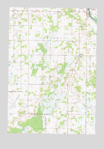
Saint Stephen, MN USGS Topographic Map
Click on map above to begin viewing in our Map Viewer.

This topographic map contains these locations and features:
Feature Name Type Latitude Longitude GNIS ID View Map
City of Saint StephenCivilN45.7009°W94.2741°2396521View Map
County Ditch Number TwelveCanalN45.6650°W94.2981°641630View Map
County Ditch Number TwentysevenCanalN45.7111°W94.3228°641888View Map
John F Kennedy Elementary SchoolSchoolN45.7028°W94.2778°2067956View Map
OpolePopulated PlaceN45.7466°W94.3689°648980View Map
Opole Post Office (historical)Post OfficeN45.7467°W94.3686°2068264View Map
Our Lady of Mount Carmel CemeteryCemeteryN45.7438°W94.3683°648166View Map
Saint Stephani CemeteryCemeteryN45.7008°W94.2750°2068101View Map
Saint StephenPopulated PlaceN45.7027°W94.2744°651056View Map
Saint Stephen ChurchChurchN45.7017°W94.2744°2067957View Map
Saint Stephen City HallBuildingN45.7028°W94.2639°2067958View Map
Saint Stephen Elementary SchoolSchoolN45.7025°W94.2775°2067955View Map
Saint Stephen Fire StationBuildingN45.7026°W94.2632°2666522View Map
Saint Wendel CemeteryCemeteryN45.6678°W94.3674°2068111View Map
Saint Wendel ParishChurchN45.6664°W94.3672°2068309View Map
School Number 1915SchoolN45.6964°W94.3575°651435View Map
School Number 1920SchoolN45.6480°W94.2889°651437View Map
School Number 1921SchoolN45.7472°W94.3367°651438View Map
School Number 1984SchoolN45.7175°W94.2853°651457View Map
School Number 2063SchoolN45.6577°W94.3461°651493View Map
Stony CreekStreamN45.7500°W94.2733°652680View Map
Township of BrockwayCivilN45.7210°W94.3110°663669View Map
Township of Saint WendelCivilN45.6302°W94.3255°665536View Map

Note: Coordinates in the location and feature list above are referenced to NAD83 datum.


Copyright (C) 2008-2025 Ryan Niemi / Sunset Dynamics ... All Rights Reserved