TopoQuest Logo
Do you find TopoQuest useful?
Help keep TopoQuest running and adding new maps/features by donating!
Bitcoin:  19c7KJd3qBynnjoSw5npx9KScwjBe4ifkT
Litecoin:  LXs6TkuXGGXo1vDsWCkWVdjQX94eUKd6ui
Home View Maps Find Maps Find Places Resources & Links


Salem, Nebraska Topographic Map

USGS Map Title: Salem, NE
USGS Map MRC: 40095A6
DRG (GeoTIFF) Download: o40095a6.tif


Neighboring USGS Topographic Map Quads:


  Dawson, NE  
40095B7
 

  Verdon, NE  
40095B6
 

  Barada, NE  
40095B5
 

  Humboldt SE, NE  
40095A7
 

  Salem, NE  
40095A6
 

  Falls City, NE  
40095A5
 

  Sabetha, KS  
39095H7
 

  Morrill, KS  
39095H6
 

  Reserve, KS  
39095H5


Map MRC Location:

N41°
W96°
N41°
W95°
H8 H7 H6 H5 H4 H3 H2 H1
G8 G7 G6 G5 G4 G3 G2 G1
F8 F7 F6 F5 F4 F3 F2 F1
E8 E7 E6 E5 E4 E3 E2 E1
D8 D7 D6 D5 D4 D3 D2 D1
C8 C7 C6 C5 C4 C3 C2 C1
B8 B7 B6 B5 B4 B3 B2 B1
A8 A7 A6 A5 A4 A3 A2 A1
N40°
W96°
N40°
W95°

Salem, NE USGS 1:24K Topographic Map Preview:
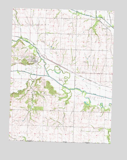
Salem, NE USGS Topographic Map
Click on map above to begin viewing in our Map Viewer.

This topographic map contains these locations and features:
Feature Name Type Latitude Longitude GNIS ID View Map
Campbell DamDamN40.0273°W95.6834°1767852View Map
Campbell ReservoirReservoirN40.0269°W95.6834°1767853View Map
Contrary CreekStreamN40.0561°W95.7230°828304View Map
Deer BranchStreamN40.0967°W95.7383°828644View Map
Falls ChurchChurchN40.0225°W95.6330°829264View Map
Falls City Country ClubLocaleN40.0664°W95.6592°836043View Map
Falls City Oil FieldOilfieldN40.0442°W95.6494°829267View Map
First Oil Well Historical MarkerParkN40.0661°W95.6530°1883657View Map
Five Point SchoolSchoolN40.0150°W95.6717°829316View Map
Freeling (historical)LocaleN40.0833°W95.6258°1883528View Map
Gladstone SchoolSchoolN40.0878°W95.7303°829531View Map
Goolsby BranchStreamN40.1108°W95.6289°829575View Map
Mackelroy CreekStreamN40.1186°W95.6467°830986View Map
Maple CemeteryCemeteryN40.0792°W95.7316°831025View Map
North Fork Big Nemaha RiverStreamN40.0619°W95.7033°831686View Map
Old Channel Big Nemaha RiverChannelN40.0661°W95.6833°831848View Map
Pedee CreekStreamN40.0036°W95.7478°832027View Map
Pleasant Ridge SchoolSchoolN40.1022°W95.6917°832215View Map
Rock CreekStreamN40.0562°W95.7232°472763View Map
Saint Marks ChurchChurchN40.1161°W95.6869°832968View Map
SalemPopulated PlaceN40.0756°W95.7208°833121View Map
SalemLocaleN40.0800°W95.7114°1883618View Map
Salem Election PrecinctCivilN40.0440°W95.7279°1929264View Map
Salem Grain Company ElevatorLocaleN40.0756°W95.7208°1883620View Map
Salem Post OfficePost OfficeN40.0756°W95.7208°1883619View Map
Salem Volunteer Fire DepartmentBuildingN40.0753°W95.7209°2553440View Map
South Fork Big Nemaha RiverStreamN40.0617°W95.7028°472736View Map
StraussvilleLocaleN40.1083°W95.6339°1883552View Map
StraussvillePopulated PlaceN40.1083°W95.6339°833858View Map
Straussville Grain Incorporated ElevatorLocaleN40.1083°W95.6339°1883594View Map
Straussville Post Office (historical)Post OfficeN40.1083°W95.6339°1883508View Map
Towle-Martin DamDamN40.0338°W95.6581°1767850View Map
Towle-Martin ReservoirReservoirN40.0326°W95.6591°1767851View Map
Township of Falls CityCivilN40.0417°W95.6258°1883491View Map
Township of SalemCivilN40.0417°W95.7267°1883492View Map
Village of SalemCivilN40.0769°W95.7285°2399174View Map
Wildcat CreekStreamN40.0497°W95.6769°834726View Map

Note: Coordinates in the location and feature list above are referenced to NAD83 datum.


Copyright (C) 2008-2024 Ryan Niemi / Sunset Dynamics ... All Rights Reserved