TopoQuest Logo
Do you find TopoQuest useful?
Help keep TopoQuest running and adding new maps/features by donating!
Bitcoin:  19c7KJd3qBynnjoSw5npx9KScwjBe4ifkT
Litecoin:  LXs6TkuXGGXo1vDsWCkWVdjQX94eUKd6ui
Home View Maps Find Maps Find Places Resources & Links


Salineno, Texas Topographic Map

USGS Map Title: Salineno, TX
USGS Map MRC: 26099E1
DRG (GeoTIFF) Download: o26099e1.tif


Neighboring USGS Topographic Map Quads:


  Beckwith Arm, TX  
26099F2
 

  Lopeno, TX  
26099F1
 

  Las Escobas Ranch, TX  
26098F8
 

  Falcon Village, TX  
26099E2
 

  Salineno, TX  
26099E1
 

  El Chapote Creek, TX  
26098E8


  Roma-Los Saenz West, TX  
26099D1
 

  Roma-Los Saenz East, TX  
26098D8


Map MRC Location:

N27°
W100°
N27°
W99°
H8 H7 H6 H5 H4 H3 H2 H1
G8 G7 G6 G5 G4 G3 G2 G1
F8 F7 F6 F5 F4 F3 F2 F1
E8 E7 E6 E5 E4 E3 E2 E1
D8 D7 D6 D5 D4 D3 D2 D1
C8 C7 C6 C5 C4 C3 C2 C1
B8 B7 B6 B5 B4 B3 B2 B1
A8 A7 A6 A5 A4 A3 A2 A1
N26°
W100°
N26°
W99°

Salineno, TX USGS 1:24K Topographic Map Preview:
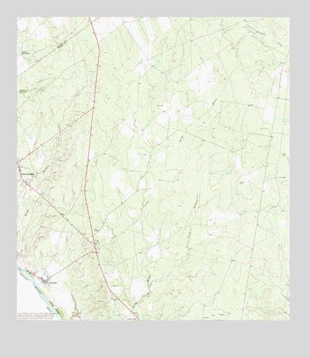
Salineno, TX USGS Topographic Map
Click on map above to begin viewing in our Map Viewer.

This topographic map contains these locations and features:
Feature Name Type Latitude Longitude GNIS ID View Map
Arroyo QuemadoStreamN26.5137°W99.0645°1329751View Map
Falcon HeightsPopulated PlaceN26.5589°W99.1231°1335664View Map
Falcon Heights Census Designated PlaceCensusN26.5604°W99.1225°2408107View Map
Falcon Heights Post OfficePost OfficeN26.5607°W99.1236°2731194View Map
Falconaire Census Designated PlaceCensusN26.5511°W99.1169°2584638View Map
Falconaire ColoniaPopulated PlaceN26.5523°W99.1173°2011250View Map
Indio Census Designated PlaceCensusN26.5489°W99.0959°2584654View Map
Indio Number 1 ColoniaPopulated PlaceN26.5564°W99.0942°2010849View Map
Indio Number 2 ColoniaPopulated PlaceN26.5553°W99.0953°2010850View Map
Jardin de San Julian Census Designated PlaceCensusN26.5254°W99.0999°2584655View Map
Jardin de San Julian ColoniaPopulated PlaceN26.5264°W99.1003°2010853View Map
La Loma de Falcon Census Designated PlaceCensusN26.5368°W99.0960°2584664View Map
La Minita Census Designated PlaceCensusN26.5023°W99.0735°2584665View Map
Lago Vista Census Designated PlaceCensusN26.5643°W99.1078°2584663View Map
Lago Vista ColoniaPopulated PlaceN26.5642°W99.1084°2010874View Map
Los Arrieros Census Designated PlaceCensusN26.5158°W99.0845°2584680View Map
Los Arrierous CemeteryCemeteryN26.5020°W99.0956°1340569View Map
Mangus LakeReservoirN26.5803°W99.1070°1865415View Map
Mangus Lake DamDamN26.5803°W99.1070°1865414View Map
SalineņoPopulated PlaceN26.5164°W99.1123°1346183View Map
Salineņo Census Designated PlaceCensusN26.5176°W99.1121°2409238View Map
Salineņo North Census Designated PlaceCensusN26.5281°W99.0910°2584729View Map
Salineno Post OfficePost OfficeN26.5186°W99.1116°2731119View Map
Salineno Volunteer Fire DepartmentBuildingN26.5273°W99.0945°2551367View Map
Starr County Constable's Office Precinct 7BuildingN26.5274°W99.0946°2750773View Map

Note: Coordinates in the location and feature list above are referenced to NAD83 datum.


Copyright (C) 2008-2025 Ryan Niemi / Sunset Dynamics ... All Rights Reserved