TopoQuest Logo
Do you find TopoQuest useful?
Help keep TopoQuest running and adding new maps/features by donating!
Bitcoin:  19c7KJd3qBynnjoSw5npx9KScwjBe4ifkT
Litecoin:  LXs6TkuXGGXo1vDsWCkWVdjQX94eUKd6ui
Home View Maps Find Maps Find Places Resources & Links


Salmon, Idaho Topographic Map

USGS Map Title: Salmon, ID
USGS Map MRC: 45113B8
DRG (GeoTIFF) Download: o45113b8.tif


Neighboring USGS Topographic Map Quads:


  Napoleon Hill, ID  
45114C1
 

  Bird Creek, ID  
45113C8
 

  Badger Spring Gulch, ID  
45113C7
 

  Leesburg, ID  
45114B1
 

  Salmon, ID  
45113B8
 

  East of Salmon, ID  
45113B7
 

  Lake Mountain, ID  
45114A1
 

  Williams Lake, ID  
45113A8
 

  Sal Mountain, ID  
45113A7


Map MRC Location:

N46°
W114°
N46°
W113°
H8 H7 H6 H5 H4 H3 H2 H1
G8 G7 G6 G5 G4 G3 G2 G1
F8 F7 F6 F5 F4 F3 F2 F1
E8 E7 E6 E5 E4 E3 E2 E1
D8 D7 D6 D5 D4 D3 D2 D1
C8 C7 C6 C5 C4 C3 C2 C1
B8 B7 B6 B5 B4 B3 B2 B1
A8 A7 A6 A5 A4 A3 A2 A1
N45°
W114°
N45°
W113°

Salmon, ID USGS 1:24K Topographic Map Preview:
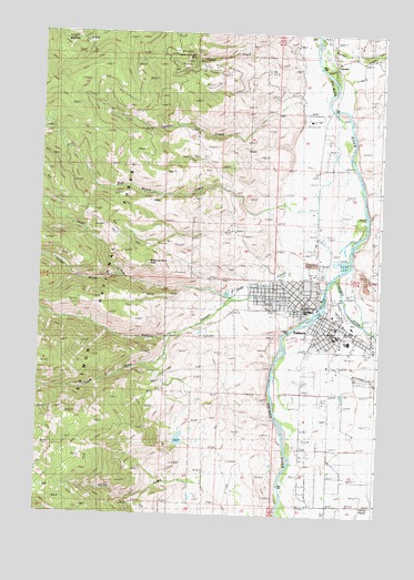
Salmon, ID USGS Topographic Map
Click on map above to begin viewing in our Map Viewer.

This topographic map contains these locations and features:
Feature Name Type Latitude Longitude GNIS ID View Map
Billy Creek DamDamN45.1466°W113.9442°398747View Map
Bob Moore CreekStreamN45.2058°W113.9117°377975View Map
Bridgeview Alternative High SchoolSchoolN45.1680°W113.8856°401305View Map
Brooklyn Intermediate Elementary SchoolSchoolN45.1783°W113.9034°401304View Map
Bureau of Land Management Salmon Field OfficeBuildingN45.1706°W113.8892°2417951View Map
CarmenPopulated PlaceN45.2424°W113.8934°397530View Map
Carmen CreekStreamN45.2499°W113.9012°378945View Map
Carmen Post OfficePost OfficeN45.2423°W113.8928°2767308View Map
Chipps CreekStreamN45.1713°W113.9506°399829View Map
City CemeteryCemeteryN45.1606°W113.8805°2766755View Map
City of SalmonCivilN45.1743°W113.8949°2411770View Map
Deriar CreekStreamN45.2419°W113.9065°397623View Map
Fenster CreekStreamN45.2316°W113.9073°381652View Map
Gorley CreekStreamN45.1305°W113.9315°382458View Map
Gorley Creek DamDamN45.1283°W113.9259°398748View Map
Jesse CreekStreamN45.1955°W113.9078°383904View Map
Lemhi County Sheriff's OfficeBuildingN45.1793°W113.9022°2722455View Map
Lemhi RiverStreamN45.1880°W113.9065°384571View Map
Lemhi ValleyValleyN45.1880°W113.8878°384573View Map
Morning Glory PeakSummitN45.1896°W113.9606°397931View Map
Pollard CanyonValleyN45.1808°W113.9301°388704View Map
Queen of the Hills MineMineN45.2430°W113.9465°388983View Map
SalmonPopulated PlaceN45.1758°W113.8959°398084View Map
Salmon Advanced Ambulance Service Station 2BuildingN45.1738°W113.8916°2642839View Map
Salmon City - Lemhi County Fire District 1BuildingN45.1757°W113.8963°2618995View Map
Salmon High SchoolSchoolN45.1704°W113.8862°401181View Map
Salmon Middle SchoolSchoolN45.1720°W113.8909°401180View Map
Salmon Pioneer Primary SchoolSchoolN45.1716°W113.8897°401182View Map
Salmon Police DepartmentBuildingN45.1770°W113.8968°2722384View Map
Salmon Post OfficePost OfficeN45.1760°W113.8918°2781798View Map
Salmon Seven-Day Adventist SchoolSchoolN45.1845°W113.9050°401150View Map
Steele Memorial Medical CenterHospitalN45.1732°W113.8918°2721851View Map
Turner GulchValleyN45.1860°W113.9720°392464View Map

Note: Coordinates in the location and feature list above are referenced to NAD83 datum.


Copyright (C) 2008-2025 Ryan Niemi / Sunset Dynamics ... All Rights Reserved