TopoQuest Logo
Do you find TopoQuest useful?
Help keep TopoQuest running and adding new maps/features by donating!
Bitcoin:  19c7KJd3qBynnjoSw5npx9KScwjBe4ifkT
Litecoin:  LXs6TkuXGGXo1vDsWCkWVdjQX94eUKd6ui
Home View Maps Find Maps Find Places Resources & Links


Napoleon Hill, Idaho Topographic Map

USGS Map Title: Napoleon Hill, ID
USGS Map MRC: 45114C1
DRG (GeoTIFF) Download: o45114c1.tif


Neighboring USGS Topographic Map Quads:


  Ulysses, ID  
45114D2
 

  Ulysses Mountain, ID  
45114D1
 

  North Fork, ID  
45113D8
 

  Pine Creek Ridge, ID  
45114C2
 

  Napoleon Hill, ID  
45114C1
 

  Bird Creek, ID  
45113C8
 

  Jureano Mountain, ID  
45114B2
 

  Leesburg, ID  
45114B1
 

  Salmon, ID  
45113B8


Map MRC Location:

N46°
W115°
N46°
W114°
H8 H7 H6 H5 H4 H3 H2 H1
G8 G7 G6 G5 G4 G3 G2 G1
F8 F7 F6 F5 F4 F3 F2 F1
E8 E7 E6 E5 E4 E3 E2 E1
D8 D7 D6 D5 D4 D3 D2 D1
C8 C7 C6 C5 C4 C3 C2 C1
B8 B7 B6 B5 B4 B3 B2 B1
A8 A7 A6 A5 A4 A3 A2 A1
N45°
W115°
N45°
W114°

Napoleon Hill, ID USGS 1:24K Topographic Map Preview:
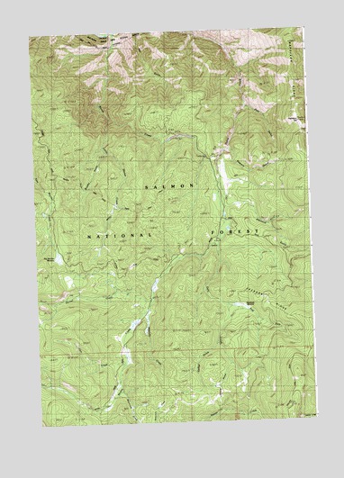
Napoleon Hill, ID USGS Topographic Map
Click on map above to begin viewing in our Map Viewer.

This topographic map contains these locations and features:
Feature Name Type Latitude Longitude GNIS ID View Map
Allen CreekStreamN45.2685°W114.0876°376545View Map
Bear GulchValleyN45.3505°W114.0281°377150View Map
Beartrack CreekStreamN45.2621°W114.0892°371413View Map
Big Boulder MeadowLocaleN45.3030°W114.1148°376196View Map
Brushy GulchValleyN45.3369°W114.0923°376195View Map
Brushy Gulch TrailTrailN45.3249°W114.1009°376194View Map
Coffee GulchValleyN45.2749°W114.0440°400476View Map
Coffee GulchValleyN45.2756°W114.0442°398447View Map
Daly CreekStreamN45.3085°W114.0420°380222View Map
Daly Creek Trail (historical)TrailN45.2633°W114.0412°380223View Map
Diamond GulchValleyN45.3188°W114.0381°380574View Map
East Fork Daly CreekStreamN45.2871°W114.0387°381079View Map
Hornet CreekStreamN45.2908°W114.0740°383343View Map
Hornet Creek TrailTrailN45.2891°W114.1148°383344View Map
Jackass RidgeRidgeN45.2855°W114.0195°376192View Map
Little Moose CreekStreamN45.3477°W114.0912°384897View Map
Moose CreekStreamN45.3741°W114.0884°387177View Map
Moose Creek TrailTrailN45.3166°W114.0676°376193View Map
Napoleon HillSummitN45.3452°W114.0045°387467View Map
Napoleon RidgeRidgeN45.3660°W114.0076°387468View Map
Racetrack MeadowFlatN45.2841°W114.0340°400053View Map
Sawmill GulchValleyN45.3371°W114.0356°389975View Map
Sierra GulchValleyN45.2688°W114.0387°398456View Map
Webfoot CreekStreamN45.2871°W114.0745°398455View Map

Note: Coordinates in the location and feature list above are referenced to NAD83 datum.


Copyright (C) 2008-2025 Ryan Niemi / Sunset Dynamics ... All Rights Reserved