TopoQuest Logo
Do you find TopoQuest useful?
Help keep TopoQuest running and adding new maps/features by donating!
Bitcoin:  19c7KJd3qBynnjoSw5npx9KScwjBe4ifkT
Litecoin:  LXs6TkuXGGXo1vDsWCkWVdjQX94eUKd6ui
Home View Maps Find Maps Find Places Resources & Links


Salmon Prairie, Montana Topographic Map

USGS Map Title: Salmon Prairie, MT
USGS Map MRC: 47113F7
DRG (GeoTIFF) Download: o47113f7.tif


Neighboring USGS Topographic Map Quads:


  Porcupine Creek, MT  
47113G8
 

  Cilly Creek, MT  
47113G7
 

  Thunderbolt Mountain, MT  
47113G6
 

  Cedar Lake, MT  
47113F8
 

  Salmon Prairie, MT  
47113F7
 

  Swan Peak, MT  
47113F6
 

  Piper-Crow Pass, MT  
47113E8
 

  Peck Lake, MT  
47113E7
 

  Condon, MT  
47113E6


Map MRC Location:

N48°
W114°
N48°
W113°
H8 H7 H6 H5 H4 H3 H2 H1
G8 G7 G6 G5 G4 G3 G2 G1
F8 F7 F6 F5 F4 F3 F2 F1
E8 E7 E6 E5 E4 E3 E2 E1
D8 D7 D6 D5 D4 D3 D2 D1
C8 C7 C6 C5 C4 C3 C2 C1
B8 B7 B6 B5 B4 B3 B2 B1
A8 A7 A6 A5 A4 A3 A2 A1
N47°
W114°
N47°
W113°

Salmon Prairie, MT USGS 1:24K Topographic Map Preview:
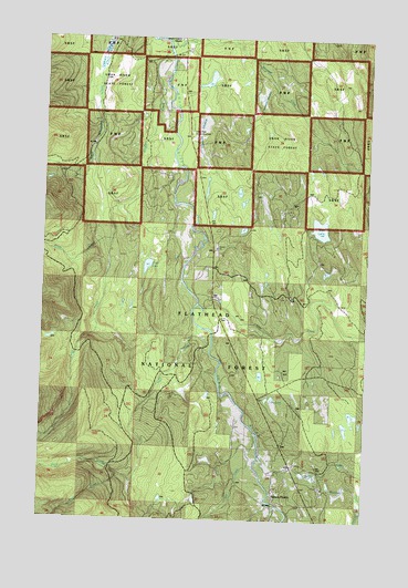
Salmon Prairie, MT USGS Topographic Map
Click on map above to begin viewing in our Map Viewer.

This topographic map contains these locations and features:
Feature Name Type Latitude Longitude GNIS ID View Map
22N17W08BDBD01 WellWellN47.6824°W113.8109°824495View Map
22N17W21CAAA01 WellWellN47.6511°W113.7865°824310View Map
23N17W18DBDD01 WellWellN47.7494°W113.8245°824811View Map
23N17W31ADDD01 WellWellN47.7091°W113.8182°824641View Map
23N17W31BCCA01 WellWellN47.7105°W113.8370°824647View Map
Alder CreekStreamN47.6416°W113.7912°778922View Map
Cedar CreekStreamN47.7472°W113.8295°781100View Map
Cedar Creek CampgroundLocaleN47.7461°W113.8309°799063View Map
Crow Creek TrailTrailN47.6347°W113.8376°781929View Map
Dry LakeLakeN47.6568°W113.7869°782654View Map
Fatty CreekStreamN47.6974°W113.8495°783315View Map
Goat CreekStreamN47.7491°W113.8298°784008View Map
Jim CreekStreamN47.6483°W113.7934°785484View Map
Lion CreekStreamN47.6808°W113.8162°786191View Map
Meadow CreekStreamN47.6369°W113.7695°787134View Map
Moore CreekStreamN47.6366°W113.8451°787619View Map
Piper CreekStreamN47.6752°W113.8162°788945View Map
Salmon PrairiePopulated PlaceN47.6299°W113.7854°789973View Map
Salmon Prairie SchoolSchoolN47.6308°W113.7853°1796855View Map
Shay LakeLakeN47.6908°W113.8357°790303View Map
Simmons MeadowFlatN47.7258°W113.8165°799015View Map
Squeezer CreekStreamN47.7499°W113.8162°791399View Map
Squeezer MeadowFlatN47.7341°W113.7934°799024View Map
Swan Valley Emergency Services Station 2BuildingN47.6439°W113.7833°2546624View Map
Van LakeLakeN47.7009°W113.7693°792677View Map
Woodward MeadowsSwampN47.7474°W113.8530°793533View Map

Note: Coordinates in the location and feature list above are referenced to NAD83 datum.


Copyright (C) 2008-2025 Ryan Niemi / Sunset Dynamics ... All Rights Reserved