TopoQuest Logo
Do you find TopoQuest useful?
Help keep TopoQuest running and adding new maps/features by donating!
Bitcoin:  19c7KJd3qBynnjoSw5npx9KScwjBe4ifkT
Litecoin:  LXs6TkuXGGXo1vDsWCkWVdjQX94eUKd6ui
Home View Maps Find Maps Find Places Resources & Links


San Luis Ranch, California Topographic Map

USGS Map Title: San Luis Ranch, CA
USGS Map MRC: 37120B7
DRG (GeoTIFF) Download: o37120b7.tif


Neighboring USGS Topographic Map Quads:


  Gustine, CA  
37120C8
 

  Stevinson, CA  
37120C7
 

  Arena, CA  
37120C6
 

  Ingomar, CA  
37120B8
 

  San Luis Ranch, CA  
37120B7
 

  Turner Ranch, CA  
37120B6
 

  Volta, CA  
37120A8
 

  Los Banos, CA  
37120A7
 

  Delta Ranch, CA  
37120A6


Map MRC Location:

N38°
W121°
N38°
W120°
H8 H7 H6 H5 H4 H3 H2 H1
G8 G7 G6 G5 G4 G3 G2 G1
F8 F7 F6 F5 F4 F3 F2 F1
E8 E7 E6 E5 E4 E3 E2 E1
D8 D7 D6 D5 D4 D3 D2 D1
C8 C7 C6 C5 C4 C3 C2 C1
B8 B7 B6 B5 B4 B3 B2 B1
A8 A7 A6 A5 A4 A3 A2 A1
N37°
W121°
N37°
W120°

San Luis Ranch, CA USGS 1:24K Topographic Map Preview:
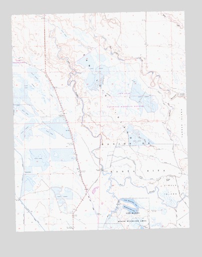
San Luis Ranch, CA USGS Topographic Map
Click on map above to begin viewing in our Map Viewer.

This topographic map contains these locations and features:
Feature Name Type Latitude Longitude GNIS ID View Map
Big Buttonwillow LakeLakeN37.1361°W120.7928°219142View Map
Circle IslandIslandN37.1472°W120.7644°221117View Map
Circle Island DrainCanalN37.1547°W120.7702°221118View Map
Deadmans SloughGutN37.2058°W120.8113°222134View Map
Deep SloughGutN37.2449°W120.7608°222162View Map
Exeter FarmsLocaleN37.1594°W120.8685°223309View Map
Fremont CanalCanalN37.2141°W120.8683°223865View Map
Grasslands Wildlife Management AreaParkN37.2411°W120.7972°2765594View Map
Hereford DrainCanalN37.1630°W120.7735°225199View Map
Hereford RanchLocaleN37.1530°W120.7674°225200View Map
Island Canal BCanalN37.1466°W120.7538°226004View Map
Island Canal CCanalN37.1741°W120.7613°226006View Map
Island Canal DCanalN37.1636°W120.7705°226005View Map
Little Buttonwillow LakeLakeN37.1400°W120.7916°227212View Map
Los Banos State Waterfowl AreaParkN37.1280°W120.7932°227663View Map
Mud SloughStreamN37.1544°W120.8080°229253View Map
Old Dickenson Ferry (historical)CrossingN37.2233°W120.7844°1662001View Map
Old Poso SloughStreamN37.1466°W120.7505°252199View Map
Salt Slough Island CanalCanalN37.1597°W120.7885°232332View Map
San Jose Gun ClubLocaleN37.1266°W120.8352°1654418View Map
San Luis CanalCanalN37.1397°W120.8202°232440View Map
San Luis Drain Number OneCanalN37.1722°W120.7785°253822View Map
San Luis IslandIslandN37.1999°W120.8177°1654901View Map
San Luis National Wildlife RefugeParkN37.2367°W120.8532°255934View Map
San Luis RanchLocaleN37.1597°W120.8135°232445View Map
Santa Cruz Gun ClubLocaleN37.1352°W120.7744°1654424View Map
Standard Gun ClubLocaleN37.1336°W120.8349°1654465View Map
Terrels Gun ClubLocaleN37.1344°W120.8174°1654480View Map
Underwood Gun ClubLocaleN37.1902°W120.8394°1654491View Map
Underwood Ranch (historical)LocaleN37.1916°W120.8385°1662010View Map
West Delta DrainCanalN37.1255°W120.7566°237454View Map
Yellow Jacket Gun ClubLocaleN37.1741°W120.8330°1654529View Map
Zimmerman Gun ClubLocaleN37.1588°W120.8294°1654533View Map

Note: Coordinates in the location and feature list above are referenced to NAD83 datum.


Copyright (C) 2008-2025 Ryan Niemi / Sunset Dynamics ... All Rights Reserved