TopoQuest Logo
Do you find TopoQuest useful?
Help keep TopoQuest running and adding new maps/features by donating!
Bitcoin:  19c7KJd3qBynnjoSw5npx9KScwjBe4ifkT
Litecoin:  LXs6TkuXGGXo1vDsWCkWVdjQX94eUKd6ui
Home View Maps Find Maps Find Places Resources & Links


Delta Ranch, California Topographic Map

USGS Map Title: Delta Ranch, CA
USGS Map MRC: 37120A6
DRG (GeoTIFF) Download: o37120a6.tif


Neighboring USGS Topographic Map Quads:


  San Luis Ranch, CA  
37120B7
 

  Turner Ranch, CA  
37120B6
 

  Sandy Mush, CA  
37120B5
 

  Los Banos, CA  
37120A7
 

  Delta Ranch, CA  
37120A6
 

  Santa Rita Bridge, CA  
37120A5
 

  Charleston School, CA  
36120H7
 

  Dos Palos, CA  
36120H6
 

  Oxalis, CA  
36120H5


Map MRC Location:

N38°
W121°
N38°
W120°
H8 H7 H6 H5 H4 H3 H2 H1
G8 G7 G6 G5 G4 G3 G2 G1
F8 F7 F6 F5 F4 F3 F2 F1
E8 E7 E6 E5 E4 E3 E2 E1
D8 D7 D6 D5 D4 D3 D2 D1
C8 C7 C6 C5 C4 C3 C2 C1
B8 B7 B6 B5 B4 B3 B2 B1
A8 A7 A6 A5 A4 A3 A2 A1
N37°
W121°
N37°
W120°

Delta Ranch, CA USGS 1:24K Topographic Map Preview:
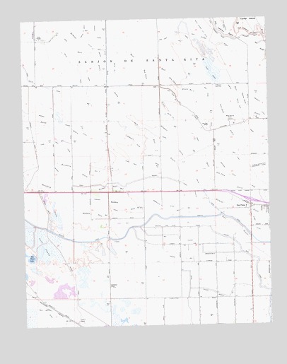
Delta Ranch, CA USGS Topographic Map
Click on map above to begin viewing in our Map Viewer.

This topographic map contains these locations and features:
Feature Name Type Latitude Longitude GNIS ID View Map
Agatha CanalCanalN37.0163°W120.7249°218010View Map
Arroyo CanalCanalN37.0438°W120.6555°233430View Map
Arroyo Farm (historical)LocaleN37.0569°W120.6702°1661961View Map
Belmont DrainCanalN37.0749°W120.6732°219012View Map
Bennett DitchCanalN37.0841°W120.6263°219042View Map
Boundary DrainCanalN37.0461°W120.7157°219706View Map
Boundary Drain Number FiveCanalN37.0572°W120.7071°254653View Map
Boundary Drain Number Five-TwoCanalN37.0488°W120.7016°254654View Map
Circle Six RanchLocaleN37.0019°W120.7244°254745View Map
Clark DitchCanalN37.0405°W120.6338°221156View Map
Colony Branch Number FiveCanalN37.0311°W120.6605°254765View Map
Colony Branch Number FourCanalN37.0127°W120.6532°254764View Map
Colony Main CanalCanalN37.0277°W120.6360°233702View Map
Community DitchCanalN37.0747°W120.6932°221432View Map
County Road DitchCanalN37.1180°W120.7091°233729View Map
Delta CanalCanalN37.1080°W120.7255°222252View Map
Delta Number One CanalCanalN37.0947°W120.6907°253669View Map
Delta RanchLocaleN37.1180°W120.7427°222255View Map
Dos Palos DivisionCivilN37.0365°W120.6492°1935076View Map
Dos Palos YPopulated PlaceN37.0488°W120.6355°1655978View Map
Dos Palos Y Census Designated PlaceCensusN37.0467°W120.6394°2582998View Map
East Delta CanalCanalN37.1113°W120.7185°222871View Map
East Delta CanalCanalN37.1199°W120.7182°222872View Map
Geis DitchCanalN37.0061°W120.7410°224109View Map
Lone Tree Camp (historical)LocaleN37.0655°W120.7071°1661991View Map
Lone Tree CanalCanalN37.0747°W120.7313°227521View Map
Machado DitchCanalN37.0627°W120.6463°227887View Map
Merced County Fire Department Station 75 Dos Palos WyeBuildingN37.0468°W120.6364°2624294View Map
Midway CanalCanalN37.0605°W120.6824°228631View Map
Midway Ranch (historical)LocaleN37.0652°W120.7413°1661996View Map
Midway Swamp DitchCanalN37.0819°W120.7252°228638View Map
Miller and Lux RanchLocaleN37.0836°W120.6449°228724View Map
O'Banion Gun ClubLocaleN37.0983°W120.6524°1654449View Map
Poso DrainCanalN37.0730°W120.6819°253781View Map
Salt Slough DitchCanalN37.1197°W120.6699°265790View Map
San Juan CanalCanalN37.0886°W120.6560°232419View Map
San Juan Number One Levy CanalCanalN37.0891°W120.6688°253820View Map
San Juan RanchLocaleN37.0811°W120.6585°232423View Map
Sanjon De Santa RitaCivilN37.1058°W120.6944°234650View Map
Santa Rita Park Post OfficePost OfficeN37.0493°W120.6370°2789147View Map
Sierra Gun ClubLocaleN37.0069°W120.7382°1654433View Map
Sportsman RanchLocaleN37.0158°W120.7080°235217View Map
Tambellini DitchCanalN37.0483°W120.6796°236003View Map
Temple Santa Rita Extension CanalCanalN37.0647°W120.6263°236098View Map
Toscano DitchCanalN37.0488°W120.7071°236469View Map
West San Juan DrainCanalN37.0961°W120.6846°237521View Map
West San Juan Drain Number OneCanalN37.0966°W120.6705°255227View Map
West Santa Rita DrainCanalN37.0869°W120.6341°237522View Map

Note: Coordinates in the location and feature list above are referenced to NAD83 datum.


Copyright (C) 2008-2024 Ryan Niemi / Sunset Dynamics ... All Rights Reserved