TopoQuest Logo
Do you find TopoQuest useful?
Help keep TopoQuest running and adding new maps/features by donating!
Bitcoin:  19c7KJd3qBynnjoSw5npx9KScwjBe4ifkT
Litecoin:  LXs6TkuXGGXo1vDsWCkWVdjQX94eUKd6ui
Home View Maps Find Maps Find Places Resources & Links


Sand Lake, Oregon Topographic Map

USGS Map Title: Sand Lake, OR
USGS Map MRC: 45123C8
DRG (GeoTIFF) Download: o45123c8.tif


Neighboring USGS Topographic Map Quads:


  Netarts, OR  
45123D8
 

  Tillamook, OR  
45123D7


  Sand Lake, OR  
45123C8
 

  Beaver, OR  
45123C7


  Nestucca Bay, OR  
45123B8
 

  Hebo, OR  
45123B7


Map MRC Location:

N46°
W124°
N46°
W123°
H8 H7 H6 H5 H4 H3 H2 H1
G8 G7 G6 G5 G4 G3 G2 G1
F8 F7 F6 F5 F4 F3 F2 F1
E8 E7 E6 E5 E4 E3 E2 E1
D8 D7 D6 D5 D4 D3 D2 D1
C8 C7 C6 C5 C4 C3 C2 C1
B8 B7 B6 B5 B4 B3 B2 B1
A8 A7 A6 A5 A4 A3 A2 A1
N45°
W124°
N45°
W123°

Sand Lake, OR USGS 1:24K Topographic Map Preview:
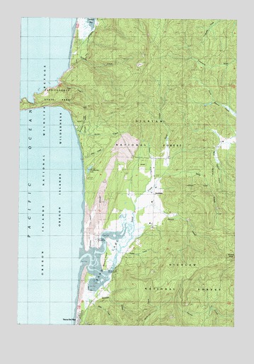
Sand Lake, OR USGS Topographic Map
Click on map above to begin viewing in our Map Viewer.

This topographic map contains these locations and features:
Feature Name Type Latitude Longitude GNIS ID View Map
Allen CreekStreamN45.3173°W123.9635°1137141View Map
Andy CreekStreamN45.3126°W123.9173°1137215View Map
Beltz CreekStreamN45.2609°W123.9607°1159260View Map
Beltz DikeLeveeN45.2637°W123.9576°1137907View Map
Big Medicine CreekStreamN45.3287°W123.9671°1138047View Map
Buzzard ButteSummitN45.2779°W123.8779°1139078View Map
Camp ClarkLocaleN45.3309°W123.9679°1139202View Map
Camp MeriwetherLocaleN45.3193°W123.9640°1139256View Map
Cape CreekStreamN45.3490°W123.9793°1139345View Map
Cape LookoutCapeN45.3395°W123.9929°1139349View Map
Cape Lookout State ParkParkN45.3526°W123.9723°1139350View Map
Chamberlain LakeLakeN45.3133°W123.9606°1139553View Map
Clay Myers State Natural Area at Whalen IslandParkN45.2731°W123.9486°1155338View Map
Clay Myers State Natural Area at Whalen Island Boat LaunchLocaleN45.2731°W123.9476°2668556View Map
Davis CreekStreamN45.3045°W123.9287°1159258View Map
East Dunes Recreation SiteLocaleN45.2868°W123.9562°1952946View Map
Gurtis CreekStreamN45.2798°W123.9429°1159259View Map
Hathaway CreekStreamN45.3742°W123.9583°2127515View Map
Jackson CreekStreamN45.3695°W123.9607°1144198View Map
Jewel CreekStreamN45.2970°W123.9340°1144266View Map
Nestucca Rural Fire Protection District Station 85 SandlakeBuildingN45.3035°W123.9223°2577011View Map
Netarts Bay CampgroundLocaleN45.3707°W123.9596°1132134View Map
Reneke CreekStreamN45.2645°W123.9546°1148373View Map
Rover CreekStreamN45.3282°W123.9682°1148809View Map
Sand Beach Recreation SiteLocaleN45.2851°W123.9568°1159261View Map
Sand CreekStreamN45.2901°W123.9382°1149029View Map
Sand LakeSwampN45.2823°W123.9442°1161498View Map
SandlakePopulated PlaceN45.3032°W123.9235°1149049View Map
Sandlake Post Office (historical)Post OfficeN45.3032°W123.9235°1165915View Map
Tierra Del MarPopulated PlaceN45.2520°W123.9646°1639337View Map
Wells CoveBayN45.3415°W123.9951°1851752View Map
West Winds Recreation SiteLocaleN45.2904°W123.9560°1952958View Map
Whalen IslandIslandN45.2768°W123.9523°1134970View Map

Note: Coordinates in the location and feature list above are referenced to NAD83 datum.


Copyright (C) 2008-2024 Ryan Niemi / Sunset Dynamics ... All Rights Reserved