TopoQuest Logo
Do you find TopoQuest useful?
Help keep TopoQuest running and adding new maps/features by donating!
Bitcoin:  19c7KJd3qBynnjoSw5npx9KScwjBe4ifkT
Litecoin:  LXs6TkuXGGXo1vDsWCkWVdjQX94eUKd6ui
Home View Maps Find Maps Find Places Resources & Links


Sand Point, Colorado Topographic Map

USGS Map Title: Sand Point, CO
USGS Map MRC: 40107B1
DRG (GeoTIFF) Download: o40107b1.tif


Neighboring USGS Topographic Map Quads:


  Dunckley, CO  
40107C2
 

  Rattlesnake Butte, CO  
40107C1
 

  Oak Creek, CO  
40106C8
 

  Dunckley Pass, CO  
40107B2
 

  Sand Point, CO  
40107B1
 

  Yampa, CO  
40106B8
 

  Devils Causeway, CO  
40107A2
 

  Orno Peak, CO  
40107A1
 

  Trapper, CO  
40106A8


Map MRC Location:

N41°
W108°
N41°
W107°
H8 H7 H6 H5 H4 H3 H2 H1
G8 G7 G6 G5 G4 G3 G2 G1
F8 F7 F6 F5 F4 F3 F2 F1
E8 E7 E6 E5 E4 E3 E2 E1
D8 D7 D6 D5 D4 D3 D2 D1
C8 C7 C6 C5 C4 C3 C2 C1
B8 B7 B6 B5 B4 B3 B2 B1
A8 A7 A6 A5 A4 A3 A2 A1
N40°
W108°
N40°
W107°

Sand Point, CO USGS 1:24K Topographic Map Preview:
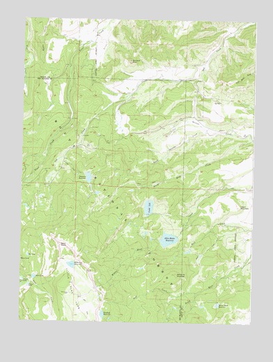
Sand Point, CO USGS Topographic Map
Click on map above to begin viewing in our Map Viewer.

This topographic map contains these locations and features:
Feature Name Type Latitude Longitude GNIS ID View Map
Allen Basin DamDamN40.1600°W107.0423°200016View Map
Allen Basin District DitchStreamN40.1633°W107.0378°196692View Map
Allen Basin Fill DitchStreamN40.1594°W107.0403°196687View Map
Allen Basin ReservoirReservoirN40.1593°W107.0455°173384View Map
Bellyache MountainSummitN40.1450°W107.0417°173378View Map
Burnt Mesa DamDamN40.1333°W107.0173°200018View Map
Burnt Mesa Filler DitchStreamN40.1330°W107.0187°196682View Map
Burnt Mesa ReservoirReservoirN40.1325°W107.0184°173377View Map
Camel LakeLakeN40.1419°W107.1238°173390View Map
Chapman DamDamN40.1864°W107.0912°201530View Map
Chapman ReservoirReservoirN40.1846°W107.0892°173383View Map
Chatfield ReservoirReservoirN40.1281°W107.0804°173386View Map
Crater LakeLakeN40.1401°W107.1207°173389View Map
Crosho Inlet Rossi BypassStreamN40.1700°W107.0501°196683View Map
Crosho LakeLakeN40.1728°W107.0564°173385View Map
Crosho Outlet DitchStreamN40.1694°W107.0337°196688View Map
Heart MountainSummitN40.1730°W107.0070°173376View Map
Killarney ReservoirReservoirN40.1485°W107.0975°173387View Map
Last Chance DitchStreamN40.2316°W107.1153°196690View Map
Little Oak CreekStreamN40.1936°W107.1028°173398View Map
Mill CreekStreamN40.1372°W107.0292°173382View Map
Mill Creek DitchStreamN40.1591°W107.0195°196689View Map
Oat LakeLakeN40.1522°W107.1210°173392View Map
Pinnacle PeakSummitN40.2330°W107.0676°173379View Map
Rich DitchStreamN40.2039°W107.0920°196691View Map
Sand LakeLakeN40.1432°W107.1177°173391View Map
Sand PointCliffN40.1564°W107.1028°173388View Map
Simon Number 1 DamDamN40.1716°W107.0556°200034View Map
Simon Reservoir Number 1ReservoirN40.1716°W107.0556°200035View Map
South Spronks CreekStreamN40.2066°W107.0267°173380View Map
Spronks CreekStreamN40.2011°W107.0012°173381View Map
Trout Creek DitchStreamN40.2380°W107.0826°196695View Map
Trout Creek School DitchStreamN40.2416°W107.0895°196694View Map

Note: Coordinates in the location and feature list above are referenced to NAD83 datum.


Copyright (C) 2008-2025 Ryan Niemi / Sunset Dynamics ... All Rights Reserved