TopoQuest Logo
Do you find TopoQuest useful?
Help keep TopoQuest running and adding new maps/features by donating!
Bitcoin:  19c7KJd3qBynnjoSw5npx9KScwjBe4ifkT
Litecoin:  LXs6TkuXGGXo1vDsWCkWVdjQX94eUKd6ui
Home View Maps Find Maps Find Places Resources & Links


Dunckley, Colorado Topographic Map

USGS Map Title: Dunckley, CO
USGS Map MRC: 40107C2
DRG (GeoTIFF) Download: o40107c2.tif


Neighboring USGS Topographic Map Quads:


  Hayden, CO  
40107D3
 

  Mount Harris, CO  
40107D2
 

  Milner, CO  
40107D1
 

  Hayden Gulch, CO  
40107C3
 

  Dunckley, CO  
40107C2
 

  Rattlesnake Butte, CO  
40107C1
 

  Pagoda Peak, CO  
40107B3
 

  Dunckley Pass, CO  
40107B2
 

  Sand Point, CO  
40107B1


Map MRC Location:

N41°
W108°
N41°
W107°
H8 H7 H6 H5 H4 H3 H2 H1
G8 G7 G6 G5 G4 G3 G2 G1
F8 F7 F6 F5 F4 F3 F2 F1
E8 E7 E6 E5 E4 E3 E2 E1
D8 D7 D6 D5 D4 D3 D2 D1
C8 C7 C6 C5 C4 C3 C2 C1
B8 B7 B6 B5 B4 B3 B2 B1
A8 A7 A6 A5 A4 A3 A2 A1
N40°
W108°
N40°
W107°

Dunckley, CO USGS 1:24K Topographic Map Preview:
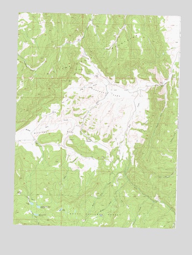
Dunckley, CO USGS Topographic Map
Click on map above to begin viewing in our Map Viewer.

This topographic map contains these locations and features:
Feature Name Type Latitude Longitude GNIS ID View Map
Austrian CreekStreamN40.2680°W107.1464°171525View Map
Coyote CreekStreamN40.3353°W107.1362°171518View Map
Dubeau MeadowFlatN40.2691°W107.2453°171513View Map
DunckleyPopulated PlaceN40.3008°W107.1942°204651View Map
Dunckley and Dubeau ReservoirReservoirN40.2610°W107.2309°171511View Map
Dunckley ParkFlatN40.3278°W107.1784°171522View Map
Dunkley Dubeau DamDamN40.2616°W107.2323°201428View Map
East Side Number 2 DitchCanalN40.3044°W107.1562°171516View Map
Fish Creek CanyonValleyN40.3479°W107.1256°171526View Map
James Marion Yoast ReservoirReservoirN40.2979°W107.1849°199795View Map
James Yoast Marion DamDamN40.2983°W107.1856°199794View Map
Lily PondReservoirN40.2597°W107.2137°171509View Map
Long GulchValleyN40.3338°W107.1807°171520View Map
Middle Fish CreekStreamN40.2778°W107.1623°171524View Map
Pinnacle MineMineN40.2664°W107.1881°1735644View Map
Salt CreekStreamN40.3072°W107.2395°171515View Map
Seaton DamDamN40.2566°W107.1839°199792View Map
Sellers-Crowell DamDamN40.2566°W107.2323°201424View Map
Sellers-Crowell ReservoirReservoirN40.2564°W107.2327°171510View Map
Shaffer DamDamN40.2633°W107.2373°201426View Map
Shaffer ReservoirReservoirN40.2627°W107.2361°171512View Map
West Fish CreekStreamN40.2828°W107.1639°171523View Map
West Side Highland DitchCanalN40.2950°W107.1698°171517View Map
Williams ParkFlatN40.3055°W107.2173°171521View Map
Williams Park DitchCanalN40.3278°W107.1784°171519View Map
Yoast DamDamN40.3166°W107.1939°200912View Map
Yoast GulchValleyN40.3285°W107.1778°171514View Map
Yoast Reservoir Number 1ReservoirN40.3173°W107.1940°200913View Map

Note: Coordinates in the location and feature list above are referenced to NAD83 datum.


Copyright (C) 2008-2025 Ryan Niemi / Sunset Dynamics ... All Rights Reserved