TopoQuest Logo
Do you find TopoQuest useful?
Help keep TopoQuest running and adding new maps/features by donating!
Bitcoin:  19c7KJd3qBynnjoSw5npx9KScwjBe4ifkT
Litecoin:  LXs6TkuXGGXo1vDsWCkWVdjQX94eUKd6ui
Home View Maps Find Maps Find Places Resources & Links


Santa Maria, Texas Topographic Map

USGS Map Title: Santa Maria, TX
USGS Map MRC: 26097A7
DRG (GeoTIFF) Download: o26097a7.tif


Neighboring USGS Topographic Map Quads:


  Mercedes, TX  
26097B8
 

  La Feria, TX  
26097B7
 

  Harlingen, TX  
26097B6
 

  Progreso, TX  
26097A8
 

  Santa Maria, TX  
26097A7
 

  La Paloma, TX  
26097A6


Map MRC Location:

N27°
W98°
N27°
W97°
H8 H7 H6 H5 H4 H3 H2 H1
G8 G7 G6 G5 G4 G3 G2 G1
F8 F7 F6 F5 F4 F3 F2 F1
E8 E7 E6 E5 E4 E3 E2 E1
D8 D7 D6 D5 D4 D3 D2 D1
C8 C7 C6 C5 C4 C3 C2 C1
B8 B7 B6 B5 B4 B3 B2 B1
A8 A7 A6 A5 A4 A3 A2 A1
N26°
W98°
N26°
W97°

Santa Maria, TX USGS 1:24K Topographic Map Preview:
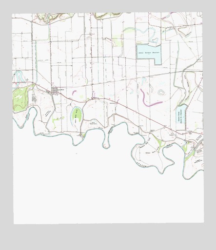
Santa Maria, TX USGS Topographic Map
Click on map above to begin viewing in our Map Viewer.

This topographic map contains these locations and features:
Feature Name Type Latitude Longitude GNIS ID View Map
Adams Gardens Main CanalCanalN26.1031°W97.7942°1372233View Map
Adams Gardens Pumping StationLocaleN26.0534°W97.7925°1384716View Map
Adams Gardens ReservoirReservoirN26.1015°W97.7933°1372234View Map
Adams Winter Garden DamDamN26.1054°W97.7803°1862232View Map
Adams Winter Garden ReservoirReservoirN26.1012°W97.7850°1862233View Map
BluetownPopulated PlaceN26.0742°W97.8231°1372642View Map
Bluetown Census Designated PlaceCensusN26.0734°W97.8199°2584610View Map
Bluetown ColoniaPopulated PlaceN26.0704°W97.8233°2010326View Map
Bluetown-Iglesia Antigua Census Designated Place (historical)CensusN26.0742°W97.8259°2407867View Map
Cameron County District Number One ReservoirReservoirN26.0648°W97.7649°1372882View Map
Colonia Iglesia AntiguaPopulated PlaceN26.0773°W97.8383°2010338View Map
Culebron Banco Number 153LeveeN26.0373°W97.7536°1373311View Map
El Venadito ColoniaPopulated PlaceN26.0554°W97.7714°2010248View Map
El Zurron Banco Number 26LeveeN26.0662°W97.8522°1373612View Map
Galveston RanchLocaleN26.0545°W97.7853°1373797View Map
Gloria RanchLocaleN26.0717°W97.8072°1373857View Map
Harlingen Pumping StationLocaleN26.0479°W97.7617°1384740View Map
Iglesia Antigua Census Designated PlaceCensusN26.0749°W97.8342°2584653View Map
KBFM-FM (Edinburg)TowerN26.1001°W97.8381°1387951View Map
KMBH-TV (Harlingen)TowerN26.1209°W97.8219°1388137View Map
KQXX-FM (McAllen)TowerN26.1001°W97.8381°1388032View Map
KRGY-FM (Brownsville)TowerN26.0817°W97.8292°1387919View Map
KTEX-FM (Brownsville)TowerN26.1209°W97.8219°1387918View Map
KVEO-TV (Brownsville)TowerN26.1001°W97.8381°1388109View Map
KVMV-FM (McAllen)TowerN26.0817°W97.8292°1388033View Map
La Bolsa Banco Number 27LeveeN26.0740°W97.8600°1374411View Map
La Feria Main CanalCanalN26.0979°W97.8272°1374415View Map
La Feria Pumping StationLocaleN26.0534°W97.8300°1384746View Map
La Gloria Main CanalCanalN26.0929°W97.8092°1374416View Map
Las Palomas Wildlife Management Area - Anacua UnitParkN26.0567°W97.8475°2029010View Map
Las RusiasPopulated PlaceN26.0540°W97.7575°1374481View Map
Las Sierritas Banco Number 8LeveeN26.0426°W97.7528°1374482View Map
Las Tranquitas Banco Number 20LeveeN26.0509°W97.7533°1374483View Map
Lewis Main CanalCanalN26.0887°W97.8133°1374516View Map
Longoria Townsite ColoniaPopulated PlaceN26.0792°W97.8522°2010287View Map
Los Nogales Estates ColoniaPopulated PlaceN26.0542°W97.7642°2010290View Map
Pacheco Banco Number 117LeveeN26.0437°W97.7583°1375324View Map
Palma Banco Number 25LeveeN26.0651°W97.8336°1375330View Map
Rangerville ColoniaPopulated PlaceN26.0915°W97.7514°2010201View Map
Resaca del Rancho ViejoLakeN26.0848°W97.7605°1375700View Map
San Benito Pumping StationLocaleN26.0445°W97.7561°1384761View Map
Santa MariaPopulated PlaceN26.0787°W97.8494°1376017View Map
Santa Maria Census Designated PlaceCensusN26.0768°W97.8466°2409279View Map
Santa Maria High SchoolSchoolN26.0765°W97.8445°1985445View Map
Santa Maria Main CanalCanalN26.0870°W97.8592°1376018View Map
Santa Maria Middle SchoolSchoolN26.0765°W97.8445°2434433View Map
Santa Maria Post OfficePost OfficeN26.0780°W97.8473°2731782View Map
Santa Maria Pumping StationLocaleN26.0534°W97.8550°1384762View Map
Solisenito Banco Number 81LeveeN26.0473°W97.7883°1376176View Map
Soliseno Banco Number 23LeveeN26.0429°W97.7828°1376177View Map
Tony Gonzalez Elementary SchoolSchoolN26.0770°W97.8458°1985444View Map
VenaditoPopulated PlaceN26.0526°W97.7692°1380938View Map
Villitas Banco Number 24LeveeN26.0612°W97.8219°1376598View Map
Zacatal ColoniaPopulated PlaceN26.0834°W97.8703°2011488View Map

Note: Coordinates in the location and feature list above are referenced to NAD83 datum.


Copyright (C) 2008-2025 Ryan Niemi / Sunset Dynamics ... All Rights Reserved