TopoQuest Logo
Do you find TopoQuest useful?
Help keep TopoQuest running and adding new maps/features by donating!
Bitcoin:  19c7KJd3qBynnjoSw5npx9KScwjBe4ifkT
Litecoin:  LXs6TkuXGGXo1vDsWCkWVdjQX94eUKd6ui
Home View Maps Find Maps Find Places Resources & Links


Santaquin, Utah Topographic Map

USGS Map Title: Santaquin, UT
USGS Map MRC: 39111H7
DRG (GeoTIFF) Download: o39111h7.tif


Neighboring USGS Topographic Map Quads:


  Goshen Valley North, UT  
40111A8
 

  West Mountain, UT  
40111A7
 

  Spanish Fork, UT  
40111A6
 

  Goshen, UT  
39111H8
 

  Santaquin, UT  
39111H7
 

  Payson Lakes, UT  
39111H6
 

  Slate Jack Canyon, UT  
39111G8
 

  Mona, UT  
39111G7
 

  Nebo Basin, UT  
39111G6


Map MRC Location:

N40°
W112°
N40°
W111°
H8 H7 H6 H5 H4 H3 H2 H1
G8 G7 G6 G5 G4 G3 G2 G1
F8 F7 F6 F5 F4 F3 F2 F1
E8 E7 E6 E5 E4 E3 E2 E1
D8 D7 D6 D5 D4 D3 D2 D1
C8 C7 C6 C5 C4 C3 C2 C1
B8 B7 B6 B5 B4 B3 B2 B1
A8 A7 A6 A5 A4 A3 A2 A1
N39°
W112°
N39°
W111°

Santaquin, UT USGS 1:24K Topographic Map Preview:
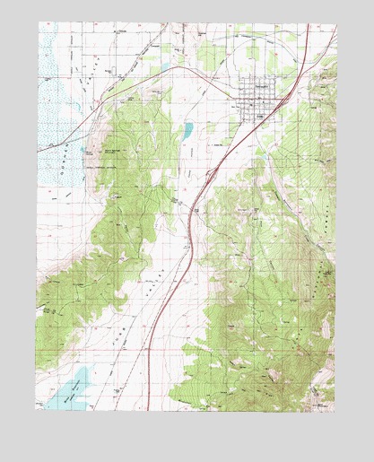
Santaquin, UT USGS Topographic Map
Click on map above to begin viewing in our Map Viewer.

This topographic map contains these locations and features:
Feature Name Type Latitude Longitude GNIS ID View Map
Bald MountainSummitN39.8772°W111.7583°1438357View Map
Black HollowValleyN39.9305°W111.8680°1438852View Map
Bountiful Peak Picnic AreaLocaleN39.9794°W111.8049°1448166View Map
C S Lewis AcademySchoolN39.9821°W111.7658°2648309View Map
Calvary Chapel Assembly of God ChurchChurchN39.9744°W111.7855°1436693View Map
Cedar HollowValleyN39.9627°W111.8122°1439571View Map
City of SantaquinCivilN39.9712°W111.7937°2411829View Map
East Warm Creek DitchCanalN39.9794°W111.8569°1440855View Map
Ewell DamDamN39.9866°W111.8224°1447827View Map
Ewell Regulating ReservoirReservoirN39.9857°W111.8223°1447826View Map
GenolaPopulated PlaceN39.9963°W111.8433°1441295View Map
Goshen HillSummitN39.9963°W111.8091°1441387View Map
Little ValleyValleyN39.9405°W111.8497°1442795View Map
Mendenhall CreekStreamN39.8811°W111.8230°1443304View Map
Mona DamDamN39.8766°W111.8708°1447810View Map
Pole CanyonValleyN39.9558°W111.7860°1444518View Map
Rocky RidgePopulated PlaceN39.9250°W111.8272°1865575View Map
Rocky Ridge CemeteryCemeteryN39.9265°W111.8267°2769293View Map
Rocky Ridge Fire DepartmentBuildingN39.9382°W111.8227°2627292View Map
SantaquinPopulated PlaceN39.9755°W111.7852°1445329View Map
Santaquin Baptist ChurchChurchN39.9821°W111.7656°2648308View Map
Santaquin CanyonValleyN39.9558°W111.7802°1445330View Map
Santaquin City AmbulanceBuildingN39.9752°W111.7911°2665422View Map
Santaquin City CemeteryCemeteryN39.9699°W111.7827°1448972View Map
Santaquin Debris Basin DamDamN39.9566°W111.7808°1447821View Map
Santaquin Debris Basin ReservoirReservoirN39.9566°W111.7808°1447820View Map
Santaquin Elementary SchoolSchoolN39.9743°W111.7941°1448973View Map
Santaquin Fire DepartmentBuildingN39.9752°W111.7911°2627180View Map
Santaquin Police DepartmentBuildingN39.9753°W111.7911°2730377View Map
Santaquin Post OfficePost OfficeN39.9760°W111.7857°1455503View Map
Starr 8LocaleN39.8763°W111.8505°1446100View Map
Summit CreekStreamN39.9547°W111.7888°1446238View Map
Summit Creek Number Two DamDamN39.9666°W111.8124°1447825View Map
Summit Creek Number Two ReservoirReservoirN39.9640°W111.8127°1447824View Map
The Church of Jesus Christ of Latter Day SaintsChurchN39.9802°W111.7816°1449625View Map
The Church of Jesus Christ of Latter Day SaintsChurchN39.9769°W111.7922°1449626View Map
The Church of Jesus Christ of Latter Day SaintsChurchN39.9966°W111.8438°1449461View Map
Town of Rocky RidgeCivilN39.9197°W111.8257°2412568View Map
TownsendPopulated PlaceN39.9927°W111.8285°1446661View Map
Trumbolt Picnic AreaLocaleN39.9197°W111.7519°1446747View Map
Warm SpringsSpringN39.9583°W111.8557°1446987View Map
Warm Springs DitchCanalN39.9427°W111.8749°1446989View Map
Warm Springs MountainSummitN39.9580°W111.8485°1446985View Map
Wash CanyonValleyN39.8977°W111.8055°1447014View Map
West ParkFlatN39.9727°W111.7930°1447170View Map

Note: Coordinates in the location and feature list above are referenced to NAD83 datum.


Copyright (C) 2008-2024 Ryan Niemi / Sunset Dynamics ... All Rights Reserved