TopoQuest Logo
Do you find TopoQuest useful?
Help keep TopoQuest running and adding new maps/features by donating!
Bitcoin:  19c7KJd3qBynnjoSw5npx9KScwjBe4ifkT
Litecoin:  LXs6TkuXGGXo1vDsWCkWVdjQX94eUKd6ui
Home View Maps Find Maps Find Places Resources & Links


Goshen, Utah Topographic Map

USGS Map Title: Goshen, UT
USGS Map MRC: 39111H8
DRG (GeoTIFF) Download: o39111h8.tif


Neighboring USGS Topographic Map Quads:


  Allens Ranch, UT  
40112A1
 

  Goshen Valley North, UT  
40111A8
 

  West Mountain, UT  
40111A7
 

  Eureka, UT  
39112H1
 

  Goshen, UT  
39111H8
 

  Santaquin, UT  
39111H7
 

  Tintic Mountain, UT  
39112G1
 

  Slate Jack Canyon, UT  
39111G8
 

  Mona, UT  
39111G7


Map MRC Location:

N40°
W112°
N40°
W111°
H8 H7 H6 H5 H4 H3 H2 H1
G8 G7 G6 G5 G4 G3 G2 G1
F8 F7 F6 F5 F4 F3 F2 F1
E8 E7 E6 E5 E4 E3 E2 E1
D8 D7 D6 D5 D4 D3 D2 D1
C8 C7 C6 C5 C4 C3 C2 C1
B8 B7 B6 B5 B4 B3 B2 B1
A8 A7 A6 A5 A4 A3 A2 A1
N39°
W112°
N39°
W111°

Goshen, UT USGS 1:24K Topographic Map Preview:
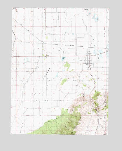
Goshen, UT USGS Topographic Map
Click on map above to begin viewing in our Map Viewer.

This topographic map contains these locations and features:
Feature Name Type Latitude Longitude GNIS ID View Map
Alcorns CanyonValleyN39.8875°W111.9416°1425065View Map
City DitchCanalN39.9486°W111.9205°1426655View Map
Crooked CanyonValleyN39.8760°W111.9433°1427111View Map
Currant CreekStreamN39.9836°W111.9274°1440201View Map
Currant Creek CanalCanalN39.8897°W111.9797°1427163View Map
Elberta Census Designated PlaceCensusN39.9739°W111.9554°2408067View Map
Elberta Post OfficePost OfficeN39.9526°W111.9566°2767353View Map
First CanyonValleyN39.8966°W111.9283°1427944View Map
Goosenest CanyonValleyN39.8766°W111.9663°1428263View Map
GoshenPopulated PlaceN39.9530°W111.9008°1428272View Map
Goshen CanyonValleyN39.8797°W111.8905°1435593View Map
Goshen CemeteryCemeteryN39.9407°W111.9034°1435594View Map
Goshen DivisionCivilN39.9839°W111.9698°1939371View Map
Goshen Elementary SchoolSchoolN39.9540°W111.8991°1435595View Map
Goshen Fire DepartmentBuildingN39.9532°W111.9007°2627446View Map
Goshen Post OfficePost OfficeN39.9511°W111.9007°1455297View Map
Goshen ReservoirReservoirN39.9502°W111.9338°1428275View Map
Government CanyonValleyN39.9163°W111.8827°1441392View Map
Government FlatFlatN39.8944°W111.8805°1428287View Map
Kimball CreekStreamN39.9388°W111.9355°1429347View Map
LantPopulated PlaceN39.9625°W111.9155°1437616View Map
Mount NeboPopulated PlaceN39.9527°W111.9563°1427772View Map
The Church of Jesus Christ of Latter Day SaintsChurchN39.9505°W111.9558°1436900View Map
The Church of Jesus Christ of Latter Day SaintsChurchN39.9516°W111.9008°1436912View Map
Town of GoshenCivilN39.9511°W111.9008°2412693View Map

Note: Coordinates in the location and feature list above are referenced to NAD83 datum.


Copyright (C) 2008-2025 Ryan Niemi / Sunset Dynamics ... All Rights Reserved