TopoQuest Logo
Do you find TopoQuest useful?
Help keep TopoQuest running and adding new maps/features by donating!
Bitcoin:  19c7KJd3qBynnjoSw5npx9KScwjBe4ifkT
Litecoin:  LXs6TkuXGGXo1vDsWCkWVdjQX94eUKd6ui
Home View Maps Find Maps Find Places Resources & Links


Santiago, Minnesota Topographic Map

USGS Map Title: Santiago, MN
USGS Map MRC: 45093E7
DRG (GeoTIFF) Download: o45093e7.tif


Neighboring USGS Topographic Map Quads:


  Foley, MN  
45093F8
 

  Ronneby, MN  
45093F7
 

  Foreston, MN  
45093F6
 

  Duelm, MN  
45093E8
 

  Santiago, MN  
45093E7
 

  Princeton SW, MN  
45093E6
 

  Clear Lake, MN  
45093D8
 

  Becker, MN  
45093D7
 

  Orrock, MN  
45093D6


Map MRC Location:

N46°
W94°
N46°
W93°
H8 H7 H6 H5 H4 H3 H2 H1
G8 G7 G6 G5 G4 G3 G2 G1
F8 F7 F6 F5 F4 F3 F2 F1
E8 E7 E6 E5 E4 E3 E2 E1
D8 D7 D6 D5 D4 D3 D2 D1
C8 C7 C6 C5 C4 C3 C2 C1
B8 B7 B6 B5 B4 B3 B2 B1
A8 A7 A6 A5 A4 A3 A2 A1
N45°
W94°
N45°
W93°

Santiago, MN USGS 1:24K Topographic Map Preview:
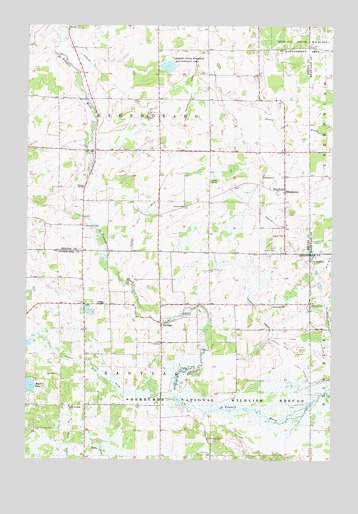
Santiago, MN USGS Topographic Map
Click on map above to begin viewing in our Map Viewer.

This topographic map contains these locations and features:
Feature Name Type Latitude Longitude GNIS ID View Map
Benlacs State Wildlife Management AreaParkN45.6186°W93.7619°639924View Map
Bibles State Wildlife Management AreaParkN45.6133°W93.8186°640074View Map
Country ChurchChurchN45.5730°W93.8116°641540View Map
County Ditch Number FiveCanalN45.5333°W93.7711°642161View Map
County Ditch Number NineteenCanalN45.5080°W93.8566°641762View Map
County Ditch Number ThirteenCanalN45.5877°W93.8100°641649View Map
County Ditch Number TwentytwoCanalN45.5269°W93.8500°641832View Map
Fox PondReservoirN45.5250°W93.7919°1776861View Map
Fox Pond DamDamN45.5250°W93.7919°1776860View Map
GlendoradoPopulated PlaceN45.5780°W93.7697°644180View Map
Glendorado ChurchChurchN45.5822°W93.7786°644181View Map
Glendorado Lutheran Church CemeteryCemeteryN45.5824°W93.7784°2069557View Map
Glendorado Post Office (historical)Post OfficeN45.5781°W93.7694°2069601View Map
Good Shepherd Lutheran ChurchChurchN45.5667°W93.7778°2069555View Map
Oak Hill CemeteryCemeteryN45.5447°W93.7587°648817View Map
Our Savior ChurchChurchN45.5447°W93.7694°649076View Map
Our Savior Lutheran Church CemeteryCemeteryN45.5436°W93.7709°2069533View Map
Our Savior SchoolSchoolN45.5575°W93.7589°649078View Map
Pool Number 1ReservoirN45.5251°W93.8237°1776999View Map
Saint Francis CemeteryCemeteryN45.5672°W93.8519°650583View Map
SantiagoPopulated PlaceN45.5391°W93.8200°651206View Map
Santiago CemeteryCemeteryN45.5059°W93.8004°651207View Map
Santiago Post OfficePost OfficeN45.5392°W93.8197°2069446View Map
School Number 114SchoolN45.5802°W93.8003°651352View Map
School Number 1898SchoolN45.5447°W93.8436°651430View Map
School Number 86SchoolN45.5786°W93.8522°651756View Map
School Number 88SchoolN45.5783°W93.7702°651762View Map
Sherburne National Wildlife Refuge DamDamN45.5250°W93.8219°1776998View Map
South Santiago CemeteryCemeteryN45.5088°W93.8725°652340View Map
South Santiago ChurchChurchN45.5152°W93.8575°652341View Map
Township of GlendoradoCivilN45.6042°W93.8215°664278View Map
Township of SantiagoCivilN45.5160°W93.8207°665552View Map

Note: Coordinates in the location and feature list above are referenced to NAD83 datum.


Copyright (C) 2008-2025 Ryan Niemi / Sunset Dynamics ... All Rights Reserved