TopoQuest Logo
Do you find TopoQuest useful?
Help keep TopoQuest running and adding new maps/features by donating!
Bitcoin:  19c7KJd3qBynnjoSw5npx9KScwjBe4ifkT
Litecoin:  LXs6TkuXGGXo1vDsWCkWVdjQX94eUKd6ui
Home View Maps Find Maps Find Places Resources & Links


Saunders Reef, California Topographic Map

USGS Map Title: Saunders Reef, CA
USGS Map MRC: 38123G6
DRG (GeoTIFF) Download: o38123g6.tif


Neighboring USGS Topographic Map Quads:


  Point Arena, CA  
38123H6
 

  Eureka Hill, CA  
38123H5


  Saunders Reef, CA  
38123G6
 

  Gualala, CA  
38123G5


Map MRC Location:

N39°
W124°
N39°
W123°
H8 H7 H6 H5 H4 H3 H2 H1
G8 G7 G6 G5 G4 G3 G2 G1
F8 F7 F6 F5 F4 F3 F2 F1
E8 E7 E6 E5 E4 E3 E2 E1
D8 D7 D6 D5 D4 D3 D2 D1
C8 C7 C6 C5 C4 C3 C2 C1
B8 B7 B6 B5 B4 B3 B2 B1
A8 A7 A6 A5 A4 A3 A2 A1
N38°
W124°
N38°
W123°

Saunders Reef, CA USGS 1:24K Topographic Map Preview:
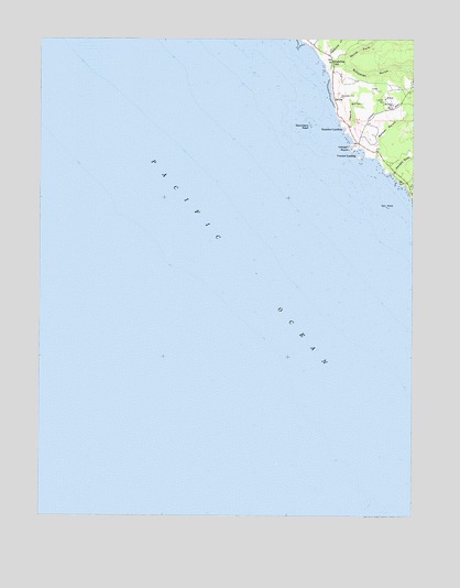
Saunders Reef, CA USGS Topographic Map
Click on map above to begin viewing in our Map Viewer.

This topographic map contains these locations and features:
Feature Name Type Latitude Longitude GNIS ID View Map
Bowling Ball BeachBeachN38.8707°W123.6583°1723242View Map
GallawayPopulated PlaceN38.8691°W123.6533°1653032View Map
Galloway CreekStreamN38.8691°W123.6561°224022View Map
Galloway School (historical)SchoolN38.8691°W123.6525°224023View Map
Hearn GulchValleyN38.8519°W123.6486°225099View Map
Iversen LandingLocaleN38.8457°W123.6428°1658844View Map
Iversen PointCapeN38.8469°W123.6470°254831View Map
Morrison GulchValleyN38.8399°W123.6331°254954View Map
North Fork Schooner GulchValleyN38.8694°W123.6500°229716View Map
Sail RockIslandN38.8310°W123.6350°232120View Map
Sail Rock RanchLocaleN38.8369°W123.6267°1653107View Map
Saunders LandingLocaleN38.8510°W123.6492°1659605View Map
Saunders ReefBarN38.8527°W123.6603°232600View Map
Schooner GulchValleyN38.8669°W123.6542°232695View Map
Schooner Gulch State BeachParkN38.8680°W123.6553°1724251View Map
Shinglemill GulchValleyN38.8677°W123.6295°233023View Map
Slick Rock CreekStreamN38.8366°W123.6286°233273View Map
Walker GulchValleyN38.8441°W123.6383°237175View Map

Note: Coordinates in the location and feature list above are referenced to NAD83 datum.


Copyright (C) 2008-2025 Ryan Niemi / Sunset Dynamics ... All Rights Reserved