TopoQuest Logo
Do you find TopoQuest useful?
Help keep TopoQuest running and adding new maps/features by donating!
Bitcoin:  19c7KJd3qBynnjoSw5npx9KScwjBe4ifkT
Litecoin:  LXs6TkuXGGXo1vDsWCkWVdjQX94eUKd6ui
Home View Maps Find Maps Find Places Resources & Links


Eureka Hill, California Topographic Map

USGS Map Title: Eureka Hill, CA
USGS Map MRC: 38123H5
DRG (GeoTIFF) Download: o38123h5.tif


Neighboring USGS Topographic Map Quads:


  Mallo Pass Creek, CA  
39123A6
 

  Cold Spring, CA  
39123A5
 

  Philo, CA  
39123A4
 

  Point Arena, CA  
38123H6
 

  Eureka Hill, CA  
38123H5
 

  Zeni Ridge, CA  
38123H4
 

  Saunders Reef, CA  
38123G6
 

  Gualala, CA  
38123G5
 

  McGuire Ridge, CA  
38123G4


Map MRC Location:

N39°
W124°
N39°
W123°
H8 H7 H6 H5 H4 H3 H2 H1
G8 G7 G6 G5 G4 G3 G2 G1
F8 F7 F6 F5 F4 F3 F2 F1
E8 E7 E6 E5 E4 E3 E2 E1
D8 D7 D6 D5 D4 D3 D2 D1
C8 C7 C6 C5 C4 C3 C2 C1
B8 B7 B6 B5 B4 B3 B2 B1
A8 A7 A6 A5 A4 A3 A2 A1
N38°
W124°
N38°
W123°

Eureka Hill, CA USGS 1:24K Topographic Map Preview:
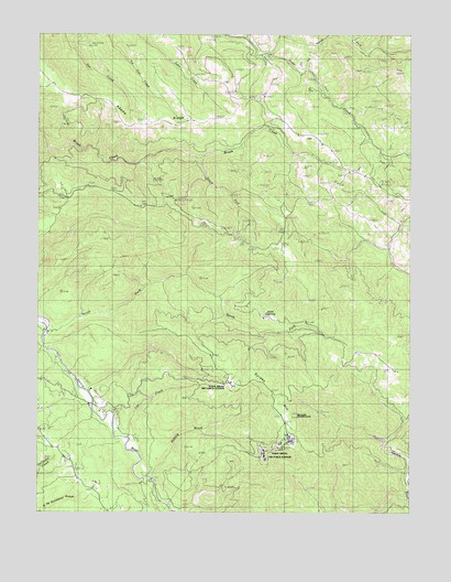
Eureka Hill, CA USGS Topographic Map
Click on map above to begin viewing in our Map Viewer.

This topographic map contains these locations and features:
Feature Name Type Latitude Longitude GNIS ID View Map
Adams RidgeRidgeN38.9782°W123.5911°217975View Map
Brayton Ranch (historical)LocaleN38.9080°W123.5600°1652992View Map
Buckridge RanchLocaleN38.9221°W123.6245°1652996View Map
Campbell RanchLocaleN38.9119°W123.5061°1653001View Map
Dunbar RanchLocaleN38.8957°W123.5978°1653017View Map
Eureka HillSummitN38.9077°W123.5464°1656003View Map
Garcia River ForestForestN38.8935°W123.5166°2772383View Map
Jacks OpeningFlatN38.9280°W123.5439°226069View Map
Lee CreekStreamN38.8949°W123.5972°1662267View Map
Lookout RanchLocaleN38.9452°W123.5436°1653061View Map
Moungovans RanchLocaleN38.9071°W123.6081°1653074View Map
Mount View RanchLocaleN38.9632°W123.5164°1653075View Map
North Fork Alder CreekStreamN38.9952°W123.5492°229638View Map
North Fork Garcia RiverStreamN38.9230°W123.6239°229677View Map
Piper RanchLocaleN38.9716°W123.5311°1653093View Map
Point Arena Air Force StationMilitaryN38.8914°W123.5456°2511980View Map
Point Arena Air Force Station (historical)MilitaryN38.8914°W123.5475°2086564View Map
Point Arena DivisionCivilN38.9109°W123.5617°1935256View Map
Rolling BrookStreamN38.8838°W123.5886°231833View Map
Signal CreekStreamN38.8782°W123.5020°233110View Map
South Fork Brush CreekStreamN38.9677°W123.5731°234977View Map

Note: Coordinates in the location and feature list above are referenced to NAD83 datum.


Copyright (C) 2008-2025 Ryan Niemi / Sunset Dynamics ... All Rights Reserved